Backroads Colorado

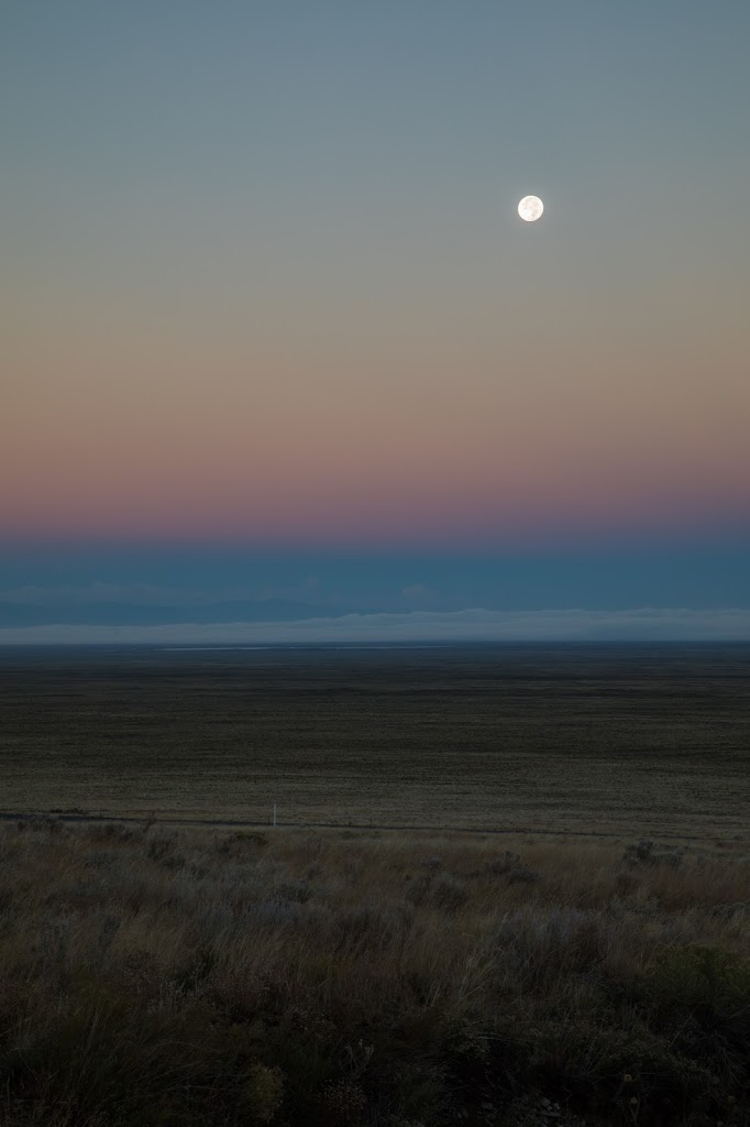
Moonlit sunrise over the dunes, chilly and gusty but quite a spectacle.

We leave the dunes early in the morning and embark on the last leg of our journey, traveling north to little known Spinney National Park and Lake George. The landscape we encounter is about as barren as you can get, flat and brown, void of trees. The Platt River is a gold medal stream for trout fishing, known as the “Dream Stream”. Unfortunately, it is too gusty and the fishing has not been good on this section of the stream so we take a drive along the 11 Mile Canyon. The canyon has hugely fissured rocky cliffs with boulders that appear ready to fall. Ray tries his hand here and I play around photographing the colors in the water. The temperature is a mere 43 degrees and it is so gusty that the wind chill freezes our hands. I retreat to read a book in the car while Ray braves the weather for a bit longer.

Thus ends our adventure in Colorado. Tomorrow we drive through Colorado Springs to Denver. It has been a terrific road trip and has increased my appreciation for this incredibly beautiful state.

Great Sand Dunes National Park

Our little cabin in the woods, Twin Rivers, is cozy. Outside it is drizzling as it has been for the last 10 days, we are told. Today’s journey takes us alongside the Conejos River and the aspens on the hillsides are abundant and more colorful than we have seen all over Colorado. The Cottonwoods line the river and the combined effect is mesmerizing. The skies clears for a few hours, great for both photographer and fisherman!

In the afternoon, we make our way north to the Great Sands National Park, the 4th national park on our journey. More than 30 square miles of dunes are ringed by the Sangre de Cristo Mountains and aspens in full color. This park has the highest dune in North America at 750 ft.
I am there to photograph the dunes at sunset. It takes us a while to figure out how to get out to the dunes but we follow others and wade across Medano Creek. After crossing, we hike across a large plain and finally onto the dunes. It is very, very windy and we can see sand blowing across the ground, which makes for difficult photographing. As the sun sets, the shadows form across the sand and interesting curvatures appear. We stay until the colors of the sky turn orange from the sunset. 

Tonight is the harvest moon and the night sky is clear enough to see it shining brightly on the desert.


Into the Past

Tours of the Long House are quite popular and not having booked online ahead of time, we had to wait a day and the first available slots are today at 12:30. The morning gusts luckily are dying down as we set out for a hike at Weatherhill Mesa. The sites in this area are not open to vehicles and can only be accessed on foot. As we walk, we notice that the terrain is dry desert and due to past fires, a multitude of grey tree trunks dot the landscape for miles and miles. I can imagine how hot it must get in the summer.

Our tour starts with a discussion of the ancestral Pueblo people who were formerly referred to as Anasazi. We learn they appeared to be an egalitarian society and that upwards of 50,000 people lived in the area, on the cliffs and in the Montezuma Valley at the peak of their civilization. 
We walk a mile to the trailhead and ascend 2 ladders into the dwelling. Yes, I did climb the ladders as you can see in the photo. 

This house is the second largest at Mesa Verde with over 100 rooms in its time. We are struck by the long storage room built high up under the alcove ceiling. Carrying stones up to this height, making mortar, and building walls that reached up to the top of the alcove was such an incredible feat.

Long House from a distance
Seep spring at the back of the alcove where water seeps down from the Mesa above. The round holes in the ground were to collect water.
Walls extend to top of alcove
Rooms
Ladders provide access to rooms

Storage room

From here we head westward through Durango, cutting down to New Mexico and back up to Antonito, a very small town in the Conejos Valley for Ray to fish tomorrow morning. The roads are deserted at night and we can’t see much in the dark but drive through 2 passes at 10,000 ft in the Rio Grande National Forest. 

Mesa Verde National Park

Mesa Verde National Park was created to preserve the archeological heritage of the Ancestral Pueblo people, and includes archeological sites from about 550AD to 1300AD. The earliest people were nomads, settling in this area in pit houses and by 1000AD, multi-story pueblos above ground. Between 1150 and 1300, thousands of people lived here, many in villages with kivas and courtyards. About 1225, people moved into cliff alcoves, ranging from one room houses to centers with 150 rooms such as Cliff Palace and Long House. By 1300AD, the area was deserted and no one knows why they left.

The park consists of 2 main roads, Chapin Mesa and Wetherill Mesa. Today we spend the day driving the Chapin Mesa area stopping at overlooks with views of the canyons and of the cliff houses. From a distance, we are amazed at the depth of Cliff Palace and the intricacy of the dwellings. There are tours of Balcony House but the fact that one must climb a 30 ft ladder scares me aware. We opt for a tour of Long House tomorrow which only has 2 10ft ladders!

Cliff Palace with 150 rooms

Tower House – a multi-story apartment

Balcony House with 30 ft ladder, 18inch tunnel and 60 ft. cliff face

It is truly mind blowing, seeing these dwellings and realizing that they were built by hand, brick by brick. How could they have brought their materials up into the caves? If you look at the depth of the canyon you quickly see that they had to have come from above, which is quite a feat.

Color-ado

Our journey takes us south today, out of Ridgway and toward Mesa Verde National Park. We have dueling weather reports, one predicting snow over the pass and the other predicting clear skies. To hedge our bets, we leave early, arriving in Telluride mid morning. This popular ski town has incredible charm and an abundance of yellow aspens. It also has an award winning pizza parlor, the Brown Dog Pizza, with choices like NY, Chicago or Detroit style and toppings never seen before. Because we are short on time, we order a thin thin which is mediocre, and which we soon regret as we see Detroit style pizzas being brought out for others that look significantly better than our soggy crusted one. On the TV is the report about the Las Vegas shooting which is a sad reminder of the state of our country.

On the road again, we head over the pass at 12,000ft with rain/snow falling and gusty winds. The colors on this stretch of the San Juan skyway are simply gorgeous, deep yellow-orange lining the highway and stretching up the sides of the mountain.

The road soon drops into the valley and the landscape changes into rolling hills and desert plains, covered in a palette of rust colors, reminding us that Halloween and Thanksgiving are soon to be here. 
Mesa Verde National Park, our national park #3 on this visit is as impressive as the prior two. The scenery is vast, tall mesas and a patchwork of color. We spend the afternoon walking the Fair View sites of pueblo ruins and stopping at overlooks to view the incredible views. 

The park is pretty much deserted as it is late in the season, and it feels like we are the only ones here as we end the day with sunset shots over the geologic oververlook.

Million Dollar Highway

It is the final morning of our workshop and again we are out the door by 5:30am and back up to our viewpoint over Ridgway. This morning, the colors are spectacular, the clouds in perfect formation. We are a happy group of photographers.

 The workshop over, it is time to explore. We take off and drive the “Million Dollar Highway”, part of the San Juan Skyway. It is one of the nation’s most spectacular and most dangerous drives, cut from the side of the mountain with hairpin turns and lack of guardrails.

We reach the very charming town of Ouray, set amidst towering cliffs.

The drive is indeed jaw dropping as it ascends the pass at 11,000 ft. in elevation. Much of the leaves have fallen from the aspens but the distant peaks are covered in snow.

At Silverton, we see the Durango Silverton narrow gauge train as it puffs its way into the historic mining town.

Our day has been without rain but we hear that 6-8 inches of snow is falling north near Breckenridge.
Quite variable is the weather in Colorado!!

Chasing Clouds

Ridgway is overflowing with photographers, in workshops and on their own. Have you ever known a motel to offer breakfast starting at 4am? We are up and out the door by 5:30am, chasing the sunset. Dan, our instructor is intent in finding us good clouds and color for our morning shoot. The first challenge is that Colorado weather is about as variable as I have ever seen. Bright white clouds can quickly turn into heavy gray storm clouds, dumping a shower before turning into blue skies again. The second challenge is to dodge the many other groups and to find your own isolated spot. We joke about being followed as we caravan out in the dark and cold morning.

The morning light is decent and we get some interesting shots.

After an afternoon session on Lightroom processing, we head out for an evening adventure, driving to  
Ouray for fall colors, only to encounter an unexpected downpour. No sunset there! We head back to a viewpoint up above the town of Ridgway for sunset.