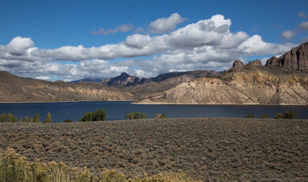
After a relaxing breakfast with Phil and Psyche, we make our way westward on our journey to the SW of Colorado, following the Gunnison River, a tributary of the Colorado that flows for 164 miles from the Taylor River of yesterday’s blog post through Gunnison and fills the Blue Mesa Reservoir, Morrow Point Reservoir and Crystal Reservoir forming the upper part of the Black Canyon. one of the longest, narrowest and deepest gorges in the world. Along its 164 mile path, it ranges from 3-50 ft deep and 10-100 ft wide.
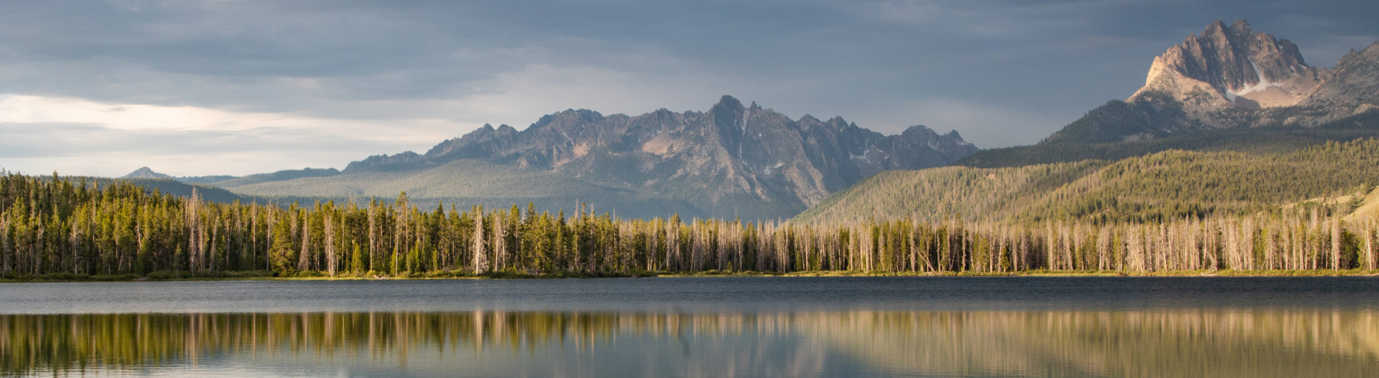
This is the Blue Mesa Reservoir
Our back roads adventure is a hike along a narrow section of the Gunnison River as it passes the Blue Mesa dam. Here we are close enough to touch the water. In a few hours we will be high above it.
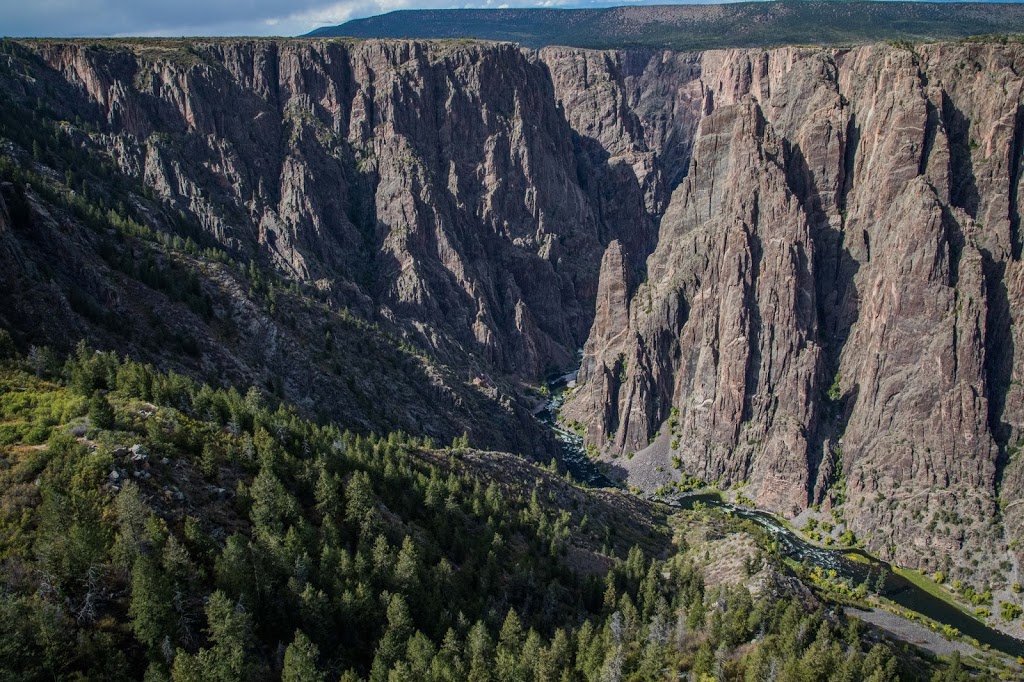
Back on the road, we take a spur before the town of Montrose, leading to the Black Canyon of the Gunnison National Park, National Park #2 on this visit. Of the three entrances, only the South Rim is easily accessible by car. East Portal has 16% grades and North Portal is a less traveled gravel road.
The South Rim drive has 12 overlooks, some by side of the road, others down a .25 mi. path. The views from the overlooks are incredibly beautiful but make my knees shake. I am grateful for the railings.
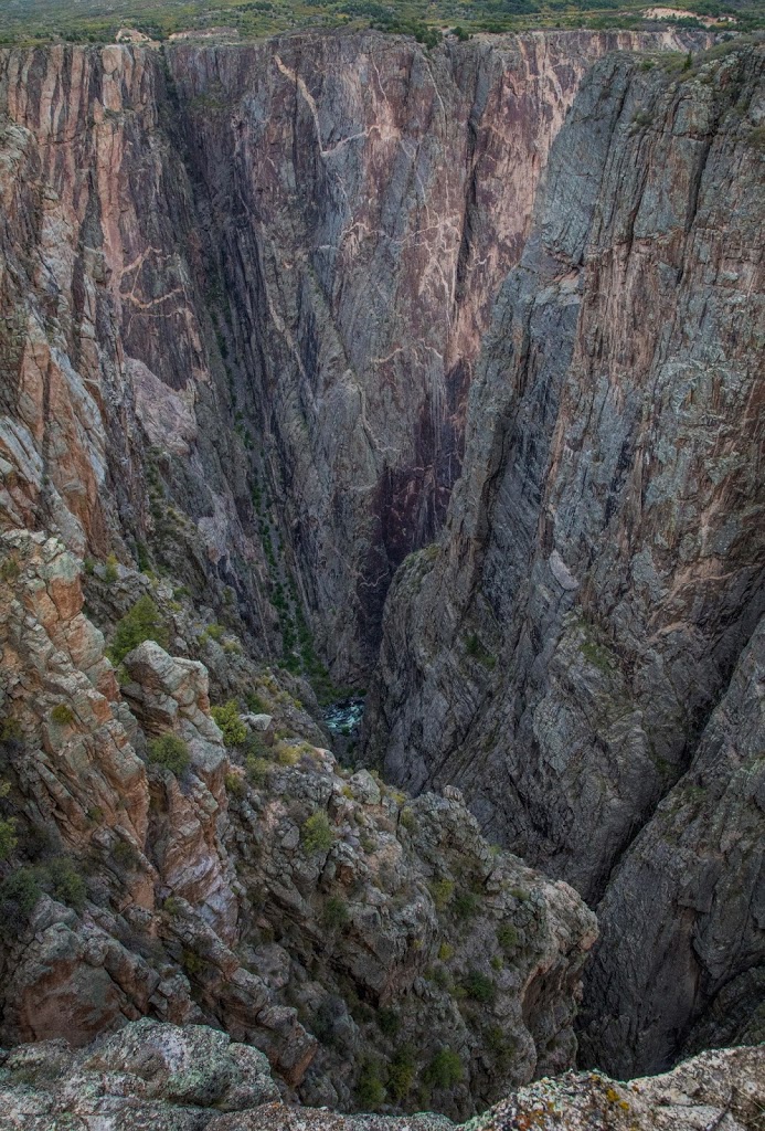
This is awe inspiring place is a visual testament to the power of erosion, a canyon 2,000 feet deep, with steep cliff walls that descend to dizzying heights below.
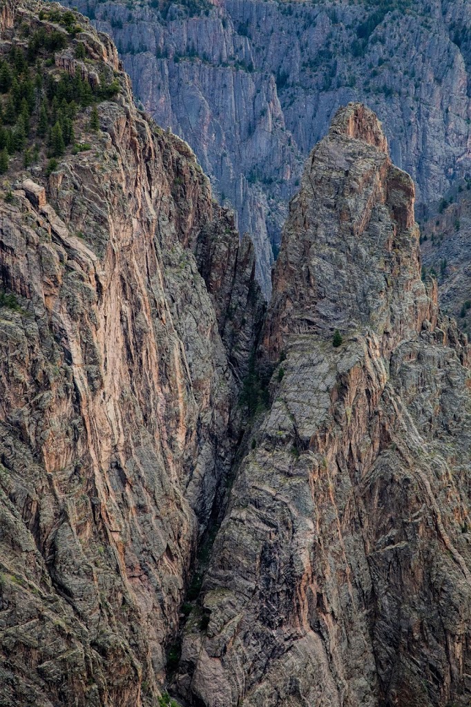
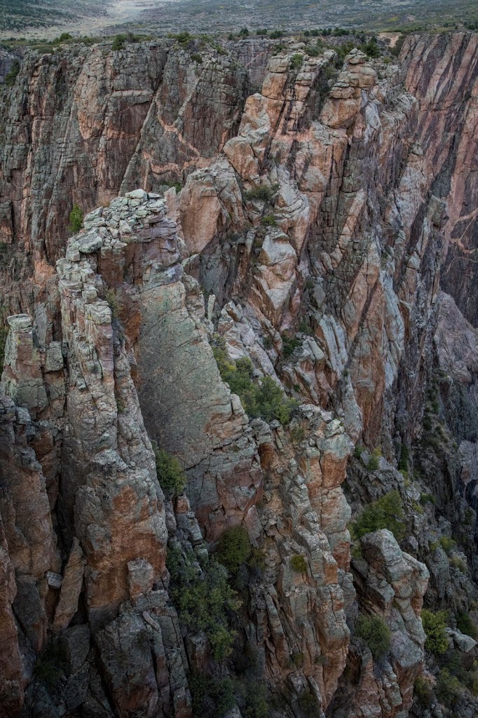
Gunnison Point is the first stop along the rim, looking northward along the canyon. Directly opposite are two deep gullies separated by fractured cliffs.
Pulpit Rock
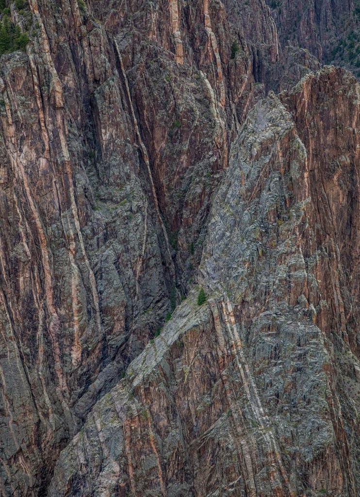
Cross Fissures – the river is not visible, but views are of overlapping ridges, plunging steeply down.
Rock Point and Devils Lookout
Chasm View is the most spectacular of the views.
Painted Wall, at 2,200 ft is the highest vertical cliff in Colorado. It stands more than twice the height of the Empire State Building. The 3-dimensional patterns were formed billions of years ago by molten rock squeezed into fractures and joints.
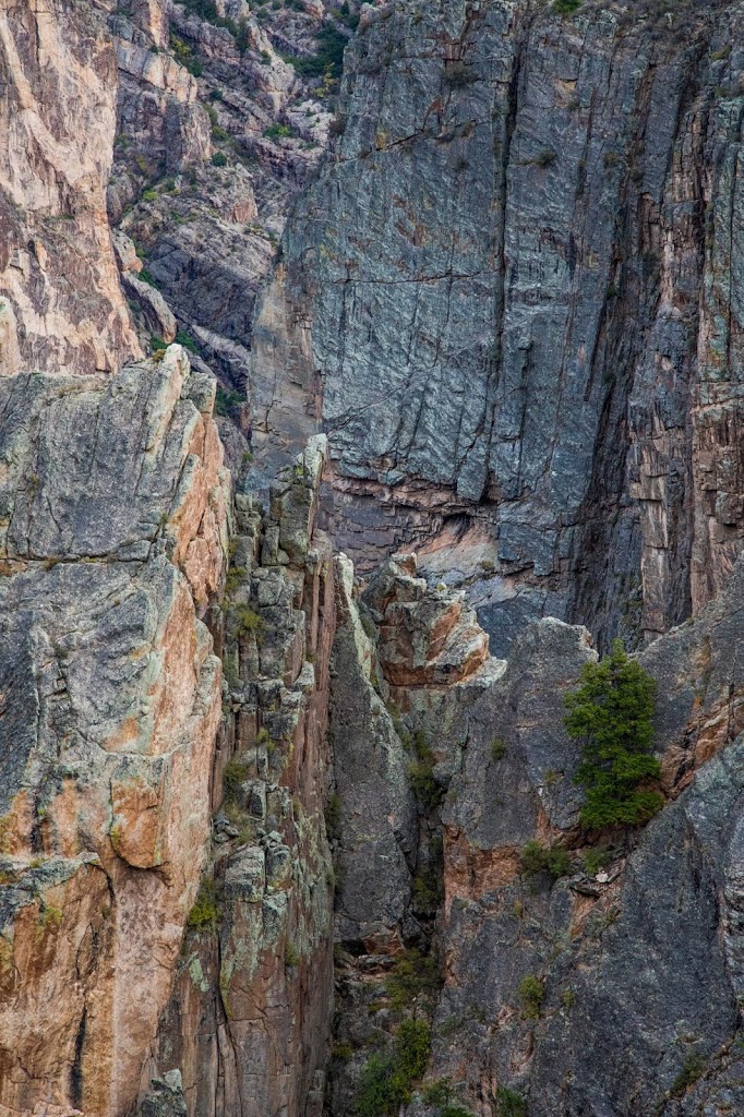
Cedar Point and Dragon Point
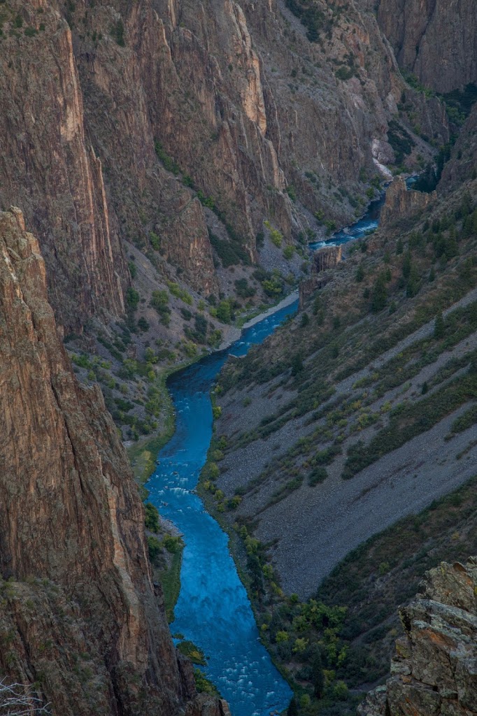
Sunset View, the westernmost viewpoint, the downstream section of the river to the Umcompagre River Valley in the distance.
The last view of the canyon is at the entrance, Tomichi Point before we leave. The sun is setting, turning the river a brilliant shade of blue.
It has been a spectacular day and the park’s beauty is far beyond my expectations. Definitely worth a visit!