Good bye Colorado

Leaving Ouray, we cross the Red Mountain Pass and Molas pass for the last time to Silverton and Durango. Much of the foliage has fallen in Silverton with peak color over. Ray takes a short break to fish the Animas River in Durango, the only river in Colorado he has not caught a fish. Well today he caught one so now we can happily continue on our way.

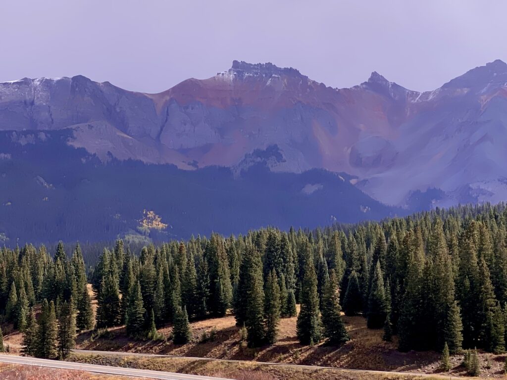
Southern Colorado and northern New Mexico is heavily forested with dense pines on the sides of the San Juan Mountains, sprinkled with spots of yellow aspens. Fields of hay and pastures appear where the land has been cleared. As we approach Taos, the vegetation changes to what we expected New Mexico to be like, flat, dry and desert-like.

Suddenly, popping out of the landscape are unusual structures which we quickly realize is the 300+ acre Greater World Earthship Community, started by architect Mike Reynolds and Earthship Biotecture. The self-sufficient dwellings are built with natural and recycled materials and with energy conservation in mind. The community is fully off the grid, using exclusively solar and wind power, and designed to collect water, manage sewage and produce food for their inhabitants’ use.
We feel like we have been transported into something out of Star Wars!

This is Eve

EVE stands for Earthship Village Ecologies. Designed as an “urban housing environment,” it was made up of five studio apartments that share a communal living space. Eve was never finished and is now used as a greenhouse to grow plants fir residents.

A few miles further lies the Rio Grande Gorge bridge which sits 600 ft above the river. It is the fifth highest bridge in the United States. During its construction in the 1960s, funding did not exist to continue the road on the other side, leading to its nickname, the “Bridge to Nowhere.” Looking down from the railing at the plunging gorge makes me very nervous!

We are staying at the Sagebrush Inn snd after checking in, we have a Peruvian meal at Aji, decent but not the 5 star rated goodness on yelp.

Lizard Head Pass

Our last day in Colorado and we are determined to make the most of it. We head west out of Ridgway, checking on the foliage along County Road 7 again but find the leaves mostly brown and still green, so we head back on the main road toward the Dallas Divide. We can see storm clouds toward the southern high pass but the weather forecast is for clearing in an hour.

The area near Placerville heading toward Telluride has steep red cliffs which quickly change to high mountain peaks and deep channeled valleys of the San Juan Mountains. The foliage is multicolored compared to the yellow aspens of Red Mountain Pass. The highway runs alongside the San Miguel River, one of the last free flowing rivers in the southwest. Flowing 81 miles, its cool, clean water provides a rare refuge for native fish; 30 miles of this river are protected in preserves.

It is cloudy and misting in sections until we reach Lizard Head Pass, elevation 10,246 ft. and the western section of the San Juan Skyway. As we eat our lunch, the clouds break revealing a dusting of snow on the nearby peaks.

With the sun breaking through, we anticipate a scenic drive back and are not disappointed. Trout Lake’s north shore is quite a sight with tall mountains and orange aspens.

Trout Lake

We decide to explore the little town of Ophir, off the main highway on a dirt road. At first sight, Ophir, established in 1881, looks like an abandoned mining town.

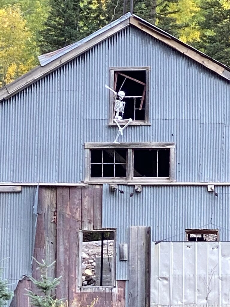
Is it a ghost town?

Driving a few miles further up the road, we see a small village (population 159) set in one of the most beautiful places to live. Though it is not for the faint of heart as avalanches are frequent and the weather is subarctic; the road is closed in winter. Ophir Pass to the east connects to 550, Red Mountain Pass via a 4 wheel drive road that winds high above a cliffside without guardrails! The town is located two miles from the Ames Hydroelectric Generating Plant, the world’s first hydroelectric plant to supply alternating current electricity for an industrial purpose (mining).

Town of Ophir in the distance
Evidence of avalanche

There is still daylight as we approach Ridgway, and daylight must not be wasted, so our last night here is spent fishing the Uncompahgre River at Pa Co Chu Puk one last time, and surprise, surprise, I catch a rainbow around 14”! Ray 0 Linda 1

Owl Creek Pass

We scrapped our initial plan to explore the county roads around Silverton after reading they are 4WD rough roads. Instead, we chose to go up Owl Creek Pass to Silver Jack Reservoir. This is the road that True Grit and How the West was Won were filmed.

Leaving Ridgway

What a beautiful drive it is, climbing up to 10,000 ft. with the Cimmaron Mountains to one side and views of Chimney Rock on the other.

Chimney Rock
Cimarron Mountains
Turrets and hoodoos

We stopped for lunch alongside the Cimmaron River, which comes out of Silver Jack Reservoir. With my eyes in the camera viewfinder, photographing the creek, I am surprised when a huge black cow appears in my photo.

Groves of aspens with backdrops of gold and green beckon me to walk in the woods. Other than the atvs on the road and an occasional cow, it is peaceful.

Aspens

Silver Jack Reservoir is almost dry, the sandy bottom visible as cliffs and undulations.

Silver Jack Reservoir

We have certainly been fortunate with the weather and couldn’t ask for more beautiful days, temperatures in the 60’s, blue skies, puffy clouds and little wind.

Reflections

Not being morning people, we are struggling to get up and be out before dawn. Today’s goal is to shoot the early morning mist, reflections and red mountain glow at Crystal Lake in Ironton Park. Fortunately the crazy scary road through Red Mountain Pass is deserted at this hour and we arrive at sunrise, well before the light hits the top of Red Mountain. Photographers are already lined up along the bank, tripods in place, trying to stay warm in the 39degree chill. Heavy mist is rising above the water and several ducks create circular ripples as they dunk and feed. Next to me is a woman from Prescott, AZ also heading to the balloon fiesta. We photograph the emerging colors on the mountain, the mist and the reflections. Ray leaves to warm up; I stay for 90 minutes before my frozen fingers lead me back to the car. It was worth the early rise.

The early morning light is still magical so we head to yesterday’s spot in Ironton Park. We walk on the dirt roads, and at last, I begin to feel this place. I tell Ray that walking as opposed to driving, allows me to ”see” and construct photographic images. Foreground, background, lighting and composition are very hard to do when standing by the side of a road. I feel very satisfied with my images this morning; they feel like me and I like the compositions.

The afternoon storm clouds move in and sends us back to Ouray. Already we can see that winds are blowing the aspen leaves off and know that in a week, all the color will be gone.

Crystal Lake in Ironton Park
Ironton Park reflections

We end the day with some flyfishing on the Uncompahgre River in Pa Co Chu Puk campground and park. Ray 3, Linda 0.

Alpenglow over the Sneffels

Chasing Colors

Finding peak color is hit and miss, and a bit of luck. I am told color is about 2 weeks late in this area but that all it takes is a few cold nights. Apparently Aspens cluster in families with networks of roots and so on some mountainsides you may see groupings of different colors, some at peak color, others with leaves already gone. My photography instructor directed me to areas outside of Ridgway with spectacular foliage – County Road 7, Dallas Divide, and Last Dollar Road. Unfortunately after driving an hour, we discover that this area has not yet turned color and yellows are spotty. Finding colorful trees in addition to photogenic spots, not to mention places to pull over, is just too challenging. We ended up driving back up to Red Mountain Pass. We spend the entire day up there, admiring and photographing. In one of the aspen groves, I meet a former Colorado forest ranger from Santa Cruz. she got to backpack and hike for her work.

At Ironton Park Downtown historical site is now a ghost town but was once a thriving downtown with hotel, stores, theatre, depot and courthouse, most built between 1870-1950. At its height, in the 1880-1890’s, Ironton (Copper Glen) was the second largest silver mining district in Colorado with a population of over 1,000. it was the major transportation junction between Red Mountain Town and Ouray, with 2 narrow gauge trains a day to/from Silverton. The fall colors provide a beautiful backdrop for the dilapidated buildings.

Historic downtown buildings

Further up the road are houses that were moved from the former Ironton and are to be preserved.

Ironton house to be preserved

Colorado

The second leg of our journey takes us from Farmington, New Mexico to Ouray, Colorado via Durango and Silverton, a 3 hr drive. We pass pueblos, deep red cliffs, beautiful mesas and several Native American reservations. In Silverton, we admire the vivid colors and feel encouraged that our timing may be right for autumn foliage. Molas Pass (10,970 ft) between Silverton and Durango parallels the railway and is part of the 233 mile San Juan Skyway, a national scenic byway in southwest Colorado.

Molas Pass

We stop for produce at Natural Grocers, a terrific local Durango natural foods store with Serious Delights bakery and enjoy their delicious sandwiches at a picnic spot alongside the Animas River. From there, Hwy 550 is named the Million Dollar Highway, consisting of the Red Mountain Pass, a distance of 25 mi. to Ouray, The pass is 11,000 ft in elevation in the San Juan Mts of southwestern Colorado and separates the Uncompahgre and Los Animas watersheds. It is named for the iron oxide rock of Red Mountain on its northeast side.

Winding switchbacks

This section is breathtakingly beautiful. At one pull-out, someone else said, ”It doesn’t get much better than this!”

Does it get better than this?

By the side of the road marked Hayden Trailhead is a lovely lake at the base of a dazzling yellow mountainside. Crystal Lake is a dammed, spring fed, man-made lake. The reflections draw photographers to its banks all day. We join them and view it from many angles, and to my great joy, puffy white clouds roll in just in time for reflection pictures.

Crystal Lake

Further along the highway is a suspended platform with a view of the 120 ft drop of Bear Creek Falls- gives me the hebejebes to be on it and looking down!

Bear Creek Falls

The lower end of Red Mountain Pass was blasted into near vertical cliffs, hundreds of feet above Red Mountain Creek and the Uncompahgre River. Narrow, with no shoulder, winding switchbacks, and an 8% grade. It is very treacherous, especially in winter with frequent avalanches. This is the road we have to take each time we go to see the fall foliage at Red Mountain!

We finally arrive in Ouray, a very small town at 7,800 ft elevation, population 1,000, with the nickname ”Switzerland of America”. As we drive through downtown, the sky is awash with alpenglow.

Alpenglow over downtown Ouray

San Juan River

Today we are going to attempt fishing at the tailwaters, directly below the dam. There is a BLM parking area with a trail that switchbacks down the cliff, meanders through marshy grassland, pools of water and 10 ft tall bushes to finally reach the river. But…that only takes you to the channel. Getting to the main river requires some serious wading through muck and over rocky bottoms. I am resigned to staying put until a group of friendly guys who have been coming from Boston for 40 yrs, direct us to a shallower section. I can’t believe I make it, wading across the channel, around a small island and ending up in a fishable spot. This section is beautiful, movie-worthy and pristine. People say it is crowded today – they don’t know crowded!

The water right below the dam is COLD and by mid-afternoon, my feet are freezing so I end up casting from the grassy bank, below bushes to get out of the strong sun. Even with a hat on, the top of me is burning hot while my feet are cold. The fishing is decent, for everyone else as people around me catch fish. It was so difficult getting over here that we stay put until dusk.

Ray catches several nice sized fish. Ray 6 Linda 0

My fishing buddy and ”gillie”

We loved the burgers from Three Rivers and go back for more, doing carry-out this time.

Guideless

We learn early in the morning that our guide is in the ER with covid and there are no other available guides, so we are out of luck and on our own. We feel badly for the guide but are also thankful he got covid before seeing us! The guy in the fly shop tells us that tiny midges are the trout’s only food source and therefore tiny itsy bitsy flies are used to fish. They are sooo tiny, it is hard to hold them in your fingers, much less tying a knot in the hole! Tying 2 flies on is supposed to resemble a cluster of midges, which we begin to comprehend after seeing them clumped on our waders and fishing line.

Midges clustered on our fly line

We stop in a variety of places, the river is quite mucky in places due to yesterday’s storm. It takes me a while to get my groove back since it has been a number if months since I last fished. Ray catches a couple; I catch 3 about the size of sardines. We don’t have much luck but we are learning about this river.

After lunch, we try to reach the other side of the river, driving down a bumpy dirt road until we reach a flooded out wash. The workman on a bulldozer waves to us saying we can make it in our rental Honda Passport, but we don’t chance it. so much for this side of the river. We do see lots of oil pumps everywhere, even on BLM land.

Oops, flooded out
Oil pumping everywhere

We get burgers from Three Rivers, sitting inside, a bit nervously, though it is practically empty. As we walk out, a couple of men on the bench yell to us, ”We don’t have covid!” Sigh…

Albuquerque

Getting on an airplane these days creates a myriad of emotions-anticipation of new adventures, joy in returning to normalcy, uncertainty about changes to transit procedures and the never ending anxiety about covid. We’ve traveled so much with the trailer, we have forgotten how challenging it is to stuff all our belongings into suitcases. I stuff the bare minimum of flyfishing gear with jacket, rain gear, waders, boots and wading staff into one roll on; clothing, tripod and hiking boots into another and then there is my photography bag which always seems to weigh a ton.

Our flight is on time and we are seated next to a beautifully coiffed and very talkative woman in her 60’s who has a wings pin on her lapel. She is a flight attendant returning from Australia. She tells us her favorite route was to Taiwan but because of the threat of attack by China, has chosen a new route. she keeps us entertained on the less than 2 hour flight.

New Mexico terrain from the air

Albuquerque airport is small and we quickly get our car and begin our 3 hour drive to Farmington. Storm clouds roll in with gusts and heavy rain. Such timing… this rain will wash the rivers out, making for poor fishing conditions.

Ooh, big storm rolling in

We check in at the Best Western. Our guide for tomorrow calls and we arrange a meeting time. We are looking forward to fishing the San Juan river.