Fields of Tulips

A laid back morning with a long walk to and around downtown, sitting on piles of driftwood by Jackson Beach and sipping coffee at the harbor until time to board the ferry. Calm waters and sunshine make it a smooth passage back to Annacortes.

Ray notices in a visitor’s guide that the Skagit Valley tulip festival is going on and it is just up the road in Mt. Vernon. We’ll check it out with hopes we can get in today but as we drive over, we see multiple fields already topped off. Are they still in full bloom, we wonder? The parking lot is full…people are going in…and we see fields of color. It takes our breath away. I’ve always pictured being in Amsterdam for tulip season and here we are in the midst of tulip season much closer to home. The colorful patterns are magnificent in the sunlight with the Cascades in the background. Pure chance in timing. Sometimes you just end up in the right place at the right time.

And… the Warriors win to end the night.

San Juan Island

The Washington Ferry System is amazingly well organized. Vehicle reservation in hand, we line up and are out of the harbor right on time. From Annacortes, the ferry meanders through the strait, past Orcas Island, stopping at the heavily forested Lopez Island before ending the journey at Friday Harbor on San Juan Island. We head out to the western coast, through lush woods, green rolling farmland, past alpaca farms and to the coast overlooking the east side of Vancouver Island. The area below a lighthouse is frequented by whales and other sea mammals. We see a sea lion but no Orcas today. The old English soldiers camp sits in a picturesque cove and the walking paths are pleasant. Huge billowing clouds make for a cool, breezy beautiful day.

The Discovery Inn is not as charming as its website photos but is quiet and clean. Off season and midweek, most of the restaurants are closed but the Downrigger serves up tasty clams in curry sauce and a healthy buddha bowl.

Ferry arriving at Annacortes
Field of cute alpacas
Lopez Island
Whale research station
Empty of containers heading to Canada

On Our Way

Formerly seasoned travelers, it has been over 2 years since we have been on a plane and the packing, parking, check in process feels so foreign – do we still have to separate liquids?

The airport is reasonably busy and I am surprised at the sea of cars parked in long term parking and the parking garage. unfortunately the mask mandate was overturned just this week, such timing, and half the people on the parking shuttle and waiting area are maskless. we choose to wait near those with masks on. i feel excited, apprehensive and anxious. fortunately it is a short flight. The plane is almost full; I had booked a window and aisle and trade my window for the middle, feeling grateful for the young asian guy wearing a mask who is leaning far over to the window, probably more scared of me than I am of him. I turn the air vent to high.

it is now lunchtime and despite our big breakfast, my stomach is rumbling, but I am not about to remove my mask. strange times!!

We land to gray misty skies and head north to Anacortes, a 2 hr drive through pretty heavy 5pm Seattle traffic. is this still pandemic traffic or is Seattle no longer telecommuting? Anacortes is a lovely harbor town, still off-season sleepy, with limited dining, but we find great salmon and cod at Anthonys, and eat in our room at the Salish Inn. The small new hotel reminds me of a modern European hotel, simple, clean and unadorned. We take an after dinner drive through a deserted historic and quaint downtown, a reminder that these are the places most affected in the past 2 years. It is a ”yacht” town and one looks cool lit up against the dark sky. We take an afterdinner stroll through a local market for fruit, cereal and snacks. I am amazed at the variety of muesli cereals, then Ray points out the entire row of frozen pizzas! I guess Annacortes has healthy eaters and fast food eaters!

Shipyard at night

Where are the salmon?

We are appreciating the good fishing years and the abundance of salmon we have enjoyed over the past 20+ years. The river level upstream on the Rogue was low due to decreased amounts of water released from the reservoir, a similar story heard across the west. Drought, climate change…? The salmon were having a hard time getting over the sandy bar created by the high wave action and decreased river flow so very few Chinook were caught by wishful fisherman trolling up and down the bay. Several wild salmon were returned back to the river; Greg says the ratio is about 50/50 hatchery but seems higher the few days we are here! We leave with two “jacks”, young chinooks that are small. The weather was perfect but the cooler returns quite empty. Thus ends our journey as head home tomorrow.

Sandbar on the Rogue

Caught one!

Oregon Travels

If it is Tuesday, it must be Oregon, the KOA in Albany near Corvallis. Lots of logging trucks, clear cut hillsides and lumber mills amidst the forested countryside.

Logs en route
Treeless
Mills

On Wednesday, we arrive at Secret Camp in Gold Beach, a secluded rv park nestled in the woods. We prepare for two days of salmon fishing with Greg, our guide of 20 yrs.

Alas, the fishing gods were not smiling on us today. Under clear blue skies and warm temperatures, we trolled up and down the bay for 8 hrs, getting two nibbles and catching a shimmering green colored wild silver salmon that we had to release. No fish for dinner!

The Rogue
Reeling in
A wild salmon returned to the river

Lake Quinalt

Lake Quinalt sits in a glacial carved valley within the rainforest. We are on the south shore; the north shore is part of the Olympic National Park. The southern forest is much more accessible for photography with heavy hanging moss and beautifully covered maples, firs, cedar, hemlock and spruce.

Mossy forest

Below is an example of a “nursery tree” where a dead log or stump acts as a nursery for a new tree, the wood providing a source of water during the dry season.

“Nursery tree”

My birthday hike today takes us to Irely Lake. The trail is rugged and muddy with a questionable footbridge across the creek!

Birthday hike
Would you cross this?

Our visit to the Olympic NP ends with a colorful sunset and a birthday dinner at Salmon House, all take-out these days but delicious pepper jelly blackened salmon and blackberry pie.

Pepper jelly blackened salmon
Sunset over Lake Quinalt

Backroads

Traveling south along the Peninsula coast, the highway is lined with dense forest but outside the boundaries of the national park, evidence of logging is everywhere-Pacific Lumber signs, huge logging trucks and upon close examination, the dense forest only extends a depth of 100 or so yards beyond which are young trees.

Traveling south

We stop for lunch at Ruby Beach, one of the most beautiful beaches I have seen on the west coast.

Ruby Beach

Some photos of the wildlife:

Elk on the run
Very cute grouse

We arrive at Lake Quinalt Rainforest Resort Village campground in the late afternoon ready to explore tomorrow.

Hoh River and Rainforest

The Hoh River begins at the glacier of Mt. Olympus and flows for 56 miles to the west coast of the Olympic Peninsula and the Pacific Ocean with habitat for several species of salmon.

The western entrance of the park leads to the Hoh Rainforest with an annual precipitation of 12 ft. According to the National Park Service the Hoh Rain Forest is one of the finest remaining examples of temperate rain forest in the United States, which used to range from southeastern Alaska to Central California. The ancient dense forest of giant Sitka Spruce, Red Cedar, Big Leaf Maple and Douglas Fir is home to the northern spotted owl and provides cover for ferns and hanging moss -beginning to turn green after the dry summer. We hike the Hall of Mosses trail with dripping moisture and occasional misty rain. Occasionally the sun breaks through, and the maples, which are starting to show their fall colors, glow and provide a visual feast.

Hall of Mosses

As we hike the Spruce Nature Trail, we notice that the moss hangs higher and is brown. It makes us think about the drought and my search turns up news that in 2019, the national park service upgraded the Olympic National Park to severe drought. “The entire peninsula is abnormally dry,” said Todd Rankin, Fire Management Officer for Olympic Interagency Fire Management. “People often assume parts of the peninsula are not at risk of wildfire, but even the rain forest areas like the Quinault and Hoh river valleys and beaches along the coast are susceptible too.” The abnormally low amounts of rain and heat wave this summer tragically threatens these rainforests.


That said, I’m not sure we should be happy that the weather has cooperated with us as forecasted rains stayed away until late afternoon. We explore the many rivers of the river and Ray does a bit of fishing on the Sol Duc. We try for a 5 star reviewed bbq truck in Forks but strike out again as it is closed. Meanwhile back at the Riverview RV Park, we are dwarfed by two big ones.

First Storm of the Season

The first storm of the season, more typical of late Oct. arrived today. We leave early in the morning to avoid the rain and wind advisory and are now nestled between two very large rvs watching the rain and the wind which is gusting to 20mph, and occasionally shakes Cali-alto. The pine trees that line the Elwa Dam campground are blowing vigorously but the locals aren’t particularly worried; I think they see far worse. The water faucets sit in an dugout but someone forgot to put the lid back on so it is full of water. The campground manager volunteered to bail it out with a cup when we need to fill up; she seems like someone who can “take care of herself”. We are outside of Forks, a small town on the wild and open west coast, so only the hearty can survive!

Wet and windy
Trees in the wind

The beast that pulled up next to us is a 38 ft Raptor RV pulled by a huge GMC pickup truck. They are a family of 3 and I can’t quite fathom the amount of space and how one maneuvers through town with it. Including the truck, it must be close to 50 ft!

Giant next to our mini

Glines Canyon

Glines Canyon overlook is the site of the upper Elwha dam removal, the larger of the two dams. and the highest dam removed in the US. The overlook is nicely designed with interpretive signs on the bridge and a gorgeous view of the restored river habitat. Restoration was painstakingly done over many years with plants regrown in nurseries and planted by volunteers.

The dam removal process
Remnants of the dam
Restoration to a natural habitat

Unfortunately, the road to this overlook was washed out 5 yrs ago in a flood and is now only accessible by a 7 mi round trip hike. We walk past dense forest along the clear, wild Elwha River. In some areas, we see salmon flopping as they swim up river.

The wild and scenic Elwha River

We stop for lunch along the banks and notice schools of salmon spawning in a gravel bottomed section, their fins popping above the surface and large splashes as males chase each other to claim territory.

The Olympic forest

We end the day by Lake Crescent, the largest most pristine lake In Washington. I play around with reflections.

The lake bottom
Reflections

Tomorrow we leave this area and head to the western coast and the Hoh River and rainforest. It appears we will be experiencing rainforest weather as well for the next few days. Tomorrow marks a full week spent in Cali-alto’s 100 sq ft of space.
We try for a small one-man and well -rated wood fired pizza place but alas he has decided not to open today.

Hurricane Ridge

We leave early to drive 30 min. up Hurricane Ridge Road. Even though it is late in the season, trailhead parking lots fill up quickly in the morning. Hurricane Ridge is the jewel of the Olympic National Park. At 5,757 ft in elevation, the ridge sits above treeline and on a windy day, gusts can reach up to 70 mph. Lucky for us, it is a beautiful clear and crisp day.
Past the parking lot is a steep but paved 1.6 mi trail that winds up Hurricane Hill to the ridgetop, providing a 360 degree breathtaking view of the mountain chain to the south, Vancouver Island and Vancouver to the north, forests and the Elwha Valkey to the west and the Olympic Valley to the east. There are many short spurs which lead to beautiful overlooks. We spend most of the day up here, enjoying the incredible sight. The majority of hikers on the trail are very fit, smiling and friendly seniors; I think they are newly retired baby boomers, cruising around in rvs. There seem to be a lot of us these days!

Mountain chain and view of the trail to the south
Vancouver and the Strait of Juan de Fuca to the north
View to the east
Forested mountains to the west
Fall colors appearing

Being out in the national park feels so perfectly normal until we are reminded of these unusual times in seeing everyone in the visitor center with masks on.
Traveling via trailer means we always have a home base with all our creature comforts to come back to, and not having to interact with others unless we choose to. These days, we appreciate our toilet and shower, tiny as they are, and are snug as a bug protected from the elements. Looking around, we realize that there are very few options for outdoor dining in these places where the weather is often wet, windy or cold. The Olympic National Park is also not known for fine cuisine and thus, most of our meals are home-cooked.
In ever rv park, we are by far the tiniest trailer and our unique design does attract attention. RVs seem to be getting bigger and bigger, so much so that they are a tight fit in these old rv park sites. I dream of a day when trailers run on electric motors, recharged overnight as we sleep.

The Elwha River

The Elwha River is an example of how dam removal can successfully restore a salmon fishery and create a healthy ecosystem. Years ago, we watched a documentary about these efforts and it is thrilling to stand at the spot where one of two dams were removed.

Lower Elwha Dam removal site

The upper dam at Glines Canyon has an overlook but the road is currently closed. We are able to walk part way to see the now wild and natural Elwha River. Along the way, we see salmon that have swum all the way from the ocean to spawn here. It is a spectacular sight. The video below talks about this long dam removal process.

The Elwha


Today was all about fish. We hike out to the roaring cascades of the Sol Duc River where Coho salmon come in from the ocean between July and October. Watching them swim upriver and attempt to jump up the sections of the falls in order to spawn fills us with wonder at the power of nature. I manage to capture one on camera.

Coho salmon jumping upstream
Leaping Fish
Sol Duc Falls

The Olympic National Park is mostly rainforest, very lush with moss covered tree trunks and spanish moss hanging from branches. It is misty this morning but the skies clear to give us a cloudy hiking afternoon and a lovely evening sunset.

Olympic National Park forest trail
Sunset at “near mouth” of the Elwha River

Up the Coast with Calialto

Calialto is our teardrop trailer and this week we take her on a coastal adventure, destination Olympic National Park, a long-time in the planning, delayed this summer by fires in California and Oregon but finally happening. This will be the longest trip in the trailer since picking her up in 2019. We had her checked by a mechanic in Concord with wheel bearings repacked. We’ve packed and repacked bedding and clothes in preparation for colder fall temperatures up north, and have a huge stash of pre-cooked frozen dinners and fresh produce, with plans to be self-sustaining due to covid concerns.
Our route takes us through familiar and favorite territory, the Humboldt Redwoods with an overnight at the KOA in Benbo. Several slides along the Del Norte coast have resulted in ongoing road construction on 101, closing the road for many months. We were relieved to learn that this work has progressed well and we faced no delays on our drive to the KOA in Port Orford. The rv campground is heavily wooded and particularly beautiful.

Up the coast of Oregon, the weather brings blue skies and air quality of 0 as we drive past the huge Oregon dunes.

Port Orford KOA
Oregon Sand Dunes

We spend the night south of Portland at Roamers Rest in Tualatin then cross waterway after waterway as the Williamette and Columbia rivers wind through Portland, and we enter Washington. The landscape is lush and green, dense with evergreens, rivers and lakes a feast for our eyes, so used to the parched lands of a drought ridden California. As we approach Port Angeles, we pass the bays, straits and islands of Washington’s northwest. We’ve reached the Elwa Dam Rv Park, home for the next 3 nights.

Communities

The relatively small fire in Willow Creek, due east of Jedediah Smith SP are the cause of poor air quality in the redwoods. We arrive in Benbow fairly early in the afternoon and have time to sit out and relax. I do my 3 mile walk, circling the campground 6 times, which becomes a conversation topic. We get many questions about Cali alto as well, she is much admired. I chat with fellow campers, all distanced. Being out has been a relief- people are friendly, smile and wave. I had reservations about being in some small towns, worried that there might be animosity toward Asians but that was not so. I try to be as friendly as possible.

All in all it has been a successful and positive trip. I’m glad we ventured out. We hope to fo a few more before the nights drop below freezing in the higher elevations.

Fishing

Thick fog blanketed the skies all day as we traversed the mouth of the Rogue River along with 12-20 other boats. Our guide Greg is skilled and never disappoints. We caught some nice chinooks, threw back some wild silvers that cannot be kept, and also lost a couple off the hook. All in all a nice day.

Greg told us that Gold Beach shut down in march and april but has since gone back to business with precautions. There have been only a few cases, mainly prison employees. He said none of the guides have had covid and he dies not know anyone who has. His daughter is a nurse in Medford and they have only had a few cases there as well. Being in town gave us a feeling of normalcy as well, cautiously venturing to the local grocery store and Jot’s for ice. It made us wonder if we have been too extreme in our behavior, or maybe the media has played it up too much?

Hearing Greg talk has given us a perspective on how middle America thinks. Greg is hard working and self employed. Health insurance for him and his wife is $1,800. He is saying why should people who don’t work or those who have never worked here, get free health care. He doesn’t get free care if he goes to Mexico or Canada. He says people who are destroying property and looting need to be punished. He thinks it is shameful that arsonists started the fires near Medford where over 2400 homes were lost leaving Talent and Phoenix ghost towns. He complains about power companies being held accountable for fires when they are not permitted to cut trees down, and Fish and Wildlife not releasing more hatchery fish in order to get the wild population numbers up. I asked if there were a lot of environmentalists in the area and he said no, it is the board members in Portland. It is the covid numbers in Portland keeping their schools closed. So there you have it, small town resident feeling like they get screwed because of all that goes on in major cities.

DMV Yeah

The biggest outstanding task has been to complete our trailer registration. At the dmv in Los Gatos a year ago, we had completed all the paperwork and gotten a plate, only to find out months later that this plate was temporary, and that we would not receive a title until we brought the trailer in to be seen. Well then covid and the fires hit and our plans to take it to Fall River Mills in the spring didn’t work out. Fall River Mills is where we go to fish, and the small dmv has no wait time and ample space to park. So we decided to complete this task in Crescent City this week. Lo and behold, there was no line, the agent took care of everything outside and we were out of there in 15 min. Kudos to the Crescent City DMV!!

Going through Brookings, we pass our all time favorite burger pub which sadly has closed.

Onward to Gold Beach, the KOA is decent. We set up and tried some fishing on the Rogue River by Lobster Creek campground. The smoke from the Napa fires have blown in this direction so we did not stay long. We have an early start tomorrow so spent time getting ourselves organized.


Dodging Smoke

Intending to hike in Prairie Creek Redwoods SP, we made our way south down the Drury Scenic Parkway, which runs the length of the park. The air quality deteriorated quickly and we turned back, hiking the Damnation Trail again. The setting today was completely different, much less dramatic without the fog. We hiked north on the coastal trail which descended into an area with much underbrush and smaller redwoods. We considered ourselves fortunate to have seen the mystical beauty of yesterday.

Back in Crescent City we practiced casting in the Smith river. Using yarn instead of bait, we pretended to fish and were in compliance with fishing regulations, no fishing due to low flow.

We are pleased to have tried our shower for the first time. It works well and we are grateful we can avoid using the campground facilities.

Fog

I was on a mission to seek out fog in the redwoods today but got a late start so the skies above Jedediah SP were already clear. Our next stop was Mill Creek Campground but that was closing for the season. This 40-square-mile property was purchased from Stinson Lumber Company in 2002 to protect Jedediah Smith Redwoods from the detrimental effects of upstream logging. The area was almost entirely clearcut in the 1970s, 80s, and 90s and only a few small old-growth fragments remain. Continuing our search, we made our way south along 101, the long strip of Del Norte SP. Perched on a steep hillside above the Pacific Ocean, Del Norte Coast Redwoods is perfectly positioned to catch the summer fog as it streams off the ocean. Because the higher slopes get more fog (and because redwoods don’t like salt spray), the trees get bigger toward the top of the hill. There are no formal public access points and we ended up stopping at a pull out and walking up an unmarked trail. Lucky for us, it led deep into the redwoods all the way down to the coastal trail, and eventually out to the ocean. What a visual feast as the fog rolled in and out, and the sun cast streams of light through the trees. It was a photographer’s dream and I relished every moment. It has been 6 months since I have attempted any photography and today erased those 6 months from memory.

Jedediah Smith Redwoods State Park is the last in a long string of redwood parks that stretch up Northern California’s coast. It contains seven percent of all the old-growth redwoods left in the world.

The park was named for Jedediah Strong Smith, who in the 1820s became the first white man to explore the interior of northern California.

We ended our day by walking along the Smith River, the last major undammed river in California, and even though fishing was closed for the season, just being by the river was rejuvenating for Ray. All in all a good day.

Nature’s Calm

The day started out pretty ordinary as we leisurely got ourselves and Cali-alto ready for the next leg of our trip. Heavy smoke turned to fog and smoke as we left Garberville. Suddenly, rounding the bend near Ferndale, we ended up behind a few slow moving pick up trucks and to our surprise Trump banners were flying in the breeze. Before long we were amidst a Trump caravan of around a hundred truck cabs and pick ups that wound all the way to Eureka. Some supporters lined the street and others honked in support. This was quite an eye opening experience.

I love being in this part of the state where the redwoods are shrouded in fog , creating a calm and mystical setting. There are very few visitors and as we walk the damp trails in Jedediah State Park and I feel a sense of solitude and peace. We stop here every year and the size, resiliency, and strength of these trees never ceases to amaze me. Seeing their burned out cores gives me hope for the ones burned in the Santa Cruz fires. The Redwoods NP system consists of a partnership between Prairie Creek Redwoods SP, Del Norte SP, and Jedediah Smith SP. The four parks, together, protect 45% of all remaining coast redwood old-growth forests, totaling at least 38,982 acres. The trees are the tallest, among the oldest, and one of the most massive tree species on Earth. In the next 3 days and will have a chance to explore this area more thoroughly. Being out here is renourishing my soul.

Emergence

Our annual salmon fishing trip – scheduled far in advance with Greg, a great guide we have fished with for almost 20 years. Could we get there this fall? We’ve never taken a trailer up there but it is the only way to travel right now. It has been so long since we have been anywhere, I wasn’t sure we even know how get Cali-alto out of hiding, much less tow it. We planned an 8 day trip, stopping in the redwoods and on the coast along the way. All was iffy with the fires – is it safe driving through Santa Rosa? Would there be evacuation traffic? Would there be gusts, ash? With AQI so bad, should we leave a day later? We decided we’ve been cowering at home long enough – must be bold and go for it!

The skies were very, very smokey and temps very hot but we did not see any evidence of fire, traffic was fine, no fire engines in sight…

So here we are, at the KOA campground in Benbow. The air has cleared and it will drop to 54 degrees tonight. The campground is pretty full but our little capsule feels safe. We have a weeks worth of food, our own toilet and shower, a full tank of water and full hook ups. It feels good to be anywhere…at times it feels so normal, I have to keep remembering about masks, hand sanitizers and keeping distance. I suppose it is the new normal.

Sheltered Too Long

I have a hard time believing it has been 4 months since my last entry. So much has happened personally, covid-wise, and in this country. The so called “reopening” I referred to, has come in blips and bursts with only outdoor dining and recreation permitted. Furthermore at the end of May, Ray pulled his back so with that and overcrowded campgrounds, Cali-alto, our lovely trailer has seen no action except for the two nights I pretended to camp by sleeping in our driveway.

We’ve watched as Ray’s friends have boldly gone fishing and returned just fine. We observed neighbors going to grocery stores with no ill consequences. Perhaps we are too cautious? My safe haven is Summerwinds where I can wander and roam safely outside. I’ve limited myself to buying one plant or the garden is going to resemble a haphazard nursery by years end.

In the month of June, Robert’s family stayed sheltered in order for us to see the kids. I treasured the cuddling snd hours of play. In early July, with a carload of food and kids, they made the move to Vancouver, and after quarantining for 2 weeks are living a good life. I had daily facetime sessions with Zoe, make-believe adventures with memoji characters we created, and now that she is in school, with Kira several times a day. We play with finger puppets and virtual hide and seek. With the US border closed, it is as close as we can get.

With weekly baking, I have surpassed 60 loaves of sourdough bread. I’ve settled into a comfortable retirement routine, sitting out front with coffee, newspaper and my raisin toast after my morning exercise. Although my walks are no longer quiet and void of traffic, it is enjoyable to wave and chat with the same familiar faces day after day. The garden is looking great, the vegetables plentiful and a winter crop is growing well.

The latter part of summer has been very hot and lightning started so many fires, it seems like the west coast is burning up. The smoke and heat has trapped us indoors with Purple Air as our constant companion. It is a sad climate future we face in addition to the angst about the election.

The resilience of my mom has been nothing short of incredible. She continues to greet each day with spunk and hope. We are grateful that Jen has been able to remain in CA and build a life with Czarek complete with chickens and dog.

Our Shelter at Home

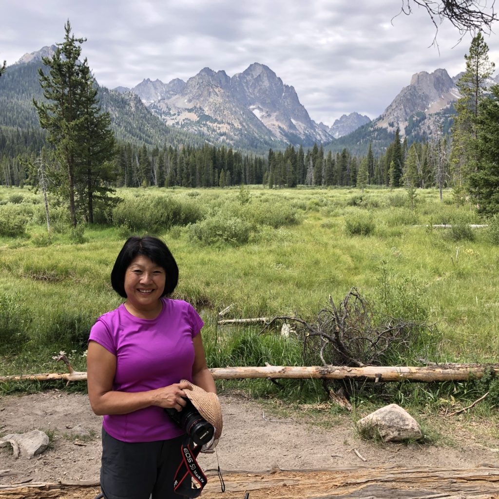
13 weeks at home, a quarter of a year, and in the midst of the community’s re-opening, feels like an appropriate point to stop, reflect, and document how life changed like the flick of a switch. Although Santa Clara County’s lockdown officially began on March 16, mine started earlier with a string of illnesses – hand foot and mouth disease and flu contracted from my lovely granddaughters. Today, I can’t help but notice how very healthy they and we have been in this saga we call sheltering in place.

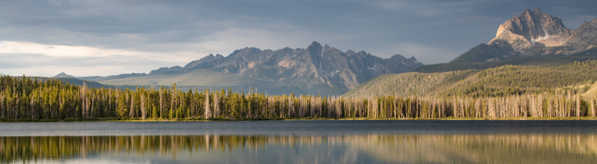
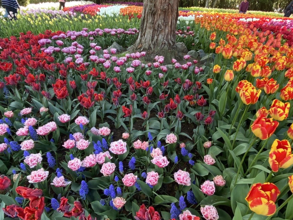
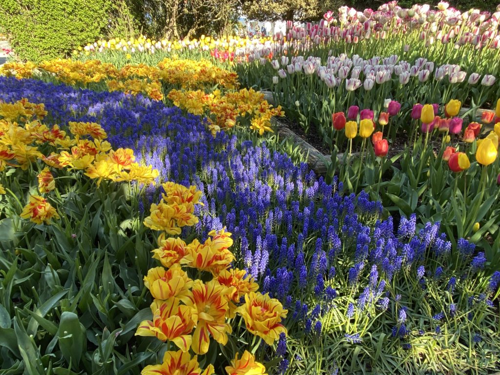
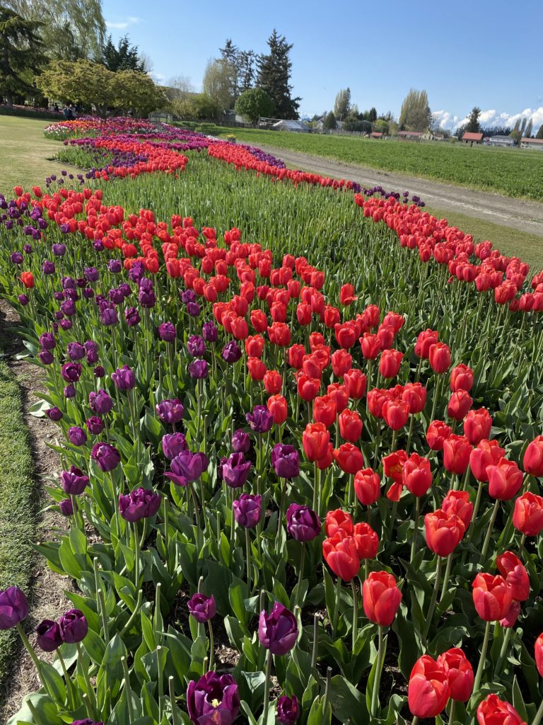
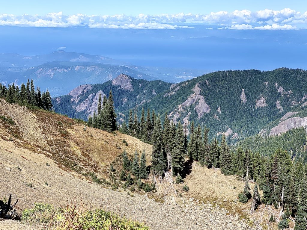
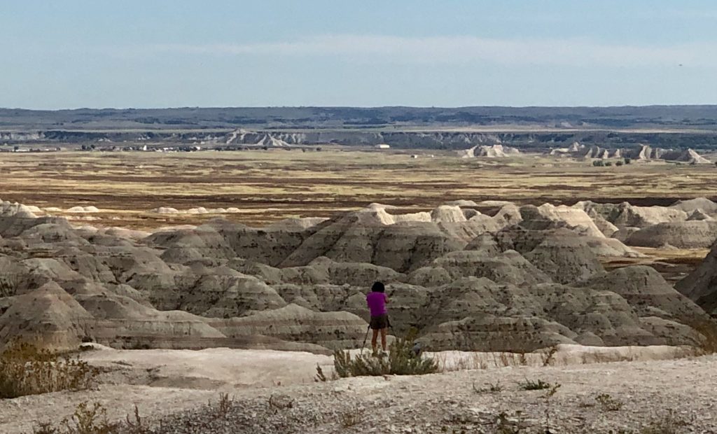
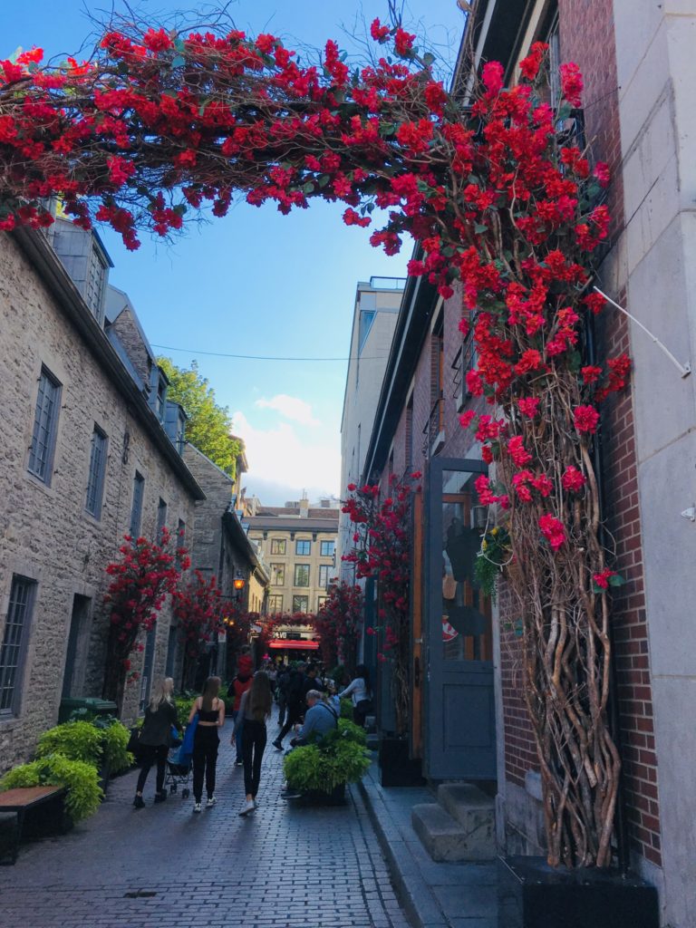
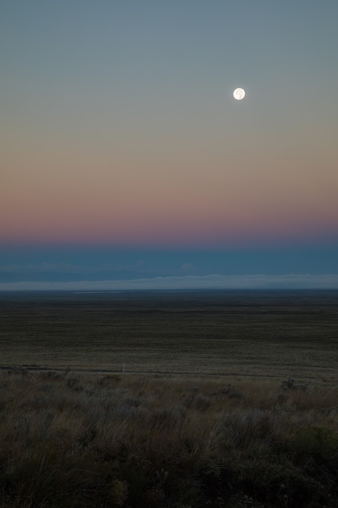
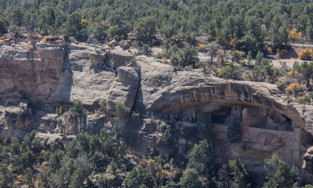
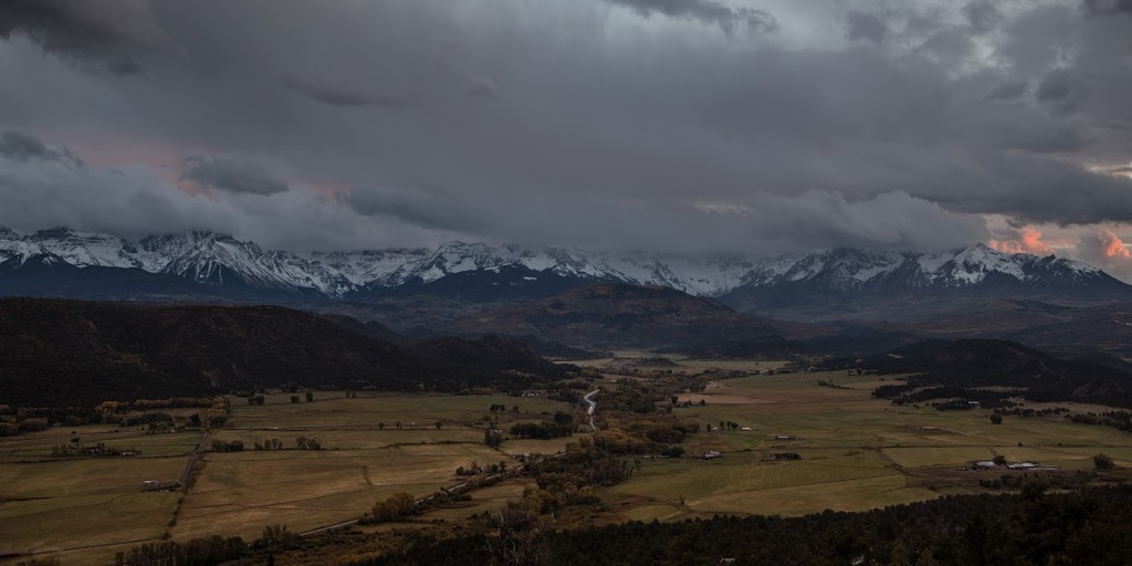
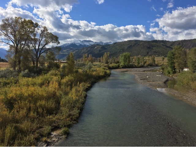
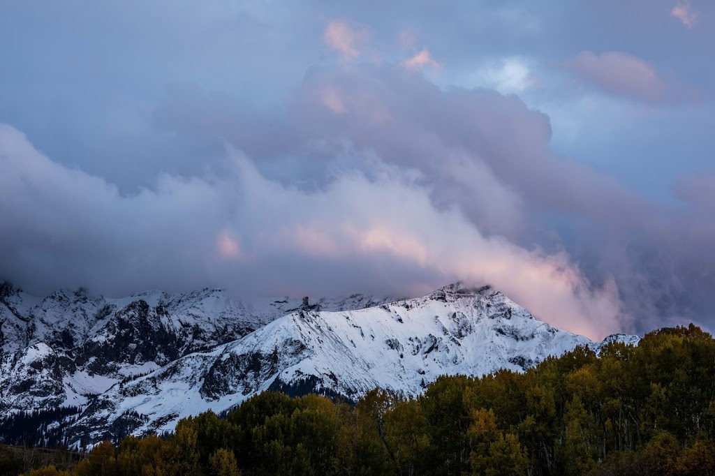
My morning exercise defines the day. It provides a reason to rise and an important purpose, that of maintaining good health and strength, but more importantly mental therapy. I alternate days of walking and running, the same 3 mile route down Los Altos Avenue through the edge of downtown and back. I see the same people day after day, making eye contact and waving hello while skirting their presence. As I make my way down the street, I am fully aware of people in front and behind me, constantly planning whether to cross the street, veer into the bike path, stay on the sidewalk, or use the middle of the road. Throughout the months of March and April, the quiet street void of cars created an ambience of peace and and serenity. Many days, I saw only a handful of people. My senses seemed heightened as the sound of birds chirping was so loud, the air clear and clean making the colors of spring leaves and flowers so incredibly vivid. At night, the stars appeared brighter and the “flower” moon amazingly detailed. The world seems so beautiful until I am jolted back to reality of our “abnormal ness”.

Since retiring in July, the weeks were busy with travels, babysitting and holidays. Suddenly life screeched to a halt. Not one to sit idle, I felt the need to control my life with projects and the organization of chaos, furiously working to complete quilts, clean cabinets, sort papers and pull weeds. There has never been a time until now when our yard was weedless. With no control over the events in the world around me, the yard was something I had full control over. I bought planter bed kits, ordered soil, filled the beds and started seeds. This would be the source of my daily salads and our daily sustenance should there be a shortage of food. It felt like an apocolypse.

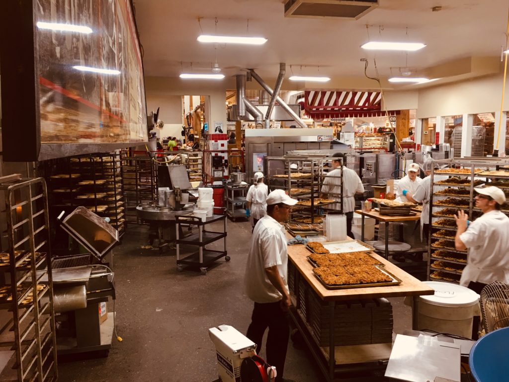
Procuring food took a good portion of each day. Not wanting to venture into stores, I explored all options and settled on a local CSA for our produce, and Instacart delivery for all other food needs. Getting items was a challenge as everyone in town was in need of the same goods and so much was sold out – toilet paper, Chlorox wipes, flour, napkins, paper towels. Finding delivery times meant getting online at 7am to place my order which sometimes meant a 2 week wait. I felt the need to stock up, storing frozen chickens and beans. I joined the bread baking craze until yeast was no where to be found and then entered the sourdough revolution. This weekend I baked my 6th loaf of sourdough raisin bread which we have toasted for breakfast every day since the first week in April. It was delicious.

Surprisingly I have not read a single book though several are stacked on the desk. I have watched every bad romantic comedy on netflix, peruse the news but avoid listening to it, and watch videos on photography but haven’t photographed anything. We’ve settled into a comfortable daily routine that is framed by exercise and ends with listening to Star Trek and Deep Space Nine down the hall on Ray’s and computer, celebrating the end of every 2 weeks with homemade pizza, and an occasional netflix movie. My sleepless nights of March are gone as my conundrum and guilt have been resolved about whether my mother should come stay here or remain in her apartment. She is safe but I wonder if her social life at the Terraces is ever going to return.

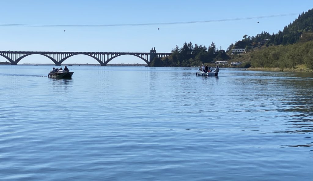
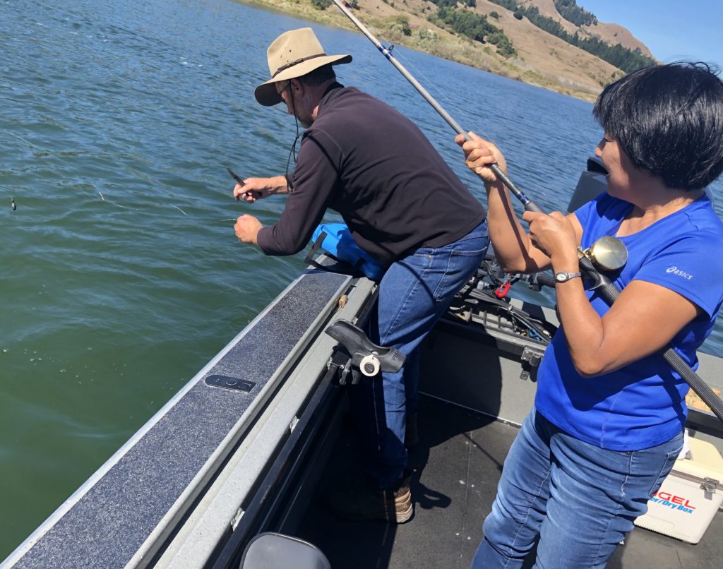
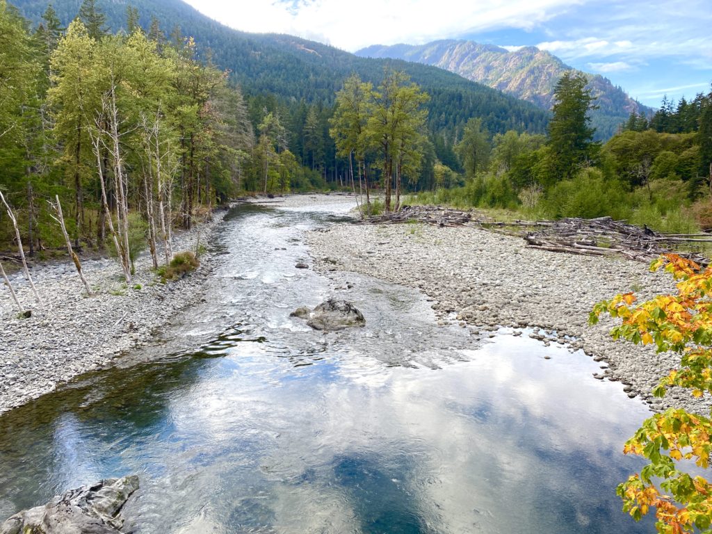
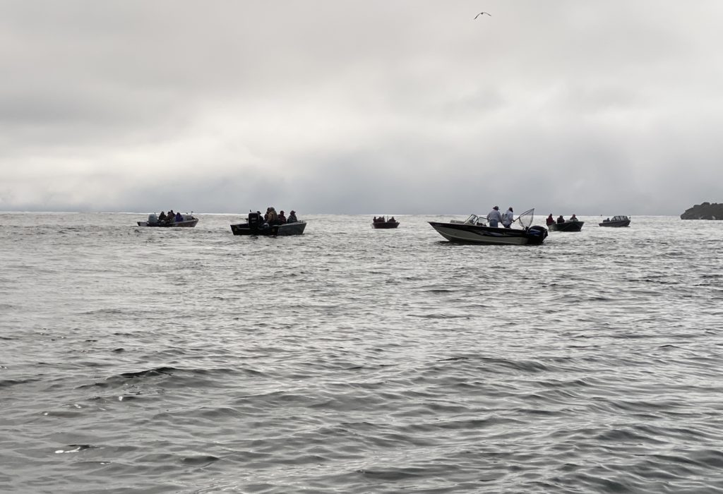
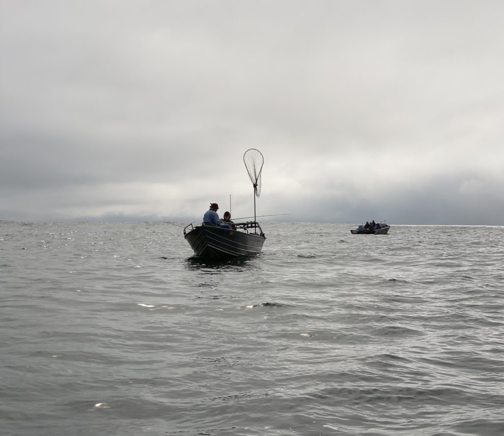
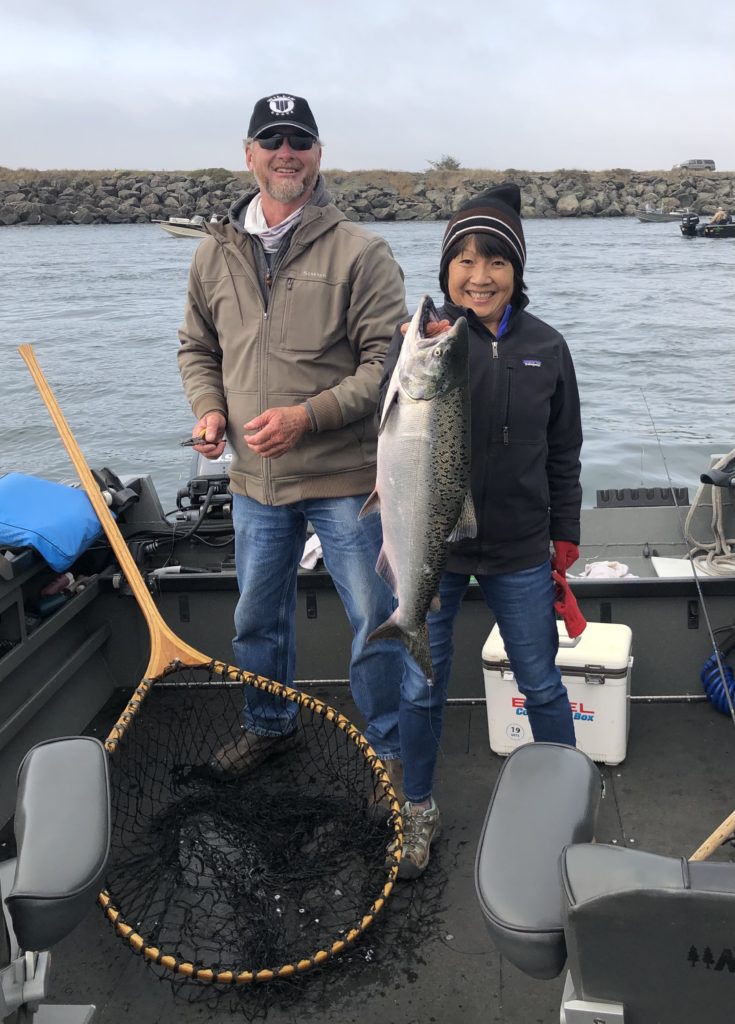
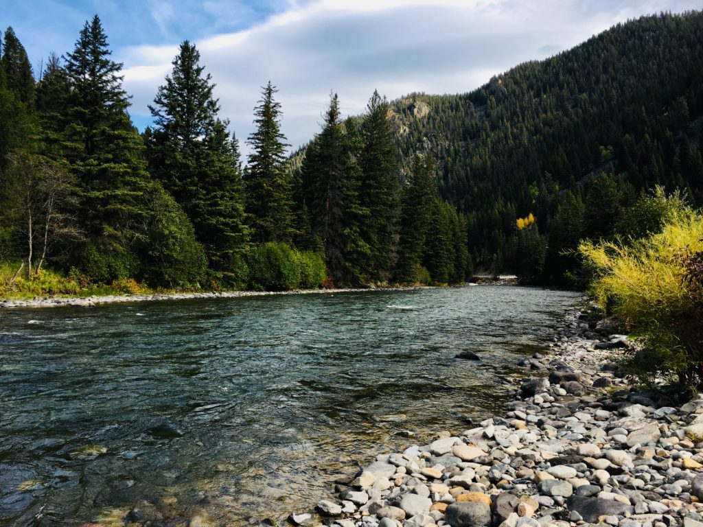
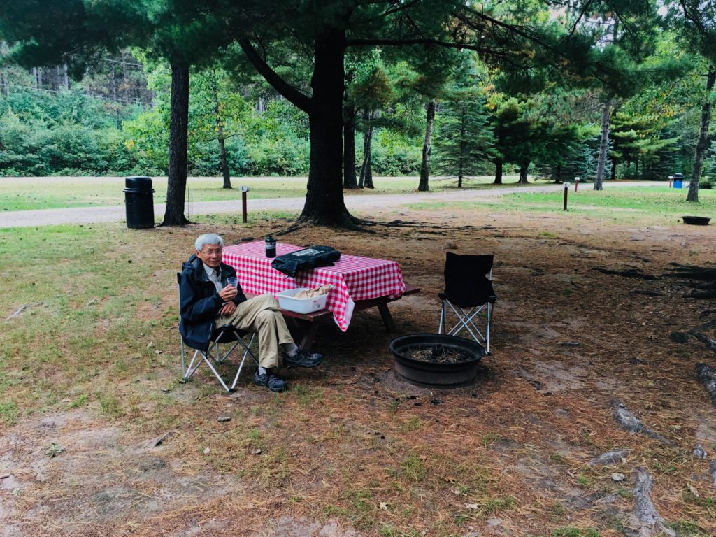
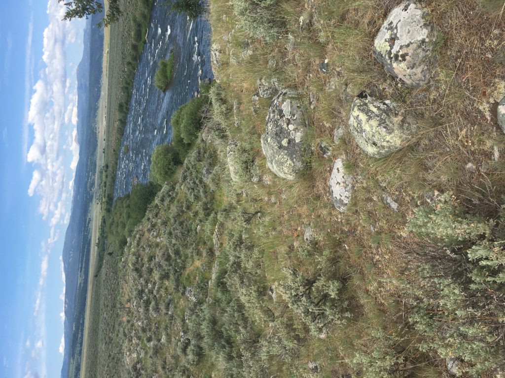
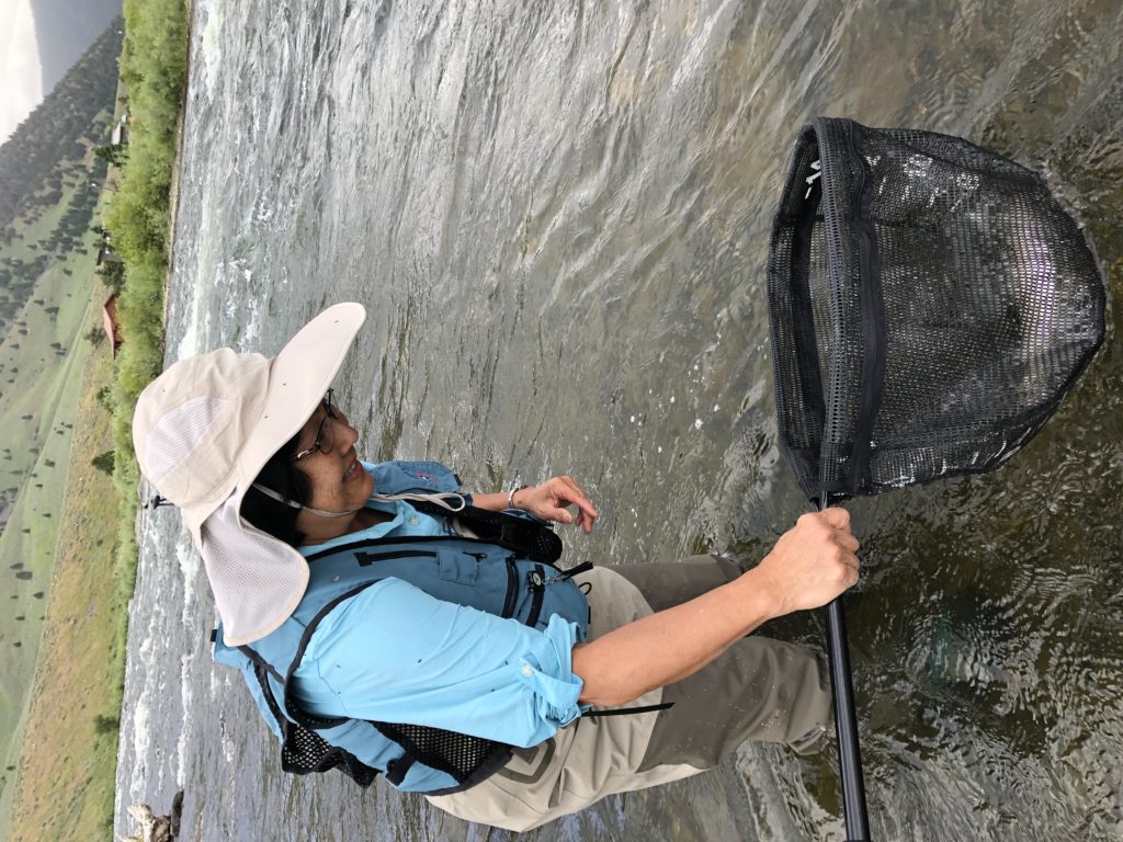
I fear being Asian in a white country and how people will react to us in many of the remote and rural places we go to fish and camp. Will we be in danger or will people forget? Can we defeat this current president who has made China the scapegoat of all his atrocities?

I am grateful for a few good friends that communicate via text or make distanced visits outside. I look forward to Zoe’s texts each day asking if I want to FaceTime and play. We’ve baked cookies virtually, played bingo and have make believe adventures. I am thankful for the uncomplicated birth of Isaac, born in his amniotic sac. I found it ironic that he stayed in a safe sac rather than coming exposed into our strange world; we all need a safe sac to live in right now. Although I have not seen Jen face to face, I am grateful she is in a safe place and not in NYC. I look with pride on Robert’s parenting and the family he feeds and nourishes in so many ways. I am thankful for a partner like Ray who although we irritate each other, is a good companion in so many ways.

Tomorrow, our county reopens and I am skeptical as to whether this is a good thing, though I know our current condition is unsustainable economically. Today as I tried to converse across the street, I noticed the increased amount of traffic. We shall see what the summer holds for us and the rest of the country. For us, it means little as the threat still remains and I am unsure when we will feel safe going to the store, traveling, or going to a restaurant. I fear our lives have forever changed and although many have pinned their hopes on vaccines and therapeutics, I don’t believe any of that is realistically in our near future. I look at the toys in our family room and it saddens me that we won’t be able to do the things with our grandchildren that we and they enjoyed. This moment in time is but a flash in their lives but a large void of time in the shorter time we have on this earth. We have Mileage and funds saved up and no where to use them. More importantly, will we stay healthy of this virus or will we be among the “herd” that contracts it, and what will become of us? I always said that when you have the opportunity to go someplace, you should go because you just never know when you won’t be able to go. I never predicted it would be because of a pandemic. Hopefully this will be merely a blip in the grand scheme of our lives and we will come out the other end stronger and more resilient, and with an appreciation of all that we have.

Mission Accomplished

We make it out of Twin Falls before the winds come. We make it past Reno before the rains and we make it over Donner Summit before the snows. The weather forecast is for up to 50 inches of snow in some parts of Montana!

Driving in the dark over the Sunol grade was a bit harrowing but we decide to push on through instead of spending the night in Sacramento. To top off the evening, we arrive to find a block party on the next street and cars are parked on both sides of our typically quiet street. Takes some maneuvering to get into the driveway- seriously?

Here we are, car is unloaded and Alto is in the driveway awaiting a bath. It all feels like a dream.

Spaceship cloud in the Nevada desert
Coming in for a landing

Foiled Plans

Even the best laid plans get foiled and you can’t argue with mother nature. We need to move on or risk getting cut off at Donner Pass by snow and cold temperatures in the Sierras this weekend. We leave Livingston early and pass through Billings and Bozeman. I find Bozeman to be a lovely city surrounded by snow dusted mountains and full of fishable rivers and creeks. I hear that winters are brutal with below zero temperatures and mounds of snow.

The buttes of Montana

We do stop at least once to fish on the Gallatin, a gorgeous meandering river. The last time I was here, it was muddy from rain. Today it is clear, and the surrounding foliage is rust colored. My casting is just as rusty but it feels good to be out there.

The Gallatin River outside West Yellowstone

I have always loved the clouds in Montana and today is no exception.

Clouds look like an ice shelf

The town of West Yellowstone is empty and the quietness is such a contrast to the crowds we have seen in August. It is obvious that the season is ending and winter is knocking at the door.

The winds pick up to around 22-24 mph as we pass Island City and Idaho Falls. I monitor wind speeds on the Weather Channel in real time an relay them to Ray. After a while we start guessing and find we are pretty accurate – it helps to pass the time!

Surprisingly, the Alto does really well with its weight distribution sway bars and we hardly notice any difference in towing but the trees swaying in the breeze are a bit disconcerting. We breathe a sigh of relief when we reach Pocatello where the air is much calmer.

Winds creating clouds of dust

The road construction never ends and this one is the messiest.

Tonight we reach Twin Falls/Jerome and the KOA is small with many large trees. I prepare sausages we bought in Wisconsin-Octoberfest brats. I have to say, the best brats are in Wisconsin just like the best pizza is in Illinois.

I am excited to see an Alto drive in late at night and hope to meet them tomorrow.

Winter is Coming

Today is a driving day as we leave Rapid City and head toward Billings Montana. We leave early after my run, to avoid forecasted winds along the way. No opportunity to visit Custer State Park, Mount Rushmore or Spearfish Canyon this trip and we promise ourselves we will come back.

Our hope is to be able to get in some fishing time either on the Madison River or Henry’s Fork, and then to head out before nighttime freezing temperatures arrive in a few days. The biggest challenge is to get over Donner Pass and the Sierras since it is expected to snow this weekend. Even if we headed home today, we wouldn’t have enough time to get through. So now our plan is to possibly stay put in Salt Lake City or West Wendover for a few days until the weather improves next week.

Today Ray finally relinquished the wheel and I drive the interstate, giving me a whole hearted appreciation for how well this Alto responds to being towed. I am unable to feel her at all, however our car struggles a bit going up the steep grades and it is somewhat unnerving to see cars zooming by on your left. I feel a bit like an old granny in the slow lane. It takes all my concentration to remember that there are two lengths of us when changing lanes, and that curves take a bigger arc to turn- It takes me back to being a high school student driver, but is also empowering to tow on my own. I today actually believe I could take her out myself and get from point A to B. We’ll see as the week progresses, don’t want to get overconfident!

The Alto is a conversation starter and we meet several fellow Altoistes on the road with plans to stay in touch. There are so few Altos that seeing one on the road is always a thrill. In addition to the couple in Quebec City, we meet a lovely couple from Iowa at a rest stop; we always leave with lots of tip. We stay in touch with others on Facebook, most of whom we have never met.

We love Montana and it feels like we have returned to familiar territory. We spend the night at Osen’s Campground in Livingston. The host has a southern accent, and both sounds like and resembles my friend Alyce from home. Her name is also Linda and she also reminds me of my late boss Lynda.

Not much else to share today aside from the fact that Ray and I are approaching 3 weeks together 24/7 and we are still talking to each other; it is a record!

With eyes on the weather, we look to tomorrow and the possibility of fishing.

Big sky country.

Cornlands and Badlands

We, or I should say Ray, is worried about winds across South Dakota and so we leave early this morning while it is calm. I am excited to see a sign announcing the town of Desmet, home of Laura Ingalls Wilder, whose family was the first resident, and who later returned to raise her own family. I loved her books and spent many hours reading them to our kids. Seeing the long stretches of prairie made her stories come real.

Wind turbines on the prairie.
Fields of soybeans.
Sunflowers
Gigantic tires, not sure what they are for.

It is all about corn today as we drive across the plains. The town of Mitchell is famous for the “world’s only corn palace” which historically was made to celebrate its prosperity and to be an agricultural showplace of the world.

The Palace is redecorated each year with naturally colored corn, other grains and native grasses – 13 different colors or shades of corn (red, brown, black, blue, white, orange, calico, yellow and even green). A different theme is chosen each year, and murals are designed to reflect that. Ear by ear the corn is nailed to the Corn Palace to create the scenes. The decorating process usually starts in late May with the removal of the rye and dock. The corn murals are stripped at the end of August and the new ones are completed by the first of October. It is quite a unique place!

Murals made with corn.

As we drive, I find some interesting corn facts: 40% of US corn is used for ethanol, 36% for feed, 20% for exports and the remainder for other processing like corn syrup. Dry millers produce flakes, grit, meal etc and wet millers for ethanol, syrup, oil etc.

The Chamberlain rest stop has a gorgeous overlook of the Missouri River. At the beginning of the path is a 50 ft sculpture “Dignity” which represents the courage, perseverence, wisdom of Lakota and Dakota cultures.

Made from 128 4 ft diamond shapes, perforated to allow wind to blow through.

By early afternoon, we reach the Badlands National Park, 244,000 acres of spectacular landscape. We drive the 30 mile scenic loop road with many overlooks and viewpoints. What a beautiful place, so peaceful and majestic, with spires and canyons, gray rock with red striations.

Photo of me courtesy of Ray
Photo courtesy of Ray

I also get my first chance to tow today. Ray finally relents… it is really not that hard; both car and trailer are great.

Our last stop today is the KOA in Rapid City and dusk falls as we arrive.

Day’s end

“Where in the World are Ray and Linda”

Ray says we are like the old game “Where in the world is Carmen Sandiego” with little dots tracking us across the US. After a nice run 10 laps around the campground, we are ready to travel across Minnesota. Green fields, the St. Croix and then the Mississippi River, quite narrow as it flows through St. Paul. It is a gorgeous day, too nice to be in a car but we have states to cross before the rains and cold weather hit Montana.

So green are the hills!
Mississippi River
So much corn!!

At a rest stop, we learn that 400,000 square miles of North America used to be prairie. Today, the most fertile and well-watered region, the tallgrass prairie, has been reduced to less than 4% of its original area. This makes it one of the rarest and most endangered ecosystems in the world. This sea of grass stretched from the Rocky Mountains to east of the Mississippi River, from Saskatchewan, south into Texas. It was the continent’s largest continuous ecosystem supporting an enormous quantity of plants and animals. Prairie began appearing in the mid-continent from 8,000 to 10,000 years ago and has developed into one of the most complicated ecosystems in the world, surpassed only by the rain forests of Brazil.

Driving through this area and into South Dakota, there are miles and miles of corn fields. We cannot believe how much corn is being grown. Did you know the US has over 96 million acres of corn, producing over 13 billion bushels and is subsidized at around $3B a year? We see what appears to be soybean fields turning a colorful yellow.

Wind turbines dot the landscape near Sioux Falls and then we see these… not sure what they are.

Tonight we are again at a KOA in Sioux Falls – so many huge rvs pulling in, it feels like a bus depot. Quite an rv culture we had no idea existed! I think visitors from China or Africa would be incredulous.

Torrential Rain

We have lived in California so long we have forgotten what it is like to have constant rain. No wonder the grass everywhere is so bright green. Some lakefront homes look like they are close to flooding.

Today starts out gray but the winds of yesterday have died down. There is an approaching storm and we are trying to beat it by leaving early. Weather along the coast of Lake Michigan can be fierce. Well we make it partway but then the torrential rains come, blinding and relentless for 15 min. but feeling like hours! There is no where to pull over so we plow through with white knuckles, kudos to Ray.

This photo doesn’t show the worst of it!

The towns along the Wisconsin coast have a history of logging and shipping, and some have beautifully restored brick buildings. Heading westward from the coast are cornfields, woods, meandering rivers, and many lakes. We take a break in the little town of Shawamo for brunch at the Farmers Inn, a cute little local cafe. As quickly as the rains come, the skies clear and it is a beautiful afternoon. In the sunlight, the ripe corn tassels create a bright golden palette that is breathtaking.

Pine Harbor Campground is near Lake Wissota on the outskirts of Chippewa Falls, almost to Eau Claire, Wisconsin. Out of the lake flows the Chippewa River which flows to the Mississippi. The sites are spacious and full of large pines. We manage to cook, eat dinner, play horseshoes and walk before it rains again.

Relaxing with Baileys Irish Cream
Compared to others in the campgrounds, we seem so tiny, a real mini!

Together we are gaining on the learning curve, taking baby steps- filled the fresh water tank today. Funny, I feel like we are on our honeymoon, traversing this incredible country together.

Lake Michigan

The colors are beautiful driving across Ontario. We see lake after lake, and networks of rivers that run along small towns. Lake Huron is enormous with two large arms, the end of which is the shipping port and Soo locks at Sault Sainte Marie.

Today’s adventure is taking the trailer over the bridge and into the US. through customs at Sault Sainte Marie.

We aren‘t really sure what to expect and are directed to back up to the dock. I manage to talk them out of the backing up part and they settle for us parking along the edge. We are told to get out of the car and up to the customs office while they search the trailer- not sure what they are looking for (drugs, weapons, people?) but they declare it clear after about 20 min. While we are waiting, we hear them talking about a huge truck carrying spaghetti sauce and making sure there is no meat in the sauce! We breathe a sigh of relief and scramble to get out of there as quickly as possible. For whatever reason, it is an intimidating place and the customs officers are a stern bunch.

The beautiful Manastique Lakeside Campground is on the northern coast of Lake Michigan and the sites are surrounded by pines and maples. in fall foliage. We arrive right as the rain starts. It is windy and the white caps on the lake are pretty big-wouldn’t want to be in a boat out there!

It’s an angry looking Lake Michigan today

We run into a couple from Michigan who tell us the lake was calm as glass yesterday. They also say getting through customs with a trailer can be dicey depending on the mood of the customs officers. They have friends whose trailers were searched and left a mess; they avoid going to Canada.

Now comes the job of figuring out the rest of our return route to avoid some night time freezing temperatures in Montana and Idaho – in September, really?? That and rain/snow showers may prevent us from fishing…and it is so hot back home!

So far we have not unhitched,; the plan is to do so in the Badlands in a few days.

Autumn and Winter?

Today is my birthday and it is a joy to hear from Jen and Robert with Kira. We will celebrate all our birthdays when we get home.

Day 2, today is easier and a bit more relaxed. The highway from Ottawa to Sudbury is 2 lane and goes through small towns. In between are vast areas of forest, lakes and rivers. We are parallel to the river which separates Quebec and Ottawa. The land is mostly flat with some rolling hills.

Our only challenge today is when we go down a side road to look at the lake, and discover that there is no turn around! Backing up for the first time is an exercise in itself.

Tonight we are at Carol’s Campground in Sudbury, looking forward to getting back to the west coast and some fun places! Again, the place is full. The owner tells us people come in May and by October, are gone. Some have 2 rvs – one north and one south, and they keep the unused one in storage. We are incredulous because the rvs have fences, gazebos, porches, storage sheds and large potted plants and some resemble small mobile homes! We find this hard to believe.

Can you believe people store all this away for the winter?

We check weather and find that our planned stays in Montana and Wyoming may not be possible as they expect snow showers next weekend! Can you believe it? We will have to wait and see and plan as we go. Hopefully this cold front will move elsewhere.

Towing

I start the day with a run, using the large KOA as a track, elderly gentlemen wave and smile to me as I pass with each lap. The KOA in Quebec City is immaculate and well kept. We pull checklists that other Altoistes have created and very diligently go through the motions of breaking camp, hitching up and checking/rechecking each step. Over an hour later we are ready to hit the road. Fortunately, the weather is clear and calm. Ray drives, I navigate; we are both very focused.

We have forgotten how much summer road construction takes place in places that have cold winters. Our route skirts Montreal by going south with Ottawa as our destination. We pull in to the KOA in Renfrew right at dusk. The site is a pull through, no need to unhitch. The site is next to cabins and pine trees, though all the trailers are packed close together.

We had expected private campgrounds to be empty this time of the year but it is full with huge trailers that appear to be there for the season; they have gardens and gazebos. Only a few spots are open for travelers. We settle in, prepare dinner and relax for the evening. Thus ends our first day of towing.

Our site sits next to cabins and the woods

Factory Tour

It is always fun to meet other Alto owners while on the road; the couple in the campground today is from Hamilton, Ontario. They have traveled to CA and back twice in 2.5 yrs. He is a retired carpenter and a wealth of information – basically, don’t worry about all the details! They are going for servicing at the factory after putting over 4,000 miles on their trailer.

We spend most of the morning testing things out. I fix a latch and Ray reads manuals. In the afternoon we drive through rolling green farm fields to the factory for our tour. St. Frederic is a small town about an hour southeast of Quebec City, and only an hour from Maine. Safaro Condo, a family owned company occupies several warehouse buildings outside of town. I am surprised how small the factory is. Surprisingly, they make each trailer individually and by hand with no large machinery. Ours was number 1807 and the ones being built right now are 1836-1838; it takes approximately 3 months to fully complete each trailer. The guide tells us they use the “just in time” system so they are able to make changes at any time, and have no inventory. Including sales staff, they have 167 employees. He said it is hard to hire people. There is a lot of demand and the waiting list remains at 18 months but they are not looking to expand right now. The Altos sold in Australia are assembled here and finished there. Their Australian partner is a family with a similar culture to the one here.

Wood framing holds the panels in place.
The walls are aluminum with a tight honeycomb layer in between; wiring is slipped through that layer.
Roof is a single sheet curved to shape.
The factory floor – windows being assembled in the center.

Leaving St. Frederic, we admire the changing colors of the forest and rolling hills. The air is crisp and fall is definitely here.

I cook dinner today, testing out the stove and propane connections. We will be leaving tomorrow to avoid Friday traffic around Montreal and to dodge rain in the upper Peninsula. We take a last look across the river at Quebec City from the ferry landing in Levis. It is a beautiful clear evening and the Chateau Frontenac and the city wall are lit up. Au revoir Quebec City. We leave with many memories.

Chateau Frontenac and skyline of the old town.

What a day!

Wow, quite a day, more eventful than buying a house and moving in. At least with a house, it is standing still – you don’t have to take it away, and everything is pretty standard- fridge, stove, etc. A trailer is quite a learning curve though we had an excellent 3 hr tutorial by Francois at Safari Condo and although it’s not as intimidating as I imagined., it is still a bit nerve racking and anxiety provoking. But we are now cozily settled in, eating chocolate, and the heater is nicely warming up the place. I had never liked KOAs but I have to say, having full hook ups is not bad, despite being parked like dominoes, but when you are inside with curtains drawn, you really can’t tell the difference. It’s not the way we plan to camp but it is a good way to start.

So here is a summary of our day: We arrive promptly at 9 at the Safari Condo office.

We are finally here- at Safari Condo12 days en route and 3,500 miles later

Our trailer is inside and Francois leads us sequentially through the exterior – (lights, storage, locks etc), interior (all the components like tank gauges, heater, water pump etc.) He warns us about errors we could make that would be catastrophic, like leaving the water pump on and flooding the trailer! His delightful French accent and his sense of humor fortunately make the lessons easy to listen to. “No notes, no videos, focus and listen”, he instructs. OK…? Francois tells us that only residents in Washington and Alberta can purchase an Alto from Canway, an RV dealership but that all other customers must make the trip here; they do not ship. 4 are picked up each day and we meet 2 other couples-one from Colorado and the other from Montana. We bond over driving stories. Customers meet and share information on Facebook.

He ends with the most complex – back up camera, brake controller, hitching on and off. This I do video. So much to remember to do and check! Francois says by the time we are back in California, it will all be second nature. I sure hope so!

Exiting the shop. It is number 1,807 produced.
This is it!

Then we are off and we space out, going out of the lot onto a rural road that is not that well kept. I keep telling Ray to slow down; he is just focused on the police car that so coincidentally is behind us. We somehow end up at the KOA that is only a few miles away, pull in, figure out how to unhitch, chock the wheels and get the roof raised. Hurray! Baby steps- one step achieved, we eat lunch and relax.

A few gifts

We spend the afternoon figuring things out – locking thing up, and unloading the car. We make a trip to Canadian Tire for a torque wrench. The place is huge and the name is deceiving; no food or clothes but just about everything else here.

We decide that getting propane can wait until morning so we stop at Tim Hortons, Canada’s equivalent of McDonalds, and have Beyond Burgers. Mine is not cooked as browned as Ray’s and I can barely get it down. His is more flavorful than mine but nevertheless, I am so glad I am not a vegetarian!

Far from being the most delicious burger I have ever had, probably not to be repeated

We are here for 3 nights, testing things out so we can go back to Safari Condo if something doesn’t work. We have a factory tour scheduled for afternoon which should be interesting.

I’m not able to upload a video of the roof raising on the KOA wifi but you can email me if you would like to see it.

Quebec

We take our time leaving Montreal/Longueuil, lingering over breakfast snd coffee. The drive to Quebec City is around 2 hrs and the highway swings away from the St. Lawrence River in the direction of the borders to Vermont and Maine. The landscape is flat and heavily forested with deep underbrush. We see a hint of fall color on some trees but are about 2 weeks too early; fall color is more dependent on length of day than temperature. Apparently cold temperatures turn the leaves brown and wind blows them off, so fall color can be variable and unpredictable. Today again it is cloudy and breezy, making us wonder how often the sun comes out!

The Comfort Inn is in Levis, across the river from Quebec City. We are staying here for the convenience to Safari Condo, where we will be picking up our trailer tomorrow. The receptionist recommends taking the ferry over to the city but we realize it is a 40 min. drive to the ferry terminal, and the ferry only runs hourly after 6pm. Since it is already mid afternoon, we decide to drive in, which takes about 20 min. and park on the outskirts of the old town.

We head for the Paillard, a french bakery, for croissants but later realize that baked goods are best sampled early in the day. These are no match for Alexanders in Mountain View, or maybe they are stale from being there all day. We walk the backside of the old town and a portion of the old city wall. The architecture is charming. The old town sits high up above the riverfront and is reached via steps, 200 on the river side, about 100 from the backside.

Narrow lanes!

We find the tourist section to be pretty commercialized with gift shops and restaurants, not quite the French city I was expecting. If we have time later in the week, we will tour the riverfront which has historical buildings and the Chateau Frontenac.

Today we are preoccupied with all that we need to know about this trailer, and if we have all the tools we need. We are a bit nervous about how it will all turn out. Stay tuned for tomorrow…

New bridge across the St. Lawrence River

Lazy Sunday

A lazy sunday on a gusty day, doing some laundry and being laid back. Le Dauphin has a nice continental breakfast and good coffee.

In the afternoon we venture out on foot and wander through Montreal’s boutiques, art galleries and plazas. The harbor’s glass enclosure provides some photographic delights on my iphone.

Lines shooting off into space
Converging lines
Montreal skyline
Mystical cloud cover

At dusk, we walk by a sign “world brisket champion”, check Trip Advisor and learn it is a highly rated bbq place. The Texas beef brisket is indeed mouth watering and the beans are smoky good. Trip Advisor, we love you!

John, the owner is a native of Montreal with a brother in Sacramento. He went around the country judging and competing in bbq contests, winning world champion at the 2012 Jack Daniels competition, before opening Lattuca 5 years ago. We had a nice chat, hearing his stories.

Award winning beef brisket and pulled pork

Sunday night is quiet in the old town as we say au revoir. Montreal, you are charming and delightful.

Montreal

The roads around Montreal are a jumbled mess of construction, detours and traffic. I can see why everyone recommends not driving in the city. It takes 2 hours to drive from Brockville; the scenery reminds us of Illinois as do the cloudy gray skies. We are staying at Le Dauphin in Longueuil, which fortunately is across the river from Montreal city center. It is easy to find and has clean and very modern rooms.

Le Dauphin is just a 5-10 min. walk to the Longueuil-Univ. Sherbonne station. The infrastructure in Montreal is older and the subway, though an efficient system, is not as sleek as Toronto. We easily get into Montreal which appears to be about half the size of Toronto. Since it is gusty and chilly, we head for the north part of downtown where 20 miles of underground promenades connect shops, restaurants, museums, theatres. What does that tell you about the weather here? After walking through one short section, we decide it feels too much like walking through a big mall and emerge at the Palace D’arts. Surprise, it is sunny and warm outside! There is an exhibit of big chess boards and games are being played.

Chess game in progress

We walk and walk and walk, through Chinatown, into the old town, through plazas with street musicians and lined with restaurants.

Huge amusement park with zipline and technical course, not an activity for me!

We stop for a simple early dinner at Modavie where tables are still available at 5. She says we must be out by 7! I guess we Americans don’t spend enough time lingering over dinner.

Bison osso bucco and saffron sage risotto

In our strolls, we come upon an Exposition of the World Press Photography Competition. These are the winners of the annual competition of press photographers, powerful images, some difficult to look at but a reminder of the hardships and tragedies we have seen on the news and that people endure – at the border, in Mexico, Honduras, Afghanistan etc.

The streets and plazas are quite lively this saturday night and as we head back, groups of young people are just starting their evening of fun.

Decadence

It’s a gusty morning and we cannot resist the temptation to see if we can get in for dim sum again, though it will be light today. We arrive at 10am and the wait is only 20 min. We order just a couple of items and a few for the road.

Curry chicken puff
Glutinous rice and chicken wrapped in lotus leaf, oxtail

Leaving Markham, we wind our way north along the St. Lawrence River toward the Thousand Islands. We take a break at The Big Apple which turns out to be a big tourist trap. One of the workers tells us the apples are imported, not local! Nevertheless, the apple pie factory is fun to see.

Next stop is the Kingston Visitor’s Center. When I come out, Ray is chatting with an elderly gentleman with an Irish twang, who is sitting on the park bench drinking coffee. He is immensely helpful, directing us up to Gananoque on highway 2, the scenic drive to Brockville. But wait…Ray spots Mio Gelato, and how could I say no?

Oh my, what a gelato shop! Again we strike gold! There are so many flavors and after tasting several, I settle on peach and passion fruit. Ray has mango and is still raving about the cinnamon latte. Will you believe me if I tell you it is the best gelato in north america and just like in Italy?

Kingston has a battery, built in the early 1800’s to protect the area from attack by the US. The streets of Kingston are lined with colorful petunias, one of the benefits of rain!

The 1,000 Islands sit at the northern end of Lake Ontario and the mouth of the St Lawrence River, ranging from tiny islands and ones with just a cottage, to large parks. You need a boat of some kind to access them, or you can take a cruise on a tour boat. We choose to view from shore.

This island has a summer home
See the bridge connecting the two houses?

We end the day at the Comfort Inn in Brockville. Tomorrow we go back to our salad diet. I’ve got the lettuce and bell peppers waiting!

Best Dim Sum Ever

We awake to rain showers in Hamilton which continue all morning as we arrive at Niagara Falls. The falls are as spectacular as I remember as a child even with rain and gusting winds. It is Ray’s first time there. The town itself is a bit Vegas-like but given the weather and time of year, is quiet. We find the grounds of the park to be nicely groomed with beautiful flower gardens and we learn that the objective of the park foundation was to maintain the view free of charge to all, which is terrific.

It takes us 90 min. to get to Markham, a suburb of Toronto, which we had been told has the “best Chinese food and dim sum in north america.” The reception host at the Hilton Garden Inn asks me what brings us to Markham, and I reply, “the food!”

With great anticipation, we walk across the street and arrive at the Dragon Boat Fusion Restaurant at 2; the timing is not coincidental as we were told each day people start lining up at 8am for the 10am opening, and the lines continue until 2. Today it so happens is a slow day and we get a table immediately. The challenge is deciding what to order. We wish we had more people with us. After all, how much can 2 people eat? Apparently quite a bit, as we do pretty well, though we won’t need to eat again for a week! It is truly the best dim sum we have had since going to a floating restaurant, the Jumbo in Hong Kong nearly 40 years ago.

Mushroom and vegetable dumplings, bean curd rolls and very crispy noodles
My favorite – eel and avocado rice rolls
Huge and very fluffy siu mai
Ray’s favorite – fried glutinous balls filled with pork, very light

After all this food, we need to walk it off, so we take the subway to downtown. The CN tower is open and we watch the sunset and lights of Toronto from 1,100 ft high. It is a crystal clear evening.

Toronto is a lovely city, very diverse, clean, safe and with a very efficient public transportation system. We are quite impressed with what appears to be a good quality of life here.

Peaches

Western Michigan is such a beautiful part of the state with lush thick forests, rolling hills and proximity to Lake Michigan. At the first visitors rest stop, there are shelves and shelves of tourist pamphlets. I find a few on farms and fruit stands which leads us to a stop at Piggot’s in Benton Harbor. How can anyone resist fresh peaches? After all, this IS Michigan! Alas, we cross the border in 3 hours and have to consume all fruit before then. Lunch is fresh blueberry pie and peaches.

I think we are following storm clouds as we drive through strong thunderstorms for about 15 min. Dark clouds loom in the distance. The air is heavy and a warm 90 degrees. I am still doing 100 jumping jacks every time we stop.

Chicago

It is a short driving day in very muggy and warm weather, and occasional showers. We are excited to be in the Land of Lincoln, and after all these years, still feels a bit like coming home. We arrive mid afternoon and spent a pleasant time visiting with Elaine (Ray’s sister) and Roger, who give us a great tutorial in using dump stations with a trailer, and show us how the hoses attach. The process is so much less intimidating now!

We meet up with Tim, our nephew for a Thai dinner, who tells us about a new assemble together kayak by pakayak. We are intrigued and learn it is a kickstarter company. The kayak can be taken apart into 6 pieces!

Elaine has arranged a surprise birthday wish after dinner and the waitresses lead everyone in singing happy birthday to me-so sweet! It is great to spend time visiting with family, such a rare occurrence these days., and always treasured.

Nebraska

In 1862, the Pacific Railroad Act chartered the Central Pacific and the Union Pacific Railroad Companies, tasking them with building a transcontinental railroad that would link the United States from east to west. Over the next seven years, the two companies would race toward each other from Sacramento, California on the one side to Omaha, Nebraska on the other, struggling against great risks before they met at Promontory, Utah, on May 10, 1869. Construction reached Cheyenne in 1867 and the old historic depot is a point of interest today.

I 80 running across the south of Nebraska runs through grasslands, treeless plains, and wheat/corn fields. I find it surprising to see so much uninhabited land. The small towns grew along the railroad lines or were the site of forts that protected the towns from Native Americans. The Old West, often referred to as the Wild West, encompasses the period after the Civil War the rest of the 1800’s, and the early part of the 20th century up to 1912, when the last mainland states entered the Union. During this time, thousands of pioneers pushed their way westward in search of land, better lives, gold and silver, and sometimes, to escape the law. Geographically, the “Old West” generally applies to those states west of the Mississippi River.

Occasionally some interesting sights are seen on the interstate. Huge headquarters of Sierra Outpost and Cabelas are a surprise to see. Then, we are puzzled by what this is until we see them being installed further up the road. It is a huge wind turbine blade being transported. Then just now, I find this article https://nebraska.tv/news/local/wind-turbine-blades-halted-near-axtell. I learn that Nebraska is the greatest wind corridor in the country; wind farms are plentiful.

Wind turbine blade
Replacement blades

We hear so much about Omaha and Berkshire Hathaway so are curious about this city. We find it to be a lovely city that sits along the Missouri River amidst rolling hills and trees. How come there is NO traffic at 6pm? Between Omaha and Des Moines is the largest rural Danish settlement in North America.

Our final destination is Des Moines, where we enjoyed a delicious meal of bbq ribs at Smokey D’s. The Best Western Plus in Altoors is where we end the day.

And Then We Fish

A trip is not complete unless there is fishing! Today we head to the Yampa River in Stagecoach State Park, just outside of Steamboat Springs for a day of fishing. Ray tells me what a great river it is and I am eager to try. We leave early in the morning so to get a good spot before others show up. The river is fed from waters below the dam keeping the water temperature cold year round. We walk a bit under a mile to the spot Ray had fished before. The morning air is chilly and as the river is in a canyon. We don’t see the sun until mid morning. Naturally, Ray immediately catches a couple while I get used to being out there and try to remember all of my skills. The water is sooo cold I end up going back to the car for another layer of pants. After following Ray around most of the morning and not catching anything, I finally branch out on my own, find my spot, set up my own line and lo and behold, actually catch a fish! What a great feeling to have done this all by myself. (see photo below).

a fish caught all on my own!

Sarvis Creek is a mile down a dirt road and that is our next spot. We fish the Yampa right by Sarvis, which is much more challenging and after an hour, strong gusts and dark clouds chase us out. Just in time as a huge rainstorm hits the area. We haven’t seen such a heavy rain in a long time! We take our time leaving Steamboat and manage to get on the road while there is a break in the storm. Misty clouds float across the skies as we ascend the summit above Steamboat.

Steamboat Springs from the summit

The road winds down from 9,500 feet to 7,000 ft. until it reaches Laramie, a frontier town that was founded in 1860 as a tent city near the Overland Stage Line route, the Union Pacific portion of the first transcontinental railroad. The landscape is flat with occasional rock outcroppings but the dark clouds and dwindling light create a very dramatic scene. Cheyenne is just an hour away and we reach town just as darkness falls. We have arrived in the Wild West. The Little America Hotel is a very nice cheap deal, the best we have seen so far.

We’re Off

Our “big adventure” has been in the planning for some time and it is hard to believe that we are really on our way across the US.

After leaving the traffic in the Bay Area, crossing Donner Pass and the Tahoe forests, I-80 drops into Reno and the flat land of Nevada is desolate and barren. I have always found this landscape to be beautiful in its own way, the purple and red mountains a contrast with the golden colored grass and olive green sagebrush.

This time, I look up the history of the small towns along the way that we have passed and ignored so many times. Some interesting pieces of information emerge regarding their roles as railroad towns.

Winnemucca – In the late 19th and early 20th centuries, Winnemucca had a vibrant Chinatown. The Chinese originally came to the area as workers on the transcontinental Central Pacific Railroad which reached Winnemucca in 1868. Some remained or returned to settle. During the 1890s, around 400 Chinese formed a community in the town. Among their prominent buildings was the Joss House on Baud Street, a place of worship and celebration. In 1911 the community was visited by Sun Yat Sen later to become Chinese president. He was on a fund-raising tour of the United States to help the Xinhai Revolution

Elko has been the home of the annual National Cowboy Poetry Competition for the last 33 years. This festival is held each January and is a week-long celebration of life in the rural West, featuring poetry, music, stories, gear, film, photography, and food.Every July, since 1963, Elko is host to the National Basque Festival.

Wells began as a place called Humboldt Wells along the trail to California. It was subsequently founded as a railroad town along the origin of the Transcontinental Railroad and was once a stopover for passenger trains. The Humboldt River as its source in springs and a swampy area just west of the city that today is called Humboldt Wells. 

West Wendover is the last town in Nevada and straddles the border with its many casinos. Wendover sits on the other side of the border in Utah and consists of motels with no gambling. The 2 towns run the length of the same street. I am standing in the middle of the road taking these pictures.

The Great Salt Lake is the largest remnant of Lake Bonneville, a prehistoric pluvial lake that once covered much of western Utah. The majority of the Great Salt Lake is dry salt flats. Further east is a small section of the Great Salt Lake that is still water. Last night a large group of movie film caterers were talking about setting up to film early in the morning. The chunks of salt on the floor of the Quality Inn that they tracked in, and the clumps stuck to the wheels of some cars, looked like snow!

The Bonneville Salt Flats today is 30,000 acres. Here is an interesting site about the speedway https://www.bonnevilleracing.com

Telephone poles run along the railroad track. An amazing feat to run a telephone line this far across the country!

Reflections

As we end this trip, my first fly fishing adventure, I reflect upon my journey since April when I attended my first fly casting class. It felt at the time that I would never be able to figure out the correct motion to get my fly line out without tangling or whipping myself in the face. Practice does lead to not perfection, but improvement and my hours at the casting ponds, with lots of help from Tony, the casting guru, eventually paid off. I have advanced to intermediate level at the Golden Gate Flycasters and can do a decent falsecast, rollcast, shooting line and

My first trip with Ray to Hat Creek was a bust as far as casting or fishing were concerned with me spending all of my time pulling my hook out of grass. My thought- fly fishing is a hard sport!

I give my success on this trip to Ray who patiently coached me, found places to fish where I would be successful, threaded my line when I couldn’t see the hole in the hook, and patiently untangled my line. The Gallatin Women’s Fly Fishing class gave me confidence to get out there without anxiety, and gave me success in catching fish on my own. I can even wade in the water without feeling like I will float away! All in all, great progress was made!

Montana and Wyoming are gorgeous with huge open vistas, few people and beautiful scenery. These are places where I feel a sense of peace and a closeness to nature. For a brief time, we can feel far away from the problems of our world.

Fly fishing is still a male dominated sport though it seems to be gaining in popularity among women of all ages. We even met a couple in Montana – the husband was accompanying his wife, new to fly fishing. We have seen more fisherman here than anywhere else- on the trails, in the stores …. I am amazed at the friendliness of fly fishers, sharing what worked, what didn’t, offering flies to each-other. It has its own culture, lingo and brother/sister hood.

For over twenty years, I have been a bystander, on the sidelines watching, mostly waiting, hoping for the time to be over so we could move on and get to where we were going. Being an insider provides an interesting perspective- what is the allure, mystique, attraction that draws people to this sport? Why is my husband so drawn to this? I think I am beginning to understand and with time, maybe I will fully comprehend. There is a unique thrill when a fish jumps up to take your fly; it is quite unbelievable actually. For now, I am enjoying the camaraderie, the shared moments of joy, being in nature together and discovering a new skill and knowledge that awakens my senses. I’m looking forward to further progress.

Leaving the Madison

Our final day on the Madison and we are going to make the most of it. We are out the door before 8am; we’ve never fished the river early in the AM and are excited to try. There are only 2 other cars in the Raynold Bridge lot and we find our favorite spot unoccupied. Ray and I each catch one, mine is a good size brown trout, a feisty one which breaks the line around Ray’s legs. It is an idyllic and beautiful morning, cool, blue skies, the air clean from last night’s storm. The clear Madison River winds its way through the sagebrush fields, the only sound is that of the bubbling river.

After a quick lunch, we stop by the fly shop to check out and say good bye to Kelly Galloup, the owner, who welcomes me to the world of flyfishing- nice guy. We drive over to 3 Dollar Bridge, which by now has gotten quite crowded with guides and their clients, every opening along the river is taken! We trod through a boggy area, tall wet grass, lots of mud, and at one spot my leg suddenly sinks and I am up to my knee in mud; I can barely pull it out, thank goodness for waders! We find a few promising openings in the bushes and I try nymphing and dry flies, but it is slow going today. I get a few bites but spend a lot of time untangling my line and extracting it from rocks. Nevertheless, being on the river is terrific and I have fun trying different flies and feel fairly confident changing them out. Ray comments that I am amazingly comfortable stepping in and out of the water and wading on the gravel. What a difference from 2 weeks ago!

Alas, it is 4pm and time to leave. We see dark clouds in the distance, looks like another afternoon storm is brewing. It has been a great trip, full of firsts and lots of memories. We drive to Twin Falls/Jerome Idaho, the Comfort Inn is quite nice. Tomorrow will be a long driving day.

Yellowstone

We decided we are not quite ready to go home and Ray wants to show me his favorite fishing spots in Yellowstone, so we are leaving the Tetons today as planned but will drive through Yellowstone and make one more stop on the Madison River before heading home. We are lucky to get a cabin for another night at the Slide Inn.

Oxbow Bend of the Snake River has a crowd of people gazing at the gorgeous reflection of the Tetons. I stop to photograph and Ray find that this is an ideal spot to fish. Too bad we didn’t figure this out last night; note this for next time!

Ray takes me to the Firehole River, which runs through the many geysers of the park. Some claim fishing here is mystical as you are among the steam of the geysers. I can imagine it is so, when it is cold out and the area is empty of crowds. As the Firehole flows north, the temperature of the water increases, and this late in the summer, the water temperature is 70, too warm to fish up north. We stop at Biscuit Basin Geyser and throw a few flies; I get a couple of bites but that is all. It is indeed a special experience!

Our next stop is the Gibbon River which in combination with the Firehole, flow to form the Madison River. I love how the river snakes through the field and we walk, wade some and cast along the banks. We have a few bites; Ray catches a couple, I am not successful in landing any but very much enjoy being there, despite the gusty winds, black clouds and thunder threatening a huge storm.

We leave reluctantly, and head toward West Yellowstone for rations. There is a huge traffic backup which we attribute to road construction, only to discover 15-20 minutes later that people are stopping to view some animal in the woods, ah Yellowstone!

I come out of the grocery store to pouring rain, thunder and lightening. Afternoon storms seem to be the pattern in July. The rain does not let up until we reach Slide Inn and we are hoping for a clear evening to fish. After dinner, it is still gusty but we decide to chance it, and head to the river for an hour of remaining daylight. Our favorite spot is open, the skies clear, the wind dies down and it is a beautiful evening. I give up on the fly and catch a 15 inch brown trout and a little one, both while nymphing. I an proud that I set the rig up myself, though the tiny holes on the flies are really getting to me. I tell Ray I am going to devise a better system for this. When we get home, I am going to find a needle that can thread this thin tippet into the eye of the hook!!

The “back if the store” cabin is very nice, a large open room with a high log ceiling and lots of windows. I think about whether we could go back to living in a place this size; it is cozy and cute, a simple life.

Dubois

Another hiking day – we decide that we should go east and explore the eastern side of the Wind River Range since we might not come this way again. I am only able to find one day hike that is doable for us, most of the trails are a 1,000-2,000 elevation gain and 20+ miles. The challenge will be to find the access road. Going east on the highway toward Dubois, we pass the Continental Divide at over 9,000 ft in elevation. Brooks Lake Road is on our left and we immediately are confronted with a large sign saying there has been bear activity, and a horse carcass; the trail is closed. Oh no- we have no bear spray and really do not want any bear encounters!

Brooks Lake seems like a good alternative so we continue on the dirt road, passing the stables which must have been the home of the unfortunate horse. The lake is pretty, with rocky spires rising up on one side. We see others hiking on the trail and run into another couple, so with safety in numbers decide to venture out a little. They are from Louisiana and he tells us he is a former gymnast. He asks us our ancestry then tries to say ni hao, and tells us about their trip to China. Despite us telling him we are born and raised here in the US, he keeps trying to talk about China, and as we separate, says zai zhen (bye) to us. We never find the lake and end up turning back as the trail enters a wooded area- no need to see a bear today!

At the campground, the host tells us a black bear has been making the rounds every afternoon. There has also been a grizzly spotted in the area a week ago.

Onward to Dubois, what an incredible surprise the guidebooks did not mention. This little western town is nestled in the foothills of striated red rock formations on the east and gentle slopes of the Wind River Range on the west. How different this side of the range is! I am struck by the vastness of the red landscape and how beautiful the scenery is. Upon the recommendation of the forest service ranger, we drive up the steep dirt road to the scenic overlook. It truly takes my breath away to be at the very top with a 360 degree view. Despite the threatening thunder and ominous black clouds, I take the path to the viewpoint and can’t stop photographing this scene. Extraordinary!!

It is getting late and time to head back to Moran. The last bit of excitement – we see several cars stopped along the side of the road and it is a mother grizzly and her sow alongside the creek. She finally leaves the area and we turn into the lake area, only to find she is there with a captive audience. One woman has been photographing her for 3 years; she said the cub is 8 months and for about 30 days, they were separated and the cub had to fend for itself. No one knows why.

Our final activity is evening fishing on the Snake River but no luck tonight and we call it a night.

Tetons and Moran

Our destination today is the Hatchet Motel in Moran, Wyoming which will give us access to the north/east Wind River Range. Passing Jackson, we had lunch at the Bunnery Bakery and walked around town with stops at the fly shop and US Fish and Wildlife. The drive runs alongside the Teton Range and into the Grand Tetons NP. Ray was trying to revisit old fishing memories at Jenny Lake, String Lake and Jackson Lake, where he had caught large fish some 20 years ago.

With an afternoon thunderstorm approaching, the skies turned dark and streaks of rain could be seen in the distance. Wyoming and Montana clouds are the best. I photographed the distant storms.

Toward evening, we went back into the Tetons NP, down a dirt road to a secluded spot on the narrow Snake River. We fished until dark and although we did not get any bites, standing and casting in the river at sunset there reminded me of the movie “The River Runs Through It”, the darkening river reflecting the last bit of light coming through the trees, totally dramatic and moving.

Long Hike!

It feels good to sleep in after so many early mornings and we don’t get on to the trail until almost 11. Fortunately it is cloudy and cool today, with a few small showers as we hike. Our trail is the Pole Creek Trail starting at Elklund trailhead at the top of Fremont Lake, which taking us to Williams Lake. We end up taking a 1.4 mi detour to “photographers viewpoint”, which we find has a spectacular view of the Wind River Range and granite outcroppings. We hike at 9,500 ft in elevation; the trail is fairly flat and groomed but there are so many mosquitos they will eat you alive. We have insect shield clothing and deet but they hover annoyingly in front of my face. If there are close to 20 in front of me, there must be millions in the entire area!

We run into an Asian couple from Colorado who said they backpacked the range 20 years ago. Their son tells us the east side is much more difficult and the terrain is quite different, giving one a sense of the geology of the range. On the trail, we pass alpacas packing up the trail and think this might be a good way to go instead of backpacking, though when it starts to shower, camping up here feels like a challenge.

We decide to make another stop and check out Elklund Lake 2 miles further up the trail then to head back down to Williams Lake. The wildflowers are in bloom and on both sides of the trail are carpets of lupine, buttercups and other flowers I don’t recognize. In total we hike 13 miles, seeing only a few groups the entire day.

We exit the trail at 8:30 pm and head for the Wind River Brewery for a quick dinner before calling it a night.

Wind River Range

It is a 3 hour drive from Rexburg Idaho to Pinedale Wyoming, and the landscape changes from flat and gentle rolling farm fields of hay and potatoes in Idaho, to wide open expanses of sagebrush in Wyoming. The low mountains have the Tetons as a backdrop, and large ranches are marked by crisscross fences and tall wood arches. The towns we pass are small with a smattering of log ranch homes among the barren landscape, some with population less than 100.

We take a short tour through Jackson, simple but with a hint of an upscale village. We learn that the town is called Jackson but the valley and surrounding towns comprise Jackson Hole. Further east, the jagged peaks of the Wind River Range come into view, with homes and towns lush green at the foothills. We are staying in Pinedale, a friendly town with a few blocks of commercial business on the main thoroughfare, one grocery store, and a few fly shop and outfitters. A knowledgeable young man gives us suggestions for hiking, views and fishing of course. Everyone says there are masses of mosquitos in the mountains no matter what time of day.

We decide to take a short drive to Fremont Lake and admire the views from the overlook. After our simple dinner, we drive along the Green River in search of a good fishing spot. There is a couple from Connecticut, camping in their reburbished 1999 Westfalia, which he promptly says is a “deathtrap”. They let us park there in order to access the river. It is a small world- they are going to Illinois this week to see their daughter and will be visiting the UI.

The currents are fast and I promptly get my fly caught under a rock. After hooking onto a log, I abandon the rod for my camera and spend the remainder of the evening photographing the river. It is good to have a second hobby!

The Wind River Range is comprised of forest service land, not national or state parks, so access is somewhat limited to dirt and gravel roads. There are very few campgrounds and a lack of picnic areas; the area is rugged and less developed than what we are used to. Most of the trails are moderate to difficult multi-day backpacking trails. I think we have found a day hike for tomorrow that leads to some views. This Wind River Range trip is exploratory so it is all an adventure.

Day 3

It is another early morning though the group is late arriving due to grizzly bear traffic through west Yellowstone. We venture out on the Madison between Raynolds Bridge and 3 Dollar Bridge. The rain starts to fall as we hike across the bridge, squeeze through a 6 inch opening of barbed wire and about a half mile along the river, the fields of sagebrush go as far as the eye can see. Dry fly fishing isn’t successful and we nymph. I catch 2 good sized trout and lose 2 among the bushy bank. As the skies clear, we rejoice in the partly cloudy cool weather, such a welcome respite from the heat of this week.

After lunch, we drive to the section of river between Quake Lake and Hebgen Lake. As we set up our rods, we share a picnic table and a guy complains how Idaho fishing is so lousy now with so many guides bringing people there. He says that “those biologists don’t know anything. The Henry Fork Foundation is ruining the river, telling them to run wastewater into it for nitrogen and potassium.” He claims he has been working in wastewater treatment for over 20 years and knows this business!!! I find it interesting to hear what a “local” person thinks. He further says their little town of Island City is getting too big, they are building a Marriott across from his house and he is going to have to move. (population of Island City- 300!)

As we fish, the wind picks up, the water runs fast and we are challenged by tangling lines and the rocky bottom of the river which catches our flies. I do catch a small whitefish but nothing else.

Nevertheless, I am proud of how far I have come in a few days, thinking back to my first attempt on this section of river with Ray earlier this week, my fear of wading, and how I was ready to give it all up! Today, I wade on gravel and rocks, cast comfortably, know how to set up my gear, select the appropriate flies, and feel confident with this sport. It is such a good feeling! I am also grateful for the casting skills I came with and am more aware of what improvements I need to make.

Too soon, the class comes to an end. We say our good byes; I have enjoyed the company and camaraderie of these women. I meet up with Ray as the clouds darken and our car is pelted with heavy rain and hail. As we drive, the skies clear to rainbows and gorgeous formations, farewell Montana.

Day 2

Second day of class, on the river today. Catching a large brown trout downstream of 3 Dollar Bridge is the highlight of the day, 2 small rainbows hooked upstream of the bridge is a mighty good way to start the day. My casting is improving as is my wading, helps to have borrowed trekking poles. It sure is hot here- in the mid 80’s by mid day with full sun! The other women wade with wading socks and boots, the girl guide/instructors in hiking pants and sandals.

Evening fishing after a break indoors, but the temperature is cool which means the fishing is slow, no rising fish but I try nymphing and catch one 12 inch rainbow and have 3 that don’t hook on. The sunset and dusk are beautiful, and I cannot resist photographing. Thus ends our last evening here.

Women’s Fly Fishing Class Day 1

Class is at the Gallatin Fly Shop in Big Sky about an hour away. I leave before 7, the mist is rising over Quake Lake and Beaver Creek. Of course, I must stop to photograph! The drive through the western part of Yellowstone is incredibly beautiful, then very foggy. I see that the Gallatin River is brown and not fishable. I later learn the daily rains have blown out the river all week.

There are only 3 in our class; the other 2 are a mother daughter from Bozeman, the daughter had outfitted her mother and signed them up to do the class together, very sweet. Kim, our instructor is a native of Montana and has been fly fishing for 9 years. The morning session is in the classroom and she assumes nothing, covering everything from how to put your rod together, to insects. We assemble our gear, tie knots and attach flies, then we suit up and are off. First stop is the river where we learn to fish. Surprisingly, there is no casting instruction and Kim is surprised to hear about our casting only classes in the bay area. We nymph but the water is too muddy to catch anything. We spend some time in the pond out back, casting pellet-like flies while she throws pellets in to attract the fish, with the intent that a fish will take the fly by mistake. The purpose is to feel what a bite feels like, and learn how to react.

Driving back I encounter horses crossing the highway and the usual Yellowstone wildlife gawkers stopped mid highway; a lone moose in the pond.

We go back out on the Madison close to sunset and I catch a 15 inch rainbow on a dry fly! What a thrill and what fun it was to see the fish jump up for it. Great day!

Wading Streams

In the morning I find this wading business to be very difficult, especially without a wading staff, which I will definitely need to get. Ray patiently takes me upriver of Quake Lake today in a beautiful stretch of the Madison. Quake Lake was formed by the earthquake of 1959 and is 6 miles long; the Madison River flows into and out of it. The current is stronger downstream of the lake. Ray patiently coaches me but every time he casts, he gets a fish! Every time I cast, nothing happens! I’m watching a little white indicator ball for 2-3 hrs. as it drifts up and down, up and down small stretches, hmm, as far as I can tell, I am doing what he does. He says I’ve missed “fish on” signals! Well, maybe in time, I too will catch fish!

My boots and cleats work well but when we get into knee deep water, the extra space in my waders are like balloons and become buoyant! I think I like ankle deep water the best. I’m ready to take a long break after 3 hours and to go back after the 80+ heat of the afternoon but Ray, well he goes all day and I mean ALL day!

Progress in the evening! We fish near Raynolds Bridge where the water is more shallow. I hook 6 fish and land 3, all 15-16 inch rainbows! It is a thrill as these fish toss and turn and fight. It is a positive thing that each time I go out, I do a little better. Little black caddis, we love you.

Fire and Lava

Driving out of Hailey, plumes of smoke fill the sky. There are several brush fires in the Boise and Challis National Forest areas, caused by lightning strikes overnight. Goodale’s Cutoff is a small wetlands area backed by several layers of pastel colored rolling hills. We stop to take pictures and learn that this was a cutoff from the Oregon Trail that Idaho pioneers used in 1862 to avoid being attacked by native americans along the Snake River. Due to a late spring season, the flowers are in bloom and water is everywhere. Within an hour though, heavy smoke fills the skies.

The next stop is Craters of the Moon National Monument formed by volcanic activity between 15,000 and 2,000 years ago along the Great Rift, an area 52 miles long which runs througthe Snake River Valley. The lava field grew to over 618 square miles. It appears that desert flowers have just finished their bloom. What a spectacle it must have been with carpets of blooms a month ago.We take the 7 mile loop and stop for a short hike up the side of the inferno cinder cone leading to a 360 degree view of the area. 

We travel northeast and the drive through Idaho is hot with temperatures in the 90’s. Several brush fires continue to create smoky conditions and brown skies. The landscape consists of acres and acres of flat land and sagebrush surrounded by mountains which in places resembles a water color painting. Off in the distance, bands of dark clouds stream down rain.

We stop for groceries in Idaho Falls, the last major city before reaching the Slide Inn, our base for the next 4 days. Ray comments that we have too much food.

Another couple of hours and we cross the Montana border. Here is the famous Madison River, where it seems all fly fisherman aspire to be. I have heard so much talk about it that it is a thrill to be here. We are told it has rained every afternoon for this past week. The cool breeze is a welcome respite from the heat.

Kelly, a very friendly guy, owns the Slide Inn and I am impressed with the well appointed log cabins. We settle in, have dinner and off we go to the river. 

It is my first attempt at wading!  The evening is beautiful although we see bolts of lightning in the distance, which I haven’t experienced in decades. I almost hook a fish and have fun trying. After sunset, the clouds darken and we make it back to the car just as the skies open to a nice rain. 

Heat of Summer

Because photographers get up early, I am up a little after dawn, thinking that I should have a hobby that allows for sleeping in; Ray suggests painting still life? We are rewarded with 15 min of morning glow and glorious reflections of the Sawtooth range at Little Redfish Lake. Feeling quite satisfied, we go for pastries at the Stanley Bakery and enjoy scones from our motel deck. It is a chilly 50 degrees and dark clouds cover the sky. We have a hard time believing it will reach the projected 89 degrees.

Today is a hiking day but given the predicted heat, we opt for a relatively flat hike up Fishhook Creek to the meadow, surrounded by jagged peaks of the Sawtooth. In the shade, it is comfortable but returning back, we realize the temperature has indeed reached 89 degrees. We pause in the woods by the river, in no hurry to leave.

There is not much activity that is enticing when it is so hot, so we stop at the fish hatchery visitors center. Did you know somewhere between 500-1,000 chinook salmon actually make it from the Pacific Ocean to Idaho, surviving all the dams along the Columbia River? It is truly mind blowing! After our rendezvous in Stanley, we travel back toward Hailey, and stop at a variety of creekside locations at the summit, but find nothing fishable.

After a surprisingly terrific dinner at Dangs Thai Restaurant, and an unsuccessful search for a fishable creek, we retire to the Airport Inn in Hailey. It is hard to believe we have only been gone 3 days; we’ve covered a lot of ground!

Rivers, Fields, and Mountains

We are up early today to get to Silver Creek Preserve, an hour drive from Hailey Idaho, a world renowned trout stream made famous by Ernest Hemingway who fished there with Gary Cooper. A large section of river has been preserved by The Nature Conservancy, and areas surrounding it, through easements with farmers. I am not fishing today and spend several hours of early morning light photographing the curving striped rows of newly harvested hay fields, and misty water from agricultural sprayers.

My worries about being alone in this preserve were unfounded. At the TNC visitors’ center is a lovely elderly couple who are volunteer hosts for 2 weeks. They spend part of the year in Seattle and Arizona, and travel in their large Mercedes Pleasure Cruiser. Their daughter works as the cfo of the TNC in Hailey, and by volunteering as hosts/docents, they get to stay in a little cabin on the preserve. We sit in the outdoor covered patio of the log structure and chat for several hours, about the current administration, traveling in a trailer, cost of housing etc. Several groups stop by- families, tourists, fishermen, and some locals- I get a flavor of the area, that many work for the resorts in Ketchum Sun Valley, the great outdoor opportunities, and affordable quality of life. It made me wonder why more people don’t choose to move to places like this.

After a disappointingly bad lunch in Hailey (almost everything is closed on sundays), we head to Stanley at the foothills of the Sawtooth Mountains. Stanley has been one of my favorite towns, a lovely setting and totally charming. We get there as everyone is packing up after the weekend arts and crafts fair. The Redfish Riverside Inn has a cancellation in their upstairs cabin room right on the river which we take. We grill our steaks and enjoy a quiet dinner on the deck overlooking the Salmon River. Sunset falls quickly as we try to fish on the creek. I remember their incredibly comfortable beds but the beds are waist high on me- getting in and out of bed is quite a feat!

Wide Open Spaces

Today we drive across the barren open spaces of Nevada and Idaho. With no traffic to contend with, my mind focuses on the vast olive colored landscape and undulating hills, which open up into flat and parched earth. They are beautiful in their own way and a reminder that outside of our dense cities exists an enormous expanse of uninhabited space. Why is this space so undesirable and will innovations in the future make these spaces viable for living?

We drive for 11 hours today, destination the Red Lion Inn, Twin Falls Idaho. To keep my circulation going, I do 100 jumping jacks at each 2-3 hour stop we make, though the 90 + heat is a bit of a deterrent. I have an 11 hour playlist, salads for lunch, and a humorous travel companion.

We reach Elko in time for dinner, arriving at Teriyaki Bowl a second after 2 busloads of soccer players arrive, thus we opt for the Mexican Fresh place instead. I have to admit, freeway fast food has improved greatly in the past few years, a bit healthier fare than McDonalds and fried chicken which were the only options in years past.

We arrive at the Red Lion after 10 pm to find the place dark, inside we see bare insulation on the walls. Double check the address, correct. It appears the place is closed for renovation and no one emailed to inform us that our reservation was moved to a different Red Lion! We are off to a great start!

Mahalo

Our last day on Kauai started gusty and rainy. We decide to search out beaches on the north shore. Kalihiwai is a protected inlet and we watch a couple of surfers from the car, waiting for the weather to clear. Anini Beach Park is a long stretch of beach, beautiful but unshielded ftom the wind. We have noticed that Kauai’s beaches have clean sand, with tiny shells and broken coral but no seaweed; tidepools are empty of sealife. The water is cool but not cold and signs warning of strong currents and riptides are everywhere. Ray, wishing he had a rod, stops to watch a fly fisherman fishing for bonefish in the shallow stretch of beach.

We stop in Princeville for Lapperts ice cream where the mango and kona coffee flavors are great. By the time we get back to Kapaa, the skies are blue and sunny. We walk along the Ke Ala Hale Makelae paved path and soak in the last bit of Hawaiian sunshine and ocean air before heading in.

Dinner tonight at Coconut Fish Cafe; its ok but not fabulous. We finish our remaining papayas and pie, preparing for our departure.

Takin’ a Chance

Such a windy day today! Our condo gets highway traffic noise by early morning. Kapaa has some severe traffic woes on its single 2 lane road which is backed up for a mile almost all day. Should we kayak on the Wailua River or attempt a hike, we debate. We find trail reviews which talk about 3 Sleeping Giant/Nou Nou access trails – they say the front trail is 3 miles and fairly flat, the east trail is half that distance but moderately difficult, however google maps shows the road is all backed up, the west trail apparently is challenging and slippery if wet. I am reluctant to do the west trail, so we attempt the front one. We encounter thick mud just a few feet in and turn back. Next I am convinced to try the west trail, with trepidation, though it is reassuring when people coming down say it is just fine. We head up, I am anxious on the uphill sections, going up is fine as there are footholds and I have my poles, but I imagine I will need to slide on my butt coming down later. We pass through a forest of trees with rings on their trunks, lining the trail like a road to a distant castle.

The view from the trail looking down on Wailua and Hanalei is majestic even with the misty cloudy skies. Oh no, a huge boulder wall over 3 ft. high must be scaled. I almost turn back, but a couple coming down says it is only 5 min more, don’t stop now… “the boulder is the worst part”. We take their word and I heave myself up this rock and we head up, more slick uphill climbing until we finally arrive at the pavilion. Alas, the bushes are so high you can’t see out, but a litle spur leads to a nice view of Hanalei, the mountains and misting rain in the distance. I chuckle as a young woman asks her friends if they think her grandma could have made it up and someone responds that she would have turned back a long time ago!

The way down is much less treacherous than I had imagined and the tall boulder is easier coming down than going up. We reach the grassy path and I am quite pleased to be still nimble enough to have made it all the way.

Chickens and Taro

Sadly, today we leave Marjories. Breakfast is waffles and crisp bacon; we linger over coffee; the other 2 couples coincidentally are both from California! It is too early to buy pie as they don’t open until 11 and so we pass time wandering the quaint little town of Hanepepe. On the road, it takes less than 30 min to get to Lihue where the traffic comes to a crawl the few miles to Kapaa. We are staying at Plantation Hale, a large complex that is behind the shopping center. It appears the apts are individually owned, rented through air b&b, with a central reservation desk outside. The apt is clean and spacious but smells musty and old, the hallways are like dark tunnels, and we can hear highway noise. It is certainly a far cry from Marjories!

We head to the north shore, stopping at the beach to admire the aquamarine water. We find itty bitty shells which are the size of rice pellets. Up the highway, the forest is lush, vines cover palm trunks and dangle like strands of rope. Kalalea has a lighthouse and we try to find whales. apparently Mark Zuckerberg has purchased close to 800 acres of open space here.

We reach Hanalei, a bustling old beach town. Unfortunately, the road past the town is closed due to flooding and so we cannot access the trails to the Napoli Coast. A side road leads to the beach and we sit and watch the surfers. I am amazed at their ability to balance through the waves! We also watch tourists!

We follow the road up to Hanalei Point, on the ground is a mother hen with her chicks. Below we see taro fields.

I am in an adventurous mood and we find the country road that is below and wander among the taro fields.


The sun is about to set so we take a quick drive through the upscale resort area of Princeville and head back. We search for fresh seafood and come up empty handed; Safeway doesn’t do it justice but will have to do for tonight.

Land of Rainbows

It is sunday and Marjories provides only a continental breakfast basket. The plaintains and papaya with granola is a tropical treat. Today we make a final visit to Waimea Canyon, hoping to hike the Alakai Swamp Trail. Alas, as we drive up the road, it starts to rain and the ground is much wetter than last time. We get to the parking lot but it is so wet, we know there is no point in attempting this trail. After all, this is one of the wettest places on earth!

What to do now? We decide to go back to Kokee SP and try the Black Pipe Trail, backroads Kauai. We walk down the dirt road and into what appears to be a rural residential area. The turn off to the trailhead is unmarked, with crazy muddy ruts. We keep at it and run into a pick up truck with a family- they tell us they are hunting for wild pigs using bow and arrow. The trail is somewhat confusing with many unmarked forks. Thank goodness for gps! It then meanders along the grassy cliffside, too close to the edge for me, the edges eroding and with no railings! I should have heeded the sign that said “hazardous cliff”! Finally, after what feels like an eternity, we reach the main trail and head out, not a minute too soon for me. Enough of muddy hiking! We head down, take one long last look at the canyon overlook; low and behold, a rainbow appears for us.

We make one last visit to the papaya stand; the parents are manning the stand today. No plantains today. We stop at a local market for snacks and prepare for dinner at Keoki’s Paradise, which is a tropical setting with wonderful fresh seafood. We opt for the duo – oma and mani, and decline the hula cake. It is our final night here and we relax.

Splendor in Poipu

Alexis and Mark, the owners of the inn, are back from their vacation in Paris, Sedona and Florida. Sarah gets time off. We learn that Marjorie was the original owner of this inn who in the 1990’s built the place to be a b&b. Alexis is a former flight attendant from Highland Park! They tell us that the town is giving b&b’s a hard time, lumping them in with air b&b’s and not letting new ones open. They continue to fight the battle as she would love to open a second place. There is french pastry, coffee cake, mesquite bread and a casserole of eggs and carmelized onions.

Today is our day to explore Poipu and we walk along the small beach, which is starting to fill up with saturday beachgoers carrying chairs and lots of stuff. We decide to visit the 252 acre McBryde Botanical Garden and learn that the Allerton Gardens were the home of Robert Allerton of Monticello IL, memories of childhood and a connection to my Champaign- Urbana past visiting Allerton Gardens. The gardens were rated by Sunset Magazine as one of the best public gardens and we enjoy strolling through palms, spice plants, native plants and orchards.


After snacking on papaya in the car, we drive over to Shipwreck Beach and walk the sandy Mahaulepu Heritage Trail up the rugged cliff overlooking the deep blue ocean. As we wait for our table at Brennecke’s, we watch the sunset; Hawaiian monk seals frolic among the beachgoers.

Dinner is mahi mahi and opah, so delicious! We finish with gelato and smiles at the end of a pleasant day.

Mud, Pie and Papayas

Breakfast today is the usual great spread plus baked frittata. We try the fresh açaí juice, thick and sweet, full of antioxidants. Other guests are a couple from Germany and a young couple from Anchorage; she is a development officer but we try to avoid talking shop! Today’s adventure is to find hiking opportunities but first on the agenda is to get pie from the small roadside store, The Right Slice. We buy a small mango lillikoi (passion fruit mousse) and stash it in the trunk for later.

We stop briefly at the red rock hills, hiking a short way to the top of a ledge, which appears to be an old quarry. Not spectacular but the striations in the red dirt are pretty.

Today, we are in search of dry trails. and we think the dirt road at the Kokee SP sign might have possibilities. Kokee SP is a 4,345 wilderness park, 3,600 ft in elevation. We walk the down and realize this is the correct trailhead for the Canyon Trail and where we should have started yesterday; it joins the one we tried to hike yesterday but has no stream crossing. With only a few muddy spots, the hike is in ohia and koa forest then runs along the upper edge of the canyon ending at the overlook above Waimea Falls.

We see lots of helicopters in the canyon area and consider whether we should be daring and do this as well. The hike is refreshing and we reward ourselves by digging into the very delicious pie in Kokee campground and proudly eat half the pie and also manage to leave a feast of crumbs for the chickens. Did I mention wild chickens and roosters are everywhere? There is no place that you don’t hear roosters crowing dawn to dusk!

I photograph the falls in the late afternoon light as we head down the canyon road.

We can’t pass by the papaya stand without stopping. This time, a different young man, a cousin of the last, tells me he is from Tientsin and has been in the US for 8 months. We speak in Mandarin and I learn that the orchard is owned by 3 families from China! People told them Kauai would be a good place to invest so they started this huge orchard and sell locally and to produce companies. He said the papayas are not shipped to China or the mainland. The trees are a year old and he says some papayas are picked green, others ripe, depending what customers want. The ones at the stand look like rejects but are wonderfully fresh and sweet. I buy 6; he gives me a bunch of plantains and shows me huge avocados the size of big grapefruits; I have never seen avocadoes so big. These have replaced the huge coconuts of yesterday. What a delightful conversation we have.

In an exploring mood, we drive along the west coast where the land is agricultural before reaching a mesa to the east. The former sugar haul road becomes unpaved as it leads to Polihale SP. We don’t attempt the potholed road. Back to the coast, we watch the sunset and decide we like the chicken cooked in a barrel so much, we repeat the same meal, only they’ve raised their prices by $1 a dish!!

Canyon Views

Marjories Inn lives up to its word – breakfast is served on the lanai with a gorgeous view of the valley. Sarah our host has prepared a spread of sweetbreads, fresh baked bread and jams, fruit and granola. Today’s special entree is eggs benedict with artichoke and spinach hollandaise sauce with crisp bread. It is an incredible meal and we leave well fed and Sarah has armed us with many hiking tips.

We drive toward Waimea, making note to stop at The Right Slice for pie in the near future. The west side of Kauai island has a dramatic and colorful landscape. The weather is hot and dry, the area rural where sugar plantations used to exist. The towns have a slow and easy feel. Hanapepe, once a community for taro farmers, still has salt ponds that have been harvested since ancient times. Waimea is where Capt. Cook first landed.

The gradual ascent along Waimea canyon the Grand Canyon of the Pacific, has many turn outs and the views are spectacular! Across the 2 mile wide, 10 mile long canyon, the walls are striated red, below is the snaking Waimea river, rocky promontories peaks rise from the edge and to the north, a lovely ribbon waterfall.

Sara had instructed us to head to the top Kalalau lookout At 4200 ft. first as the clouds tend to roll in at mid day. Our lingering at each lookout point, Puu ka Pele and Puu hinahina as well as turnouts, gets us up there too late and it is misty and totally socked in. Since it has been raining for 3 weeks, the 1 mile Pihea trail to the Alakai swamp trail is pretty muddy. We see people slipping and sliding, their legs covered in red mud, and decide to forego this adventure. We drive back down and attempt the Cliff Trail but walk less than half a mile before reaching a stream which we are reluctant to cross so we turn back.

By this time, the sky has miraculously turned blue and we decide to head back up the canyon road. Low and behold, the view at the Kalalau Lookout is spectacular. We see the Napoli coast, down at the mouth of the canyon and out to Nii h’au island, which we later learn is inhabited by about 200 native Hawaiian fishermen.

We debate about staying for sunset but decide to head down before it gets too dark. At the end of the road, outside Kekaha, we find a papaya stand, manned by an asian boy who tells me their orchards are across the road.


I buy 4 big papayas and head down to the beach for sunset, ending the day at Chicken in a Barrel!

Aloha

Yeah, we are upgraded to first class – meal service, movies and fairly comfy seats- a nice way to start our anniversary trip! Honolulu airport is undergoing drastic upgrades, and out the windows, we can see a huge construction project in progress. I love the outdoor walking spaces and hope they retain that special Hawaiian feel in their new airport.

We then fly to Kauai on a tiny Hawaiian Airlines plane. Kauai is cool but clear in the early evening-the fresh moist breeze feels like the Hawaii I remember. In our rental Nissan, we unsuccessfully search for eateries that are still open in Lihue and stop for a quick meal. It is nothing special just a Hawaiian joint serving Kalua pork, bean threads and rice. The landscape becomes lush and rural as we leave Lihue and drive about 30 min. to the outskirts of Poipu, the south side’s major resort area. Our b&b is on the outskirts of town, thankfully not among the enormous resort complexes. It sits near the old cemetery at the end of a very sloped driveway; the room overlooks Koloa and it feels like we are part of and overlooking paradise.

Kwaheri Tanzania!

A leisurely breakfast in the camp tent, looking out over the masai mara, there is a cool breeze and the air is fresh and clean. I savor the quiet and try to hold on to this place as we recall all the special moments of our 2 weeks in Tanzania.

The Mara airstrip is only 15 min. away and I am astonished at how many safari vehicles are there. Two cessnas sit on the dirt; there is no gate, no security (and we tried so hard to keep under the 30 lb weight limit!) The guides load their guests luggage into the cargo hold below, the pilot gets in and the planes take off, all in a period of less than 15 min. A herd of elephants crosses the airstrip.  Just when I think getting there an hour before is overkill, our Air Excel finally arrives.

It is a Cessna 208 15 seater bringing new travellers as well as cardboard boxes of food and supplies to the camps. Our pilot telks us this is the only way to get perishables to camp; meat is frozen for the 1 1/2 hr flight from Arusha. We say good bye to our guide, hugs all around; he has made our stay memorable and we will remember him. He has a 12 hr drive back to Arusha.It is a tight squeeze inside and I sit in the first row, relieved that bring my big camera bag on board is not an issue. The pilot tells us another plane is goong to do a low sweep to scare away the herd of wildebeest that is currently on the strip, then we will be able to take off!

We fly low over miles and miles of the vast Serengeti. I see circular “bomas” or Masai compounds below. We land on the airstrip in Loibor to pick up passengers then continue on to Arusha. The pilot points out Ol Doinyo Lengai “mountain of God” crater, an active volcano part of the East African Rift. The landscape  is now desolate and mountainous. Meru is on our left shrouded in clouds – it is a bit bumpy and I am glad I took my Dramamine!


I am surprised at the size of Arusha, a sprawling city of low metal roofs, small shacks and a few gated mansions. The airport is small with one waiting area and a single conveyor belt; security is not a concern in this part of the world!

A driver picks us up and takes us to the Arusha Coffee Lodge for a buffet lunch. What a great business model, a holding place for safari travelers that charges a hefty price for lunch. We hang out for 5 hours then make a 1 1/2 drive to Kilimanjaro Airport. We pass rows and rows of small shacks with tiny shops, motorcycles and bikes parked in front, men in groups passing time, and uniformed schoolchildren walking home alongside the road. I am in awe of the loads carried by women on their heads, some also carrying  babies on their backs.

Our driver, who is from Manyara, has been learning English. His goal is to buy a piece of land and build a house. He tells us you can buy a used car for US$5,000 but that in Kenya you cannot buy a car older than 2010. Right now he pays for private school for his young child so he will not “be like me”. This seems to be a familiar story. Leaving the city we see banana fields, some small plots, and very few herds of cattle. I assume that there are fewer Masai in the city since our prior driver told us Masai men are reluctant to move and work in the city.

There is organized chaos in the Kilimanjaro airport. We Americans are so used to orderly processes and it is amusing to see how not having a gate # makes eveyone anxious. We shuffle between the 2 waiting areas, looking at the huge KLM plane that dominates the landing area. Actually there are 4 doors to the outside and they assign each door/gate to a section of the plane – this enormous Boeing has over 60 rows.

Somewhat disturbing is that 1 1/2 hrs into the flight, the flight attendant goes down the aisles fumigating with some kind of perfumed spray!  There has been no mention of this, no opt out or disclaimer up to this point. Apparently when on the ground in Dar Es Salaam to pick up passengers, the authorities check to make sure the pesticide canisters are empty. Our flight attendant remarks that they should be more concerned with bringing insects into Amsterdam than vice versa!

After this, we have an uneventful flught to Amsterdam. Stepping onto Dutch soil thus concludes our journey out of Africa. Kwaheri!

Reflections and Ecotourism

Traveling for me is eye-opening. There is nothing quite like being among a country’s local people, learning about their customs, and seeing with my own eyes, who they are. I leave with a greater appreciation that we are very much alike in so many ways yet shaped differently by our ancestry and environment.

We as Americans are fortunate in more ways than we can count – our quality of life (homes, schools, healthcare, income), infrastructure that we take for granted (clean water, electricity, roads), safety, and values of our country. The Tanzanians are beautiful people, kind and respectful, but life is in many ways a constant struggle in ways we cannot even begin to imagine.

Our driver reminds us that Tanzania is its own country, when the media reports on other countries of Africa, it is not them. They do not have ebola, they do not have strife, etc. They are a safe and wonderful place to visit. Africa, to me, was a far away place that I had little understanding of. I feel a bit more knowledgeable and a feeling of closeness to the people we have met.

Eco-tourism, is both a blessing and a curse. To the local economy, it provides a huge lift. To conservation, it brings much needed awareness of the fragility of wildlife. However, I am left with a feeling that I have in my quest to be here, contributed poorly to environmental protection. I have used more plastic bottles of water than I can count, and it horrifies me to know the totality of bottles both tourists and residents use in a day. As guests, we have consumed great quantities if good food, but we as Americans also waste large quantities of it- much is left uneaten on plates. Safari vehicles, mostly Land Cruisers, with 2-4 passengers drive around for 8 hours searching for wildlife; how much gas did we use and how much in emissions did we leave in this pristine environment? Our presence is surely felt by the animals; we are not always respectful of this place, their home, driving through their lines and forcing them to run off the dirt roads, interrupting their stalk and prey process, or causing them to leave their kill too scared to come out. The increasing numbers of lodges break up the scenery and migration paths, cars driving too fast hit crossing wildlife, birds and rodents are often seen eating plastic wrap of sandwiches, and animals come to drink chlorinated pool water. This article says it well. https://www.bookallsafaris.com/news/impact-ecotourism-african-wildlife

As humans, we leace an imprint and it is not always for the best. I think it is inportant for us to be vigilant, demand more attention to best conservation and green practices, and limit growth and impact. If not, the Serengeti we see today will not be the Serengeti our grandchildren see.

It pleases me to learn that Americans contribute talents, time and financial resources to uplift the lives of people here.

I am also encouraged to read that the government of Tanzania, along with environmental activists have prevented the building of a paved highway running east to west across the north Serengeti. This highway would result in road kill as well as interrupt the great migration, causing wildebeest to get stuck in Tanzania and die.

This trip leaves me with much to ponder and a quest to learn more. I hope reading my blog has taken you on a virtual adventure and given you a better understanding of this part of the world. I welcome your thoughts.

The Great Migration

Our last game drive day and we plan to take it easy, leave early and return by mid day to relax at the tent camp.  We have had spectacular sightings and can’t expect any more. Our driver suggests following the Mara River east, then heading north a bit to the Kenyan border. We can set foot in the Masai Mara of Kenya but not go any further.

It is a lovely cool morning. We stop to watch an elephant family, a pair of giraffes, and lionesses with 4 cubs. It is a lazy day in the Serengeti as I ride in the back seat, standing on the seat, with the cool wind in my face. I gaze at the beautiful grassland scene with Kenya in the distance and give a sigh of content. What a beautiful and rich country Tanzania is, and how fortunate we are to be able to experience it.

Two concrete pillars mark the border. One states that those from Kenya are not permitted past this point. I see that the dirt road continues and in the distance the dry brown valley rises to form what looks like mesas with sparse trees on top. A few herds of wildebeest graze but there is no sign of other life. Visitors to Kenya’s Masai Mara must arrive and return via Arusha in order to clear customs. There is no border control here.

Back down by the Mara River, a few cars sit waiting for a herd of wildebeest who are gathered on the banks and look like they may cross. However they would be heading north, and would need to eventualky cross back to join the masses. Sometimes they get confused and cross back the wrong way, we are told. We wait for several hours – eating lunch; our driver teaches me the Jambo Song. The wildebeest turn back. Even though we would love to see them cross, we would rather they go the direction the masses have gone. Further down, another group begins to cross- a mass of safari vehicles moves in, one gets too close and the entire herd reverses direction. Shame on him- we are angry at this driver for interrupting this natural wildlife migration.

I have seen photos of a migration but have no expectations to view it firsthand. So many factors have to come together:                                          1. Right time if the year and being at the right river crossing (there are 7). It is not a continuous crossing as I thought; groups cross separated by nothing.  Some visitirs have been waiting for days.         2. The herd making a move to cross and not getting spooked by cars- they often come down, drink water then go back up.

We sit back at a distance as far away, a herd gathers on the north bank; another herd gathers on the south bank. They watch each other.  We are not sure which herd will cross but suspect it will be the herd on the north -to go in the right migration direction. This time only a few vehicles are there and all at a distance. Suddenly, we are surprised to see a few from the south bank jump in and within seconds, a spectacular show takes place. We estimate 10,000-15,000 wildebeest jump in and swim across within a 20 min. period. It is quite simply miraculous and breathtaking. Grunting, pushing, hesitating and jumping over each other in a cloud of dust, they enter the water, then swim single and double file across. Two zebra are in the group and the swim easily across. Mid-river, only their heads are above water. The line of waiting wildebeests extends far down the plains. Unbelievable, and yet…they are going the wrong direction!! At last it is over, only one is submerged; we think a crocodile pulls it under. We are exhausted watching.

There are no more words. I am in awe. Nature is unbelievable.


”Polay Polay”

“In Africa, everything is polay polay”, says our driver, meaning slowly slowly.  He has heard the gas truck is arriving at 9am to the park but that Tanzanian time means it might be noon so we should proceed as planned and drive out of the park. At the gate is a petro truck and we laugh, but he says no, it is water (strange). We no problem getting out. The dirt road is just as bumpy going up to Mugumu and 3 hours later we get to the gas station, yeah!

On toward the park, we arrive an hour later and the entrance process is not as smooth. They want confirmation from the park manager who signed the form but she is in the firld with no cell service, they have to send a car to tell her to go somewhere where there is coverage. No, the form itself is not enough. He goes from window to inside, person to person. Finally an hour later we are permitted to enter. “Hakuna mutata, polay polay”, no problem, slowly slowly!

Since the day is still early, we head toward the river. On the both sides of the road for as far as the eye can see, are masses of wildebeest. Like black ants in the distance, there are thousands and thousands, some grazing, some trudging in a line, others running en masse. It is quite the spectacle! They have crossed the river and are slowly making their way southward. Our driver is now convinced the wildebeest are crossing, haha, don’t listen to the internet?? We follow other safari cars toward the river. We see about 6-8 waiting in the grassy knoll. There we stay until the herd on the other side of the river begin to cross, then we move in closer to the bank. What a sight as they line up and jump in, half swim and half march across. Unfortunately some safari cars on that side get too close and the remaining group stops and turns back. We wait but they don’t cross. Suddenly, cars start miving and there is a mad dash to the other bend in the river. Up to 20 cars bump along off road to get there in a rush- it is a bit crazy and really not in the best interests of the animals. I can’t imagine what the crowds are like during peak migration. Apparently hundreds jump in and make their way across in clouds of dust with crocodiles awaiting.

The Great Migration is a bit of a confusing process as every website gives fifferent infirmation. Our driver says the migration is only for wildebeest and some zebras. They make their way from Ndutu, (where millions gather), in the south, with their babies around April-May. By june-Juky theu are in central Serengeti and by August in the north. For about a month, they go back and forth into Kenya’s Masai Mara. When the rains come, in late August and September, they cross the Mara River and make their way south. They cross in groups and meet up in Ndutu again, where they feed and breed in Feb. what we see now is the last of them. Or driver told us crowds congregate in Ndutu in Feb. to see the babies. He said it is incredible to be among the millions of wildebeest.

We arrive lare afternoon at Mara Under Canvas, out above the plains. It is super hot and the bucket shower feels great. We have one more day here before our adventure ends.

A Little Too Much Excitement!

Being techno savvy SV people, we find real time reports online of the wildebeest migration on the Mara River. I share this with our driver suggesting we head there first thing tomorrow. But the Maasai use their senses not the WWW and he tells me not to believe what I read online, that the wildebeest could be there one day and not the next . So while in Africa, do as … and we acquiesce in following his plan to game drive all day driving north and seeing what we see, and not go with expectations.

Today starts out beautifully as we leave early on a game drive while the weather is cool. Almost immediately we see herds of zebras and wildebeest traveling in lines that stretch for miles. As they cross in front of us, the herds become a mass of thundering hooves and clouds of dust as they rn off to our right; this is the Great Migration as animals move southward through the Serengeti. Most photos of migrating wildebeest are taken as they cross the Mara River near Kenya, but what happens to them after this crossing? They continue their journey southwestward through the Grumeti Reserve, reaching the south Serengeti by November, where they feed on grasses rich in protein and calcium, preparing for breeding season in Feb. before repeating their migration northward. Their annual round trip trek is approximately 1,300 miles.  For us, it is a spectacular sight.

Several safari cars alert us to a sighting. This time it is a cheetah with fresh kill, a gazelle. Gazelles live in the grasslands; impalas in the woodlands.

A family of elephants tries to push a few trees over, a giraffe stands alone in the field and we visit a hippo pool. The hippos bob up and down, their noses sticking out of the water, sending sprays of muddy water with their tails- suddenly there is a huge commotion as a crocodile grabs the back of one, trying to get to the baby hippo. Seconds later, all is calm again.

In the parking lot, our driver learns that one of the 2 national park gas stations has suddenly stopped taking cash. We offer to charge the gas purchase and he suggests we rush to fill up in case they run out of gas, which would be “very bad”. He has 1/2 tank and we are to be in North Serengeti tomorrow. Along the way, he stops another driver and we see grim faces.  The stations are out of gas, he learns- we check this out ourselves and indeed, the “government” as he states, has not delivered gas and they have been out for 3 days. In typical African communication, no one knows why or when it will be delivered. Only by word of mouth are drivers finding out. Many are driving around and around, oblivious to tge fact they will not be able to fill up. We may have enough to get north but not enough for our driver to return after we fly out of Kogatende, which has no gas station. What to do???!!!

His plan is to go to the park headquarters to get permission to exit the park tomorrow, get gas in the next town, then reenter north. Permission is necessary because only one entry and one exit is allowed per visit, in our case over 5 days. An hour later he returns with the paperwork, confident that all is well. Turns out this is a faster way to get to the Mara River, which typically is not possible because of entry/exit restrictions. He smiles at me and says we will go to the Mara River in the morning after all!

Prey

At breakfast, the guests are again entertained by the sight of buffalo at the pool, 3 this morning! Today we will continue our game drives in the Serengeti which is vast. We are currently in central Serengeti – the woodland area with sparse acacia trees stretches for miles and as you travel east becomes savannah with only grass as far as the eye can see. Sections of the grasslands are black from prescribed fires, with new green sprouts of grass emerging. Off in the distance we can see wide plumes of smoke from new fires.

The animals are sparse in this area as they have all migrated north to the Masai Mara in Kenya and have not yet returned. The ones left behind have a difficult time hunting. Early in the morning, we see a herd of zebras and as we watch them, we notice one with gashes on his right thigh and rear end. It appears he escaped a lion attack but is going to have a hard time with these wounds. Far in the distance, a mother cheetah sits under a tree with her cubs. They are quite far away but we are delighted to spot it.

Further into the central area, we come across several safari vehicles and join them watching a leopard sprawled on a tree limb. Further up the tree on an upper limb, is his ‘kill’, an antelope that he has dragged and hung up there. We are amazed at his ability to carry this enormous animal in his mouth and get it up to the tree limb. Hanging on the sane branch is the dried backbone of a previous kill. The leopard sleeps soundly, oblivious to all the cars below. We learn that he will not eat if people are around.

We spot another cheetah sitting on a termite mound, off in the distance. Directly in front of us, a large elephant family makes  its way across the plains, led by the matriarch and with several young ones in tow. They rest briefly in the shade then move on.

Our last sighting of the day is a pride of juvenile male lions with partial manes, sleeping next to and on top of each other. A pride will push male juveniles out in order to prevent inbreeding. Males will sometimes band together to form a pride. They will share a lioness or a harem, but will kill any existing cubs sired by a prior male. Lionesses will teach males to hunt but males are not good hunters. If they don’t find a lioness, a juvenile male risks dying of starvation.

The sun is quite hot in the afternoon and so we call it a day and bump our way back on the dusty roads 8 hours from when we started.

Competition appears to be fierce for safari guide companies. Every vehicle has a different company name on it. Our guide tells us that some drivers are not well trained and are somewhat unscrupulous in their behavior, such as crowding around a lion’s kill, causing the lion to run away. We see a zebra, recently killed, left in the ground with close to 10 vehicles watching. Our driver passes by muttering his frustration at this behavior which is interfering with the lion’s natural environment.


Dusty and Bumpy

Today is a travel day as we make our way north to the Serengeti. We stop at Olduvai Gorge, the site of the Leakey’s 70 year study of archeological finds. From there it is a 3 hour ride on the bumpiest and dustiest road I have ever seen. The fine brown dust whips up as cars drive by and permeates throughout the car. It settles on everything-clothes, skin, seats etc. After a few hours, we all feel liked Pigpen in Charlie Brown. The dirt road is also heavily rutted and creates a journey that is jarring to every bone in our bodies and vibrates the car so badly it is amazing parts don’t fall off.

The Serengeti is 14,000 square miles comprised of the national park and Conservation areas. We will be in the central part for a few days.

Our sighting of the day us a leopard in a tree. Leopards are solitary animals and will not share their kill. They will drag it into a tree to devour it. We learn that cheetahs on the other hand are great runners and do not climb trees. A few miles up the road, a lioness walks alongside our car, close enough to touch, oblivious to the passengers inside.


We arrive at Serengeti Serena Lodge, a far cry from the tented lodging of last night. The grounds are green and rooms ressemble thatched huts. Dinner is a circular buffet of salads, meats and side dishes, certainly not what I imagined we would be eating in Africa! A bit of commotion and excitement during dinner when a buffalo end up in the lodge’s pool. It takes several staff to chase him out and he rushes away.

The food selections have been impressive: fruits-watermelon, pineapple and banana      Breakfast-eggs, sausage, bacon and breads   Lunch boxes- chicken, salad and cake      Dinner- grilled beef, chicken and fish with variations on carrots, zucchini and potatoes. Indian dishes are common.

We have been here a week now and I am struck by how little these Maasai people have compared to the safari guests that are in the hotels. The food we are served could feed a village, but most cannot afford to eat this way. Our driver tells us that the Chinese have been investing heavily in infrastructure, sending engineers and construction crews to build roads, buildings etc and providing sponsorships for students to study medicine, engineering, piloting etc. They also take alot of Tanzania’s natural resources. Schools are teaching children mandarin. The US provides much assistance by individuals, church groups and others in building schools, volunteer doctors, sponsoring children etc. We pass Maasai children in uniforms waiting for school buses. It appears to be a common thought that travelers may send money back or sponsor your child’s education.

We find the people in the hotels to be extremely respectful and service oriented.

The wildlife faces a huge challenge in poaching. Our driver points out a ranger carrying a AK37 and says this is a very dangerous job as poachers often have poison arrows. No one is allowed to be in the parks after 6pm as rangers are patrolling for poachers. In south africa, rangers killed poachers and left them, resulting in lions who developed a taste for humans and are attacking people. It is a difficult problem to solve but one that is endangering what wildlife is left, such as black rhinos, elephants, lions and giraffes.


Ngorongoro Crater

We get up before dawn in order to leave by 6:30am. A day permit to Ngorongoro Crater is limited to one entrance and exit and our driver tells us that animals are most active early in the morning. As we drive down, the view is magnificent; the caldera is much larger than I had imagined, covering 100 square miles. The original volcano was taller than Mt. Kilimanjaro. The entire Ngorongoro Conservation area consists of 9 craters but the main feature is the Ngorongoro Crater, the world’s largest inactive, intact and unfilled volcanic caldera.  The crater, which formed when a large volcano exploded and collapsed on itself two to three million years ago, is 610 metres (2,000 feet) deep and its floor covers 260 square kilometres (100 square miles). It reminds me of coming into the Death Valley area.

Animals are able to move freely in and out and migrate to and from the Serengeti. During the rainy season, the grass is tender and water is plentiful. The main lake is alkaline and there are several fresh water ponds and small streams where most of the animaks like to congregate.

As the fog lifts, we enter the crater floor. Herds if zebras cross the dirt road. Gazing across the dry grass, we spot a total of 8 lionesses, two of which gracefully slink across us. We gasp as a male lion saunters toward our car, its main heavy, handsome and splendid.

Throughout the morning, we find two black rhinos rising out of the grass. A gazelle gives birth and her baby on thin legs learns to run and wslk within an hour. We see enormous hippos, both walking in the road and wallowing together in the mud. What a special place.

The crater roads fill with safari vehicles later in the morning and at lunchtime, I count over 70 in the picnic area. Communicating via radio, many congregate at major sughtings. Our driver prefers to drive and search independentlt, providing fir a better experience. By afternoon, the winds build up to gusts and clouds of dust are everywhere. We call it a day, a splendid day!


The Rift Valley

From the lodge patio, we watch the harvest moon rise over the Tarangire plains and the Tarangire mound. We sleep, waking during the night to the sound of lions roaring outside our tents; I count five times tonight.

In the morning we leave after breakfast with a last view of the baobab trees. Along the way, our driver explains that you can tell how many wives a man has by counting the huts in his compound- one for hmself and one for each wife. We pass a huge compound of the local “famous” witch doctor. Going through town we see street stalls and 3 wheeled taxis, then make a stop at the local gift shop, owned by people from India. Seeing the number of safari vehicles in front leads us to believe there may be some collusion going on and we feel sorry for the local residents trying to sell their souvenirs to tourists.

Lake Manyara is the northernmost end of Tarangire migration path as animals are unable to cross the rift.  This is the edge of the Rift Valkey before the Maasai Steppe. At Mosquito River Town which is extremely lush with many “Yellow Fever Trees”, water table is high and rice, sugar cane, and bananas are grown here. This area belongs to an alternate tribe from Ethiopia.

At this point, the road climbs over the rift and toward Ngorongoro Crater. Ngorongoro mens “bell” and refers to the Maasai herders whose cattle have bells on their necks. N. Crater is a conservation area and not a national park. The Maasai were moved there from the Serengeti in the 1950’s through a land exchange in order to create Serengeti NP. Ngorongoro was set up ss a conservation area, protected ftom development but allowing the Maasai to live and graze there.

We officially enter the park and are forced to wait as there is some unexplained issue with our permits. Finally we are permitted entrance and drive for another hour on an extremely bumpy and dusty road arriving at Sanctuary Safari Lodge.


At first sight the “lodge” appears somewhat sketchy as it is a tented lodge in a jungle-like clearing. No guests are here and there are several male hosts. However, our impression of the place improves after we are served a lovely lunch under the trees and then shown to our tents, which have wood floors, furniture and ensuite bathroom. The bucket showers are an adventure! An attendant stands outside hoisting a bucket of water up which flows through a tube for your shower. It is ingenious though we don’t quite get the hang of it and end up with a cold trickle shower! This lodge turns out to be wonderful experience. We were told to expect zebra and leopards outside our tents at night but hear nothing. We are excited about tomorriw when we will travel down to the crater floor and view the animals there. Stay tuned..


Water is the Key to Life

Tarangire NP is comprised of 1,000 square miles of proctected land. Many lodges sit outside the park; the Tarangire Safari Lodge is in the park, and overlooks the plains. There are two rows of tents, each has a sleeping and a bathroom area. The dining and sitting lodge are in between.


Because mid day is so hot, we have done game drives early from 6am-noon and late 4-6pm. The park closes at 6:00pm and all vehicles need to be back by 6:30 to avoid fines. The park is not crowded this week and the mist we have seen is 3-4 vehicles at a lion sighting. Some drivers communicate and share sighting locations but our driver or safari company operates independently. He seems highly skilled in identifying birds and knowing where to go to spot animals.

This morning we see sausage trees (long seed pods) and baboons grabbing them and racing to the river bed to feed on them in the morning. Ostriches walk across the road-they stay together and can lay up to 70 eggs in a pile. The lions are the kings of the park, with no predators- we see two on the cliff above the beach, waiting for prey to appear. The lioness from last night sleeps with her cubs, guarding her kill which is mostly consumed and dragged to the bushes. Male lions and elephants stay apart from the females and babies and the male lion is absent today.

The morning excitement is a huge herd of wildebeest and zebras going down to the river for water. They return in the evening to sllep hidden in the grass and bushes. We have our lunch on a peak overlooking the Tarangire plains.


As the sun sets, we encounter an elephant family feeding on dry bushes, close enough to touch. Two lionesses and several cubs lounge near the beach. We cross paths with the zebras and wildebeests on their way back.

The herds of zebras and wildebeests are making their way northward this time of year, following their source of water. Naturally their predators move with them. Wildebeests mate in August and all calve in Feb. Only about half will survive as they are defenseless against lions. These animals only migrate within Tarangire.

Water is the lifeline for all, driving animal movement each day and through each season. It makes me think how drought and climate change will alter their lives and existence.


Maasai and Beyond

The harvest moon is shining brightly and a cool wind is blowing as we relax under the peaked thatched roof of the open air lodge. We are told we must not walk outside without a guard as animals such as zebras, wildebeests and monkeys can walk freely on the premises. Tarangire Safari Lodge is in Tarangire Park; the Tarangire River runs through and is the main water source for the animals some of which migrate from the Maasai Mara in Kenya southward when the rains come, and back northward as the rivers dry.  It feels like a completely world from what we left this morning.

Arusha is one of the major cities in Tanzania. We drive through areas that remind me of tge poorer villages of China, with shops and shacks that line the major thoroughfare.


Leaving the city, we pass Maasai villages and clusters of cows being led to water by Maasai herders. Finding water is a major part of this nomadic life, and water sources are few and far between. The land is very arid, much like the eastern sierras. Some herders and women with jugs walk to water each day, others walk farther and farther away frim home, only to retun when the rains come. Their diet consists of meat and a drink that is half milk and half blood, which according to our guide, allows the Maasai to survive months without drinking water.

Maasai men have many wives. A rich man has many wives, cows and children. After a woman gives birth, she stays away from her husband for 3 years. We see a few young boys by the side of the road with white painted faces. Boys at 14-15 are circumcised, and after 3 months  their faces are painted so they cannot be seen by their mothers. At 6 months, they appear as men.

Following a dusty road, we enter the park. It is hot and very dry as we make our way to the lodge. We watch herds of zebras and wildebeest in addition to many soecies of birds, and are spellbound as a small family of Asian elephants walk by. They are huge animals with large flapping ears and big tusks.

In the late afternoon, we head out on a game drive. We watch a large herd of elephants, the young frolick in the sand and water, the mothers watch over the young, and the juveniles tease eachother. Their behavior is so human like  that we are entranced. At the end of the drive, we come upon 4 young lions in a tree, and on the way back, a mother lion with 3 cubs, a recent wildebeest kill which mother prepares for consumption. It is an incredible sight and a dramatic ending to our day


Intro to Safari 101

The grounds of the lodge are lush with well tended gardens and tall trees. Breakfast is buffet style with fresh juices, fruit, breads, and eggs cooked to order. We are told most of the food is grown locally, a surprise to me but we learn that Arusha is very fertile as groundwater flows diwn from Mt Kili and Meru. Stefan our driver and guide meet us this morning and we set off for Arusha National Park at annelevation of 4,500 ft. The park is surprisingly lush, small but varied with spectacular landscapes in three distinct areas. In the west, the Meru Crater funnels the Jekukumia River; the peak of Mount Meru lies on its rim. Ngurdoto Crater in the south-east is grassland. The shallow alkaline Momella Lakes are known for their wadjng birds.

As this is a small protected park, there are a limited number of species but a good introduction to looking for animals in trees, plains and water. We learned that the Masai use many of these plants for medicinal purposes.  Highlights are seeing zebras and giraffes, as well as cobusa monkeys, blue monkeys and baboons. It is difficult to put into words the excitement of seeing these animals in their natural environments. Finding them is a combination of knowing where they are in general but no sightings are guaranteed. The road is bumpy and dusty in spots but we enjoy the pop open top which provides an open view.


Stefan tells us that poaching and corruption result in decreasing numbers of animals especially in vast ares like the Serengeti. When he talked about needing corridors for wildlife to travel, I realized we share similar needs all over the world. He also told us how difficult life is for local people, that there is no government assistance for education healthcare. The local schools do not permit kids to bring food for lunch because stealing and fighting takes place when some children cannot afford food. Some children walk several miles to go to school and do so without eating all day. It makes us feel guilty not eating the huge lunch that the hotel prepared for us.

All in all it is an enjoyable day and we are definitely ready for safari 201 tomorrow.


We Arrive

After a 8.5 hour flight from Amsterdam on KLM, we arrive at Kilimanjaro International Airport early in the evening. The big blue Boeing 777 looks out of place sitting in front of the airport door. some of us deplane; the rest will go on to Dar Es Salaam. we are a group of safari tourists mixed with Killi climbers; one group of Dutch travelers has “Specialist” boxes as they will cycle in Tanzania. the lines are long and slow as we wait to get visas then through passport control. the small airport is modern with a brand new, cardboard still attached air conditioner in the corner. There is not a mosquito in sight! (we remembered to take our Makarone)

Denniis is our driver, waiting outside and loads us into a small minivan. we drive on a paved 2 lane highway for 45 min, occasionally seeing a bicycle or moped on the side, and passing small huts with single lights on the doorways and people sitting on porches. It reminds us of driving into small villages in China decades ago when cars were a rare commodity and people travelled by bike.

The Arusha Duluti Serena Hotel is inside a gated compound. We are greeted with warm towels and pineapple banana juice. The well appointed main lodge has tall ceilings and wood beams. We walk along a stone path with flowering plants and banyan trees. I am eager to see the grounds and Lake Duluti during the day. our room is by no means rustic-semicircular with a tile floor and wood furniture, a large mosquito net around the bed.

I feels a bit unreal, this lovely compound outside of Arusha!


Food Finds

We have one free day before leaving for our safari, a day to shake off jet lag, and to explore.

In Amsterdam, bikers rule! It is truly the bikes that define this city – red brick bike roads are wider than pedestrian sidewalks and auto streets. Bikes are parked everywhere and at the train station, we even see a 3 story bike lot.

Every 2-3 blocks, a bridge crosses a canal lined with houseboats. Below is the well knowned red light district. Looking to my side, I am startled to see scantily dressed ladies of the night posing in each window trying to entice passerbys to join them inside.


Our destination is the Pancake Bakery, an underground hole in the wall, with a short Alice in Wonderland front door. Dutch pancakes are somewhere between a crepe and American pancake -thin and plate-sized, served either savory or sweet. I have one with bacon and apples. This one is topped with waffle cookies, cinnamon ice cream, chocolate and cream.

Our coffee is served with a Stroopwafel, made of thin layers of dough filled with an extremely sweet caramel syrup.

It is lunchtime and workers line up at the FEBO– a fast-food chain that sells snacks via wall-spanning, coin-operated vending machines. The hamburgers on a bun look a bit like play food.

At the local bakery, macaroons and cookies are a colorful sight.

We have now made our way from north to south and west to east. The wind is gusting at 20mph and the rains are approaching (there is a reason for the lushness). We ride the city bus back to the hotel and call it a day. There is packing to be done for our safari.

Amsterdam

We take off under clear blue skies, land in Houston and on to Amsterdam, arriving 14 hours later. With a birds eye view, I am constantly struck by the lushness of places outside of our area, Houston’s broad swatches of forests, and the flat green fields of Amsterdam broken up by sinewy waterways. In my mind I see colorful fields of spring tulips.

We stay in an area full of airport hotels. The Ibis is european simple but quite adequate. It is time to walk off our plane legs, the bus takes us to old town in a matter of minutes. My birthday dinner is at The Seafood Bar. The dish in the photo is layered, mussels cooked with herbs and onions, baby dover sole, adult sole, lobster halves, langoustines, skewers of shrimp and squid. Thank you TripAdvisor!

Leiden Square near the city center is vibrant and bustling, full of young adults, light rail and masses of bicycles. As we walk, I tell myself “red is for bikes”. Do not walk on the red brick pavement. Every few blocks, the pavement crosses a canal, quiet and unpretentious compared to Venice. Amsterdam feels comfortably  “local” in contrast to many European cities, a surprisingly lack of tour buses and cruise liners. Though we cannot escape the plethora of US establishments like McDonalds, Starbucks and Dunkin Donuts.


A World Without Plastic

Plastic floating in the ocean, left by us. We have been so repulsed by this that we decided to embark on a month long challenge of buying no food products encased in plastic. Challenges like this have a way of making us more aware of our dependencies and this was no exception. We have come to realize that we live in a world of plastic and ridding our lives of this is no easy task.
1. One of the greatest culprits is Costco. It is virtually impossible to buy anything that is not packaged in some form of plastic, most items are double packed – plastic bags tied with plastic, multiple cans wrapped in shrink wrap.
2. It is relatively easy to purchase fruits, eggs, vegetables, fresh baked bread and items from the bulk bins. Almost all processed foods have some type of plastic packaging – oatmeal lids, bags inside crackers and cereal, cheese, yogurt, frozen blueberries, pasta.  (we don’t eat canned foods) The end result, I rejected the ready made potstickers skins and made them from scratch, we ate spaghetti squash instead of noodles, and I stopped myself before going to Asian Box last week.
3. Meat is a story in itself! I bring my plastic box and buy one chicken from Whole Foods each week. The butcher guy in Los Altos long ago gave up complaining but rudely rolls his eyes at me every time. This week, I bought a pork chop and pulled out my meat box. The butcher insisted on putting it in a plastic bag first and when I told him no plastic, asked me if I wanted him to throw the bag away! That was failure #1. So… if you are willing to pay more and put up with crap, it can be done.
4. I had to be super vigilant. I went to the bakery and saw them go to the back room to put my loaf of bread in a plastic bag. I had to yell out, “no plastic” for them to bag it in paper. I’m sure they were thinking, “Crazy Chinese woman!”
5. In the check out line at Sprouts, the couple in front of me had every item in a new plastic bag. Why they needed to bag their bananas mystified me. They did have their cloth grocery bag though!
The next week will get more difficult as we have used up much of our pantry items and will not be able to replace them. More to come…

Backroads Colorado

Moonlit sunrise over the dunes, chilly and gusty but quite a spectacle.

We leave the dunes early in the morning and embark on the last leg of our journey, traveling north to little known Spinney National Park and Lake George. The landscape we encounter is about as barren as you can get, flat and brown, void of trees. The Platt River is a gold medal stream for trout fishing, known as the “Dream Stream”. Unfortunately, it is too gusty and the fishing has not been good on this section of the stream so we take a drive along the 11 Mile Canyon. The canyon has hugely fissured rocky cliffs with boulders that appear ready to fall. Ray tries his hand here and I play around photographing the colors in the water. The temperature is a mere 43 degrees and it is so gusty that the wind chill freezes our hands. I retreat to read a book in the car while Ray braves the weather for a bit longer.

Thus ends our adventure in Colorado. Tomorrow we drive through Colorado Springs to Denver. It has been a terrific road trip and has increased my appreciation for this incredibly beautiful state.

Great Sand Dunes National Park

Our little cabin in the woods, Twin Rivers, is cozy. Outside it is drizzling as it has been for the last 10 days, we are told. Today’s journey takes us alongside the Conejos River and the aspens on the hillsides are abundant and more colorful than we have seen all over Colorado. The Cottonwoods line the river and the combined effect is mesmerizing. The skies clears for a few hours, great for both photographer and fisherman!

In the afternoon, we make our way north to the Great Sands National Park, the 4th national park on our journey. More than 30 square miles of dunes are ringed by the Sangre de Cristo Mountains and aspens in full color. This park has the highest dune in North America at 750 ft.
I am there to photograph the dunes at sunset. It takes us a while to figure out how to get out to the dunes but we follow others and wade across Medano Creek. After crossing, we hike across a large plain and finally onto the dunes. It is very, very windy and we can see sand blowing across the ground, which makes for difficult photographing. As the sun sets, the shadows form across the sand and interesting curvatures appear. We stay until the colors of the sky turn orange from the sunset. 

Tonight is the harvest moon and the night sky is clear enough to see it shining brightly on the desert.


Into the Past

Tours of the Long House are quite popular and not having booked online ahead of time, we had to wait a day and the first available slots are today at 12:30. The morning gusts luckily are dying down as we set out for a hike at Weatherhill Mesa. The sites in this area are not open to vehicles and can only be accessed on foot. As we walk, we notice that the terrain is dry desert and due to past fires, a multitude of grey tree trunks dot the landscape for miles and miles. I can imagine how hot it must get in the summer.

Our tour starts with a discussion of the ancestral Pueblo people who were formerly referred to as Anasazi. We learn they appeared to be an egalitarian society and that upwards of 50,000 people lived in the area, on the cliffs and in the Montezuma Valley at the peak of their civilization. 
We walk a mile to the trailhead and ascend 2 ladders into the dwelling. Yes, I did climb the ladders as you can see in the photo. 

This house is the second largest at Mesa Verde with over 100 rooms in its time. We are struck by the long storage room built high up under the alcove ceiling. Carrying stones up to this height, making mortar, and building walls that reached up to the top of the alcove was such an incredible feat.

Long House from a distance
Seep spring at the back of the alcove where water seeps down from the Mesa above. The round holes in the ground were to collect water.
Walls extend to top of alcove
Rooms
Ladders provide access to rooms

Storage room

From here we head westward through Durango, cutting down to New Mexico and back up to Antonito, a very small town in the Conejos Valley for Ray to fish tomorrow morning. The roads are deserted at night and we can’t see much in the dark but drive through 2 passes at 10,000 ft in the Rio Grande National Forest. 

Mesa Verde National Park

Mesa Verde National Park was created to preserve the archeological heritage of the Ancestral Pueblo people, and includes archeological sites from about 550AD to 1300AD. The earliest people were nomads, settling in this area in pit houses and by 1000AD, multi-story pueblos above ground. Between 1150 and 1300, thousands of people lived here, many in villages with kivas and courtyards. About 1225, people moved into cliff alcoves, ranging from one room houses to centers with 150 rooms such as Cliff Palace and Long House. By 1300AD, the area was deserted and no one knows why they left.

The park consists of 2 main roads, Chapin Mesa and Wetherill Mesa. Today we spend the day driving the Chapin Mesa area stopping at overlooks with views of the canyons and of the cliff houses. From a distance, we are amazed at the depth of Cliff Palace and the intricacy of the dwellings. There are tours of Balcony House but the fact that one must climb a 30 ft ladder scares me aware. We opt for a tour of Long House tomorrow which only has 2 10ft ladders!

Cliff Palace with 150 rooms

Tower House – a multi-story apartment

Balcony House with 30 ft ladder, 18inch tunnel and 60 ft. cliff face

It is truly mind blowing, seeing these dwellings and realizing that they were built by hand, brick by brick. How could they have brought their materials up into the caves? If you look at the depth of the canyon you quickly see that they had to have come from above, which is quite a feat.

Color-ado

Our journey takes us south today, out of Ridgway and toward Mesa Verde National Park. We have dueling weather reports, one predicting snow over the pass and the other predicting clear skies. To hedge our bets, we leave early, arriving in Telluride mid morning. This popular ski town has incredible charm and an abundance of yellow aspens. It also has an award winning pizza parlor, the Brown Dog Pizza, with choices like NY, Chicago or Detroit style and toppings never seen before. Because we are short on time, we order a thin thin which is mediocre, and which we soon regret as we see Detroit style pizzas being brought out for others that look significantly better than our soggy crusted one. On the TV is the report about the Las Vegas shooting which is a sad reminder of the state of our country.

On the road again, we head over the pass at 12,000ft with rain/snow falling and gusty winds. The colors on this stretch of the San Juan skyway are simply gorgeous, deep yellow-orange lining the highway and stretching up the sides of the mountain.

The road soon drops into the valley and the landscape changes into rolling hills and desert plains, covered in a palette of rust colors, reminding us that Halloween and Thanksgiving are soon to be here. 
Mesa Verde National Park, our national park #3 on this visit is as impressive as the prior two. The scenery is vast, tall mesas and a patchwork of color. We spend the afternoon walking the Fair View sites of pueblo ruins and stopping at overlooks to view the incredible views. 

The park is pretty much deserted as it is late in the season, and it feels like we are the only ones here as we end the day with sunset shots over the geologic oververlook.

Million Dollar Highway

It is the final morning of our workshop and again we are out the door by 5:30am and back up to our viewpoint over Ridgway. This morning, the colors are spectacular, the clouds in perfect formation. We are a happy group of photographers.

 The workshop over, it is time to explore. We take off and drive the “Million Dollar Highway”, part of the San Juan Skyway. It is one of the nation’s most spectacular and most dangerous drives, cut from the side of the mountain with hairpin turns and lack of guardrails.

We reach the very charming town of Ouray, set amidst towering cliffs.

The drive is indeed jaw dropping as it ascends the pass at 11,000 ft. in elevation. Much of the leaves have fallen from the aspens but the distant peaks are covered in snow.

At Silverton, we see the Durango Silverton narrow gauge train as it puffs its way into the historic mining town.

Our day has been without rain but we hear that 6-8 inches of snow is falling north near Breckenridge.
Quite variable is the weather in Colorado!!

Chasing Clouds

Ridgway is overflowing with photographers, in workshops and on their own. Have you ever known a motel to offer breakfast starting at 4am? We are up and out the door by 5:30am, chasing the sunset. Dan, our instructor is intent in finding us good clouds and color for our morning shoot. The first challenge is that Colorado weather is about as variable as I have ever seen. Bright white clouds can quickly turn into heavy gray storm clouds, dumping a shower before turning into blue skies again. The second challenge is to dodge the many other groups and to find your own isolated spot. We joke about being followed as we caravan out in the dark and cold morning.

The morning light is decent and we get some interesting shots.

After an afternoon session on Lightroom processing, we head out for an evening adventure, driving to  
Ouray for fall colors, only to encounter an unexpected downpour. No sunset there! We head back to a viewpoint up above the town of Ridgway for sunset.

Local Culture

Ridgway is an old railroad town with its claim to fame being the location for True Grit. The town is framed by mountains, covered with snow today. I have the morning free before my photography workshop and wander on foot to Main Street. Today is Farmers’ Market day and I load up with fresh apples from a local orchard that remind me of apple picking days in Illinois, sourdough bread baked by a young woman who grows her own wheat (chatting with her I learn she is from Marin), and  plum jam from a woman who tells me all about the filming of True Grit. Her older sister was totally smitten by Glen Campbell and John Wayne!

Colorado cannabis shop

Local history

The Uncompahgre River

Central Ridgway

Workshop started today with classroom instruction on composition and lighting. Evening sunset shooting at Last Dollar Hwy where the snow covered mountain peaks were striking after a heavy afternoon thundershower.

Black Canyon of the Gunnison National Park

After a relaxing breakfast with Phil and Psyche, we make our way westward on our journey to the SW of Colorado, following the Gunnison River, a tributary of the Colorado that flows for 164 miles from the Taylor River of yesterday’s blog post through Gunnison and fills the  Blue Mesa Reservoir, Morrow Point Reservoir and Crystal Reservoir forming the upper part of the Black Canyon. one of the longest, narrowest and deepest gorges in the world. Along its 164 mile path, it ranges from 3-50 ft deep and 10-100 ft wide.

This is the Blue Mesa Reservoir

Our back roads adventure is a hike along a narrow section of the Gunnison River as it passes the Blue Mesa dam. Here we are close enough to touch the water. In a few hours we will be high above it.

Back on the road, we take a spur before the town of Montrose, leading to the Black Canyon of the Gunnison National Park, National Park #2 on this visit. Of the three entrances, only the South Rim is easily accessible by car. East Portal has 16% grades and North Portal is a less traveled gravel road. 

The South Rim drive has 12 overlooks, some by side of the road, others down a .25 mi. path. The views from the overlooks are incredibly beautiful but make my knees shake. I am grateful for the railings. 
This is awe inspiring place is a visual testament to the power of erosion, a canyon 2,000 feet deep, with steep cliff walls that descend to dizzying heights below. 
Gunnison Point is the first stop along the rim, looking northward along the canyon. Directly opposite are two deep gullies separated by fractured cliffs.

Pulpit Rock

Cross Fissures – the river is not visible, but views are of overlapping ridges, plunging steeply down.
Rock Point and Devils Lookout

Chasm View is the most spectacular of the views.

Painted Wall, at 2,200 ft  is the highest vertical cliff in Colorado. It stands more than twice the height of the Empire State Building. The 3-dimensional patterns were formed billions of years ago by  molten rock squeezed into fractures and joints.

Cedar Point and Dragon Point
Sunset View, the westernmost viewpoint, the downstream section of the river to the Umcompagre River Valley in the distance.

The last view of the canyon is at the entrance, Tomichi Point before we leave. The sun is setting, turning the river a brilliant shade of blue. 
It has been a spectacular day and the park’s beauty is far beyond my expectations. Definitely worth a visit!


A Day to Kick Back

Nothing on the schedule, a day to kick back and explore. We drive north of Gunnison to Taylor Reservoir and Park so Ray can try fishing this river. We are surprised to see cattle grazing openly on the sides of the paved forest service highway and meandering on the road. This is apparently a grazing project with he US Forest Service – we maneuver our way amidst roaming cattle, hundreds of them along a stretch of about 20 miles. I make a mental note that driving this section after dark might not be a good idea!

I spend the day reading The Zookeeper’s Wife, a wonderful story about Polish zookeepers who saved over 300 people from the Nazis by hiding them in zoo cages. Ray fly fishes on the Taylor River below the Taylor Reservoir. and finds the fish to be somewhat elusive. The beautiful narrow river runs alongside multiple forest service campgrounds which we store in memory for a future trip.

Traveling in Colorado makes me more aware of the story of the Colorado River, which currently has 15 dams on the main river and hundreds more on its tributaries. The water wars in Colorado extend to neighboring states of California, Arizona, Utah, Wyoming, New Mexico, and Nevada). The Colorado River is the most litigated body of water on the planet. With increased demand downstream and climate change, I wonder what the future of this river will be.

We end the day with a delicious meal at a gem of a place in downtown Gunnison, the Twisted Fork.
It is a small fusion restaurant and we enjoy a steaming bowl of ramen with fresh veggies and great fried chicken.

Foliage Seeker’s Heaven

After several days of rain, we happily welcome blue skies and sunshine. It is a great day for a drive and we head north up 135 to the town of Crested Butte, an old mining village with loads of charm. The small single street downtown is lined with colorful Victorian style buildings with numerous organic grocery and coffee houses.  Mount Crested Butte looms over the town which sits at the end of a long valley surrounded by a designated wilderness area. The Elk Mountain Range  stretches north to Aspen and south to the Black Canyon and the 16 mile Kebler Pass runs through this range. This is our destination for the day, a foliage seeker’s heaven.  The dirt road takes us through vistas of multicolored ranges, and the world’s largest single grove of Aspens, which stretch for miles and miles,  in various stages of color – so many aspens that we are overwhelmed by the beauty of the season. The end of the drive is a wide vista of the Colorado range and we are astounded at the expanse of wilderness that has not sign of development or human occupation. 
We end the day with local homemade ice cream at The Third Scoop in downtown Crested Butte.
We discover that internet can be accessed, just not from the cabin, so sitting in our car by the lodge office, we connect to civilization.

If There is Rain, There Will Be Snow

The evening rains bring a dusting of snow to the mountains and forests of Estes Park. Winter has come to the Rocky Mountain National Park overnight and we enter the park early in the morning to photograph in the best morning light. The golden aspen leaves shimmer with icicles and droplets, and the pine forested mountain ranges appear to have been dusted with powdered sugar. The elk herds are out in the meadows and the bulls’ bugles echo through the valley floor. It is a sight to behold and a reminder of how close to nature we are in this vast place. As the sun rises higher in the sky, the snow line gradually rises and disappears. 
Today is a long driving day and we make our way west toward Vail as the skies alternate between cloudy and drizzly. As we drive through Fremont Pass, we pass a series of huge reservoirs and begin to wonder why they are there at 11,000 ft in elevation when we come upon a HUGE mine that has stripped the entire mountain. The sign says Climax Molybdenum, which we learn is used in the manufacture of lightweight steel and other chemicals. We are shocked by its size! It is clear now that the names of Copper Mountain, Leadville, Telluride, Silverton originated from all the mining in Colorado.
The rest of the drive is uneventful as we make our way south to Gunnison Dinner is burgers at a local Gunnison joint with John Wayne posters on the wall and a very western small town feel. 
Our lodging in Gunnison is at Lost Canyon Resort, 8 miles from town – the skies area about as dark as they can get. We find the old log cabins sitting along the Gunnison River and deep in the heart of fly fishing country. Inside, the walls are lined with logs, the ceiling and floor with wood and a pot bellied stove stands in the corner. The tiny gas stove lights with a match, only a few outlets are in sight and there is no internet, but the place is cozy and reminds me of a Laura Ingalls Wilder story! 

Autumn in the Rockies

Rocky Mountain National Park is comprised of 265,461 acres situated between the towns of Estes Park on the east and Grand Lake on the west. The Continental Divide runs directly through the center with the headwaters of the Colorado River located in the north west.  It is incredible to think that this is the start of its 1,450-mile-long journey that is the source of water for 40 million people. 
Water wars in Colorado are as fierce as they are in California. In July of this year, Denver Water wind a permit from the federal government for a $360M Moffat Tunnel Collection System to divert water from one of the Colorado River tributaries, run it under the Rockies and provide water for Denver and Boulder. The future of the river is uncertain. 
Autumn in the Rockies is as beautiful as it is unpredictable. With the Trail Ridge pass still closed due to snow, travelers are limited to the east side of the park. Long lines of cars attempt to reach Bear Lake, one of the few paved and flat trails in the area. Our destination is Cub Lake, a 5 mile round trip through terrain that was charred in the largest wildfire of the park’s history in 2012. 3500 acres burned and evidence of that fire can be seen in the matchstick like pines that line the slopes of the mountain. The emerging aspens appear like a line of fire amongst the dried tree trunks. The trail rises from the Moraine Valley and turns colorful as it traverses groves of aspens. Cub lake is covered in lily pads, which we imagine must be quite a colorful sight in its summer bloom. Despite the drizzle, the scenes are still gorgeous though trying to keep my camera dry is a bit challenging. 

Fall in the Rockies is also elk rutting season. 2,000-3,000 elk call the Rocky Mts. their home in the summer and herds of elk can be seen in the meadows, with the male bull the center of attention, as he struts, bugles (scream and grunts) and vies for the hearts of the cows. 

Snowy Adventure Rocky Mt. National Park

We start our day early as the weather report was predicting rain in the afternoon. We leave our Ponderosa Lodge cabin in Estes Park before 8 and head into the Rocky Mountain National Park and up Old Fall River Road, a one way dirt road with no guardrails that switchbacks higher and higher along the northernmost section of the Rock Mountain National Park. Riding in the car is about the right amount of activity for us today as we are still acclimating to the high altitude – even walking 50 ft on a flat trail leaves us breathless.

The aspens show their fall glory, and the pine covered mountainsides are aflame with golden yellow and fiery orange. Though the day is cloudy with intermittent sunshine and showers, I am able to capture the essence of the season.  We stop at numerous pull outs along the way, each with a different view of the rockies.

At mid day, we reach the summit at 11,796 ft. in elevation. The Alpine Visitor’s Center is a refuge from the gusty cold wind. I try to photograph from the deck but the winds are too strong. From inside, I can see a bull elk and his harem in the distance. It is rutting season in the Rockies.

Leaving the Visitors Center, the road intersects the Trail Ridge Road, the alpine highway generally open until mid October, that runs across the park. At 2:00, we decide on one more short walk before heading back to Estes Park along the Trail Ridge Road. As we head out of the parking lot and onto the road, the rain turns to light snow and we see a ranger’s truck ahead with it’s lights flashing. They had just closed the road due to winter conditions at the summit. Unfortunately this means we are unable to return to Estes Park via this highway and must make our way around the southern part of the park, turning a 1 1/2 hr. trip into a 4 hour one.

The conditions turn wintry with falling snow and white out visibility crossing the pass by Winter Park. It is a gorgeous sight but slow going.

We reach the bottom of the summit and snow turns to rain. I am able to capture a few photos of snow on the aspens. The scenery is spectacular. Seeing falling snow on yellow aspens is a rare treat for us and we are captivated by the beauty.
Finally, we reach Estes Park in the early evening. It has been a long but memorable day and what an adventure!

Sea Level to Mile High

San Francisco was clear with puffy white clouds as we depart early in the morning. Finding traffic congestion bad on Bay Area roadways? SFO is no different as today’s runway was bumper to bumper!

There is a reason why we love this beautiful city. Look how gorgeous it is today.

 As we fly over the east bay hills, the wind turbines appear to be matchsticks in the undulating hills.

I am surprised that Denver is so flat!. The colorful farm fields appear as sharp striations and as circular plots of land.

We arrive to 80 degree temperatures in Denver. After collecting our car, we head out to Estes Park. Our last visit here was 30 years ago, with 2 little kids ages 3 and 5 who both got altitude sickness. Not much looks familiar.

We spend the late afternoon with a quick stop at Bear Lake and Sprague Lake. Here is a teaser to what is to come, though rain, snow and cold weather is predicted for the next few days. We wonder if this is all the color we will see!

We have a delightful dinner at the Dunraven Inn visiting with Ray’s former UI and fly fishing buddy, Phil and his wife Psyche, who provide us with many wonderful tips for the area.

Reflections

     We drop Gay off for her Stewart Island adventure where she will hunt for kiwis and search for New Zealand birds in an environment focused on their protection. Many of the birds in NZ evolved to be flightless as there were no predators until recently. Today, sadly many species are endangered but can be found on Stewart Island. I look forward to hearing her stories and seeing her photos. From the Bluff cliff overlook, we watch her ferry bounce across the waves in the distance. 

     Bluff has potential as a tourist town but the entire town is in need of a coat of paint. I wonder if it comes to life during oyster season. 

     My own journey is nearing an end and as we drive from Bluff to Queenstown. As the guys stop at local streams and fly fish in the gusty wind, I have a chance to read, something I haven’t had a chance to do. I am reading the Orchardist, a story about a man’s life on his family orchard. I also have a moment to reflect on our two week circuit through this pristine and beautiful country. 
     The scenery of the south island is unparalleled. As so much of the country is preserved through its14 national parks, 30 conservation and forest parks, and 40 marine preserves, every direction you turn, there are green or golden hills, sharp clifftops, lush forests, waterfall, rivers that ressemble canals, and enormous blue lakes framed by cliffs that fall into the water. Wouldn’t it be magical to glide and soar quietly over this incredible landscape with a parachute or hangglider?

     There are 30 million sheep in NZ, more than there are people. On this trip, we see more cattle and deer grazing in the pastures than a decade ago. The grass is lush and the lamb meat superb. As with many countries, much of what is produced is exported, we are told by local residents. No wonder I do not see large quantities of kiwis in the stores and the local apples are half the size of those imported to the US. 
     Asians are immigrating here in large numbers, as well as visiting as tourists. Out of the 170,000 living in NZ, 117,000 live in Auckland. In CA, we see dual Spanish on signs and literature; here we see Chinese. The cuisine in NZ has become much more cosmopolitan and quite good; we didn’t have a bad meal anywhere. Chinese food is everywhere and in some large cities, appears authentic. In Queenstown, we saw a group of Chinese men having hotpot with lamb at a Chinese Ale House! I have been approached by several Chinese speaking mandarin, some curious about fly fishing as Ray carries his backpack everywhere with rods sticking out. The owner of the b&b asked me where I am from and when I replied CA, she said I look like I’m from somewhere else, and where might that be (?), a question I haven’t been asked since a trip to the coast of Maine. I don’t think of myself from mainland China and am always taken aback when in a foreign country, am seen as another Chinese tourist and not as an American. Funny how we are defined by how we look. 
     Campervans appear to be a favorite way of travel here with rental vans of all shapes, sizes and colors, from traditional Britz to Jucy to hippie painted. Campgrounds appear to be similar to Iceland, many are grassy fields with large common kitchen/shower/laundry facilities. We don’t see many tents, probably because of the rainy weather. Almost all motels have great kitchenettes, fully equipped, and all provide a small bottle of milk for your morning coffee and cereal. We find the low sugar in all foods much to our liking. I am convinced it contributes to to the leaness of people here. 
     Kiwis, the people, are laid back and friendly. In most towns, homes are very modest making some of the houses in the Bay Area appear like palaces in comparison. As in Iceland, there is less of everything. However, NZ and especially Queenstown, is no longer a country for just extreme sports; it has indeed grown up. Home prices are steep and it makes me wonder if it will feel growing pains in a few years, if not already. 
     For our short stay, we are at a funky backpacker’s motel. Walking into the covered open air hut, I am greeted by the smell of incense, signs that announce yoga clases, and a reminder of hippie days gone by. 
     During the past 2 weeks, we have minimized our exposure to US news, choosing instead to hear a NZ perspective but also in small doses. when conversations have led to politics, we have shushed eachother up! Sadly, in the morning, I will be transported back toTrumpland but for now will relish in the thought that beautiful, peaceful, loving places like this exist.